Westfield Township, Fayette County, Iowa
| Westfield Township | |
|---|---|
| Township | |
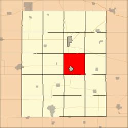 Location in Fayette County | |
| Coordinates: 42°52′17″N 91°47′10″W / 42.87139°N 91.78611°WCoordinates: 42°52′17″N 91°47′10″W / 42.87139°N 91.78611°W | |
| Country |
|
| State |
|
| County | Fayette |
| Area | |
| • Total | 35.4 sq mi (91.7 km2) |
| • Land | 35.15 sq mi (91.05 km2) |
| • Water | 0.25 sq mi (0.65 km2) 0.71% |
| Elevation | 1,138 ft (347 m) |
| Population (2010) | |
| • Total | 297 |
| • Density | 8.4/sq mi (3.2/km2) |
| Time zone | CST (UTC-6) |
| • Summer (DST) | CDT (UTC-5) |
| ZIP codes | 52141, 52142, 52164, 52169, 52175 |
| GNIS feature ID | 0468975 |
Westfield Township is one of twenty townships in Fayette County, Iowa, USA. As of the 2010 census, its population was 297.[1]
Geography
According to the United States Census Bureau, Westfield Township covers an area of 35.4 square miles (91.7 square kilometers); of this, 35.15 square miles (91.05 square kilometers, 99.29 percent) is land and 0.25 square miles (0.65 square kilometers, 0.71 percent) is water.
The city of Fayette is entirely within this township geographically but is a separate entity.
Unincorporated towns
- Albany at 42°51′57″N 91°45′32″W / 42.865814°N 91.758771°W
- Lima at 42°52′06″N 91°44′35″W / 42.868314°N 91.742937°W
(This list is based on USGS data and may include former settlements.)
Adjacent townships
- Union Township (north)
- Pleasant Valley Township (northeast)
- Illyria Township (east)
- Fairfield Township (southeast)
- Smithfield Township (south)
- Harlan Township (southwest)
- Center Township (west)
- Windsor Township (northwest)
Cemeteries
The township contains these three cemeteries: Lima, Pleasant Hill and Saint Francis.
Major highways
Lakes
- Volga Lake
Landmarks
- Volga River State Recreation Area (vast majority)
School districts
- North Fayette Community School District
- West Central Community School District
Political districts
- Iowa's 1st congressional district
- State House District 24
- State Senate District 12
References
- United States Census Bureau 2008 TIGER/Line Shapefiles
- United States Board on Geographic Names (GNIS)
- United States National Atlas
- ↑ "Profile of General Population and Housing Characteristics: 2010 Demographic Profile Data (DP-1): Westfield township, Fayette County, Iowa". U.S. Census Bureau, American Factfinder. Retrieved March 5, 2012.
External links
Municipalities and communities of Fayette County, Iowa, United States | ||
|---|---|---|
| Cities | ||
| Townships | ||
| Unincorporated communities | ||
| Footnotes | ‡This populated place also has portions in an adjacent county or counties | |
This article is issued from Wikipedia - version of the 11/17/2013. The text is available under the Creative Commons Attribution/Share Alike but additional terms may apply for the media files.