White Horse, New Jersey
| White Horse, New Jersey | |
|---|---|
| Census-designated place | |
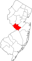
 Location in Mercer County and the state of New Jersey. | |
| Coordinates: 40°11′31″N 74°42′05″W / 40.191823°N 74.701372°WCoordinates: 40°11′31″N 74°42′05″W / 40.191823°N 74.701372°W | |
| Country |
|
| State |
|
| County | Mercer |
| Township | Hamilton |
| Area[1] | |
| • Total | 3.138 sq mi (8.129 km2) |
| • Land | 3.074 sq mi (7.963 km2) |
| • Water | 0.064 sq mi (0.167 km2) 2.05% |
| Elevation[2] | 92 ft (28 m) |
| Population (2010)[3] | |
| • Total | 9,494 |
| • Density | 3,088.0/sq mi (1,192.3/km2) |
| Time zone | Eastern (EST) (UTC-5) |
| • Summer (DST) | Eastern (EDT) (UTC-4) |
| FIPS code | 3480630[1][4] |
| GNIS feature ID | 02390504[1][5] |
White Horse is an unincorporated community and census-designated place (CDP) located within Hamilton Township, in Mercer County, New Jersey, United States.[6][7][8][9] As of the 2010 United States Census, the CDP's population was 9,494.[3]
History
The community's name derives from a local tradition that holds that George Washington rode through the area on a white horse on his journey from Virginia to New York City for his first presidential inauguration in 1789.[10]
Geography
According to the United States Census Bureau, the CDP had a total area of 3.138 square miles (8.129 km2), including 3.074 square miles (7.963 km2) of land and 0.064 square miles (0.167 km2) of water (2.05%).[1][11]
Demographics
| Historical population | |||
|---|---|---|---|
| Census | Pop. | %± | |
| 1970 | 18,680 | — | |
| 1980 | 10,098 | −45.9% | |
| 1990 | 9,397 | −6.9% | |
| 2000 | 9,373 | −0.3% | |
| 2010 | 9,494 | 1.3% | |
| Population sources: 1970-1980[12] 1990-2010[8] 2000[13] 2010[3] | |||
Census 2010
The 2010 United States Census counted 9,494 people, 3,875 households, and 2,682 families residing in the CDP. The population density was 3,088.0 per square mile (1,192.3/km2). The CDP contained 4,018 housing units at an average density of 1,306.9 per square mile (504.6/km2). The racial makeup of the CDP was 87.91% (8,346) White, 5.59% (531) Black or African American, 0.07% (7) Native American, 2.19% (208) Asian, 0.09% (9) Pacific Islander, 2.62% (249) from other races, and 1.52% (144) from two or more races. Hispanics or Latinos of any race were 8.55% (812) of the population.[3]
Out of a total of 3,875 households, 25.0% had children under the age of 18 living with them, 53.9% were married couples living together, 11.2% had a female householder with no husband present, and 30.8% were non-families. 26.6% of all households were made up of individuals, and 13.5% had someone living alone who was 65 years of age or older. The average household size was 2.45 and the average family size was 2.96.[3]
In the CDP, 19.3% of the population were under the age of 18, 6.6% from 18 to 24, 24.6% from 25 to 44, 29.5% from 45 to 64, and 20.0% who were 65 years of age or older. The median age was 44.6 years. For every 100 females the census counted 91.8 males, but for 100 females at least 18 years old, it was 90.0 males.[3]
Census 2000
As of the 2000 United States Census[4] there were 9,373 people, 3,722 households, and 2,687 families residing in the CDP. The population density was 1,134.5/km2 (2,941.8/mi2). There were 3,818 housing units at an average density of 462.1/km2 (1,198.3/mi2). The racial makeup of the CDP was 91.80% White, 3.82% African American, 0.06% Native American, 1.66% Asian, 1.48% from other races, and 1.17% from two or more races. Hispanic or Latino of any race were 3.97% of the population.[13]
There were 3,722 households out of which 27.2% had children under the age of 18 living with them, 58.5% were married couples living together, 10.5% had a female householder with no husband present, and 27.8% were non-families. 24.0% of all households were made up of individuals and 12.2% had someone living alone who was 65 years of age or older. The average household size was 2.52 and the average family size was 3.00.[13]
In the CDP the population was spread out with 20.6% under the age of 18, 6.0% from 18 to 24, 28.8% from 25 to 44, 24.8% from 45 to 64, and 19.8% who were 65 years of age or older. The median age was 42 years. For every 100 females there were 90.3 males. For every 100 females age 18 and over, there were 87.3 males.[13]
The median income for a household in the CDP was $60,061, and the median income for a family was $67,050. Males had a median income of $47,176 versus $34,710 for females. The per capita income for the CDP was $25,480. About 1.6% of families and 3.9% of the population were below the poverty line, including 4.9% of those under age 18 and 7.8% of those age 65 or over.[13]
White Horse Circle
White Horse Circle is a traffic circle locally known by name, in the southwest part of White Horse. It is no longer a true traffic circle, but is bisected by northbound U.S. Route 206, which makes a left turn in the circle. This intersection connects South Broad Street (US 206 north and Route 524 east), White Horse-Mercerville Road (Route 533 north) and Bordentown Road (US 206 south). Only Route 533 has a stop sign at the circle, while Route 524 and the southern part of Route 206 have traffic signals some distance from the circle. To allow cars to move in a safe fashion, there are six yield-signed road segments allowing cars to get to Route 206 and from the highway to Route 533. Route 206, when the light allows, has no yield sign restrictions.[14][15] Since the completion of Interstate 195 and Interstate 295, which intersect southwest of the circle, much of the traffic that would have passed through the circle is able to use the wider, faster freeways, reducing the traffic load at the circle.[16] Hamilton Township approved a construction project under which the modifications at the circle completed by 2015, at a site that the township's engineer describes as having an average of an accident a week.[17]
In the 1927 New Jersey state highway renumbering, Route 37 was legislated to run from Route 27 and Route 30 (now U.S. Route 1 Business, U.S. Route 206, and Route 31) in Trenton continuing through the White Horse Circle and on to Seaside Heights.[18][19] The western end of Route 37 was once planned to be at White Horse Circle, though that section of the planned route was eventually built as Interstate 195, with other portions returned to the counties as part of Route 524.
A 10-foot (3.0 m) tall statue of a white horse was constructed on the circle in 2010, commemorating the local tradition that George Washington rode through the area on a white horse while traveling to New York City in 1789.[10]
References
- 1 2 3 4 Gazetteer of New Jersey Places, United States Census Bureau. Accessed July 21, 2016.
- ↑ U.S. Geological Survey Geographic Names Information System: White Horse Census Designated Place, Geographic Names Information System. Accessed November 21, 2012.
- 1 2 3 4 5 6 DP-1 - Profile of General Population and Housing Characteristics: 2010 Demographic Profile Data for White Horse CDP, New Jersey, United States Census Bureau. Accessed November 20, 2012.
- 1 2 American FactFinder, United States Census Bureau. Accessed September 4, 2014.
- ↑ US Board on Geographic Names, United States Geological Survey. Accessed September 4, 2014.
- ↑ GCT-PH1 - Population, Housing Units, Area, and Density: 2010 - County -- County Subdivision and Place from the 2010 Census Summary File 1 for Burlington County, New Jersey, United States Census Bureau. Accessed January 13, 2013.
- ↑ 2006-2010 American Community Survey Geography for New Jersey, United States Census Bureau. Accessed January 13, 2013.
- 1 2 New Jersey: 2010 - Population and Housing Unit Counts - 2010 Census of Population and Housing (CPH-2-32), United States Census Bureau, August 2012. Accessed January 13, 2013.
- ↑ Locality Search, State of New Jersey. Accessed April 19, 2015.
- 1 2 Fair, Matt. "Washington rode here - White horse installed at circle", The Times (Trenton), May 30, 2010. Accessed April 7, 2013. "Finally, the White Horse Circle in Hamilton Township has been given a monument worthy of its name and, in the process, a vision that businessman Michael McGrath spent nearly a decade nurturing has been satisfied.... As the story goes, Washington passed through the crossroads on a white steed in 1789 as he made his way from his native Virginia to New York to be inaugurated as the first president of the United States."
- ↑ US Gazetteer files: 2010, 2000, and 1990, United States Census Bureau. Accessed September 4, 2014.
- ↑ Staff. 1980 Census of Population: Number of Inhabitants United States Summary, p. 1-141. United States Census Bureau, June 1983. Accessed January 12, 2012.
- 1 2 3 4 5 DP-1 - Profile of General Demographic Characteristics: 2000 from the Census 2000 Summary File 1 (SF 1) 100-Percent Data for White Horse CDP, New Jersey, United States Census Bureau. Accessed November 21, 2012.
- ↑ Davis, Mike. "Hamilton residents get a look at the new White Horse Circle", The Times (Trenton), September 27, 2012. Accessed April 4, 2013.
- ↑ Staff. "Route 206 repaving starts today", Burlington County Times, February 11, 2009. Accessed April 7, 2013.
- ↑ Staff. I-195-I-295 Completion, Mercer/Burlington Counties:Environmental Impact Statement, Volume 3, United States Department of Transportation, Federal Highway Administration, 1981. Accessed April 10, 2013.
- ↑ Prato, Maria. "White Horse Circle Poised for Redesign", Hamilton Pulse, May 17, 2012. Accessed April 7, 2013.
- ↑ State of New Jersey, Laws of 1927, Chapter 319.
- ↑ 1927 New Jersey Road Map, State of New Jersey. Accessed April 7, 2013.