Whitefield, Maine
| Whitefield, Maine | |
|---|---|
| Town | |
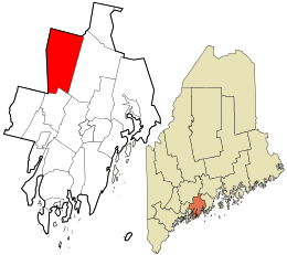 Location in Lincoln County and the state of Maine. | |
| Coordinates: 44°12′36″N 69°36′15″W / 44.21000°N 69.60417°W | |
| Country | United States |
| State | Maine |
| County | Lincoln |
| Area[1] | |
| • Total | 47.51 sq mi (123.05 km2) |
| • Land | 46.82 sq mi (121.26 km2) |
| • Water | 0.69 sq mi (1.79 km2) |
| Elevation | 108 ft (33 m) |
| Population (2010)[2] | |
| • Total | 2,300 |
| • Estimate (2012[3]) | 2,288 |
| • Density | 49.1/sq mi (19.0/km2) |
| Time zone | Eastern (EST) (UTC-5) |
| • Summer (DST) | EDT (UTC-4) |
| ZIP code | 04353 |
| Area code(s) | 207 |
| FIPS code | 23-85010 |
| GNIS feature ID | 0582811 |
| Website | http://www.townofwhitefield.com |
Whitefield is a town in Lincoln County, Maine, United States. The population was 2,300 at the 2010 census. Whitefield is named for the celebrated British evangelist George Whitefield, who inspired the colonists before the town was settled in 1770, mainly by Irish Catholics.[4] They remembered him when incorporation came in 1809. Whitefield is included in the Augusta, Maine micropolitan New England City and Town Area.
Geography
According to the United States Census Bureau, the town has a total area of 47.51 square miles (123.05 km2), of which, 46.82 square miles (121.26 km2) of it is land and 0.69 square miles (1.79 km2) is water.[1]
Demographics
| Historical population | |||
|---|---|---|---|
| Census | Pop. | %± | |
| 1810 | 995 | — | |
| 1820 | 1,429 | 43.6% | |
| 1830 | 2,020 | 41.4% | |
| 1840 | 2,150 | 6.4% | |
| 1850 | 2,158 | 0.4% | |
| 1860 | 1,883 | −12.7% | |
| 1870 | 1,594 | −15.3% | |
| 1880 | 1,511 | −5.2% | |
| 1890 | 1,215 | −19.6% | |
| 1900 | 1,156 | −4.9% | |
| 1910 | 1,056 | −8.7% | |
| 1920 | 862 | −18.4% | |
| 1930 | 908 | 5.3% | |
| 1940 | 962 | 5.9% | |
| 1950 | 1,030 | 7.1% | |
| 1960 | 1,068 | 3.7% | |
| 1970 | 1,131 | 5.9% | |
| 1980 | 1,606 | 42.0% | |
| 1990 | 1,931 | 20.2% | |
| 2000 | 2,273 | 17.7% | |
| 2010 | 2,300 | 1.2% | |
| Est. 2014 | 2,286 | [5] | −0.6% |
2010 census
As of the census[2] of 2010, there were 2,300 people, 917 households, and 643 families residing in the town. The population density was 49.1 inhabitants per square mile (19.0/km2). There were 1,055 housing units at an average density of 22.5 per square mile (8.7/km2). The racial makeup of the town was 97.8% White, 0.3% African American, 0.4% Native American, 0.3% Asian, and 1.1% from two or more races. Hispanic or Latino of any race were 1.1% of the population.
There were 917 households of which 30.9% had children under the age of 18 living with them, 55.9% were married couples living together, 9.4% had a female householder with no husband present, 4.8% had a male householder with no wife present, and 29.9% were non-families. 22.4% of all households were made up of individuals and 8% had someone living alone who was 65 years of age or older. The average household size was 2.47 and the average family size was 2.87.
The median age in the town was 44.1 years. 21.6% of residents were under the age of 18; 6% were between the ages of 18 and 24; 23.9% were from 25 to 44; 35.5% were from 45 to 64; and 12.9% were 65 years of age or older. The gender makeup of the town was 50.3% male and 49.7% female.
2000 census
As of the census[7] of 2000, there were 2,273 people, 844 households, and 620 families residing in the town. The population density was 48.5 people per square mile (18.7/km²). There were 954 housing units at an average density of 20.4 per square mile (7.9/km²). The racial makeup of the town was 97.23% White, 0.18% African American, 1.23% Native American, 0.35% Asian, 0.18% Pacific Islander, 0.13% from other races, and 0.70% from two or more races. Hispanic or Latino of any race were 0.88% of the population.
There were 844 households out of which 35.7% had children under the age of 18 living with them, 61.1% were married couples living together, 8.6% had a female householder with no husband present, and 26.5% were non-families. 20.0% of all households were made up of individuals and 5.9% had someone living alone who was 65 years of age or older. The average household size was 2.62 and the average family size was 3.02.
In the town the population was spread out with 26.4% under the age of 18, 5.6% from 18 to 24, 29.5% from 25 to 44, 26.8% from 45 to 64, and 11.7% who were 65 years of age or older. The median age was 38 years. For every 100 females there were 98.0 males. For every 100 females age 18 and over, there were 97.6 males.
The median income for a household in the town was $38,477, and the median income for a family was $41,994. Males had a median income of $27,917 versus $21,750 for females. The per capita income for the town was $16,456. About 8.2% of families and 12.5% of the population were below the poverty line, including 14.6% of those under age 18 and 19.9% of those age 65 or over.
Notable people
- William Farley, Medal of Honor recipient
References
- 1 2 "US Gazetteer files 2010". United States Census Bureau. Retrieved 2012-12-16.
- 1 2 "American FactFinder". United States Census Bureau. Retrieved 2012-12-16.
- ↑ "Population Estimates". United States Census Bureau. Retrieved 2013-07-06.
- ↑ Maine League of Historical Societies and Museums (1970). Doris A. Isaacson, ed. Maine: A Guide 'Down East'. Rockland, Me: Courier-Gazette, Inc. p. 160.
- ↑ "Annual Estimates of the Resident Population for Incorporated Places: April 1, 2010 to July 1, 2014". Retrieved June 4, 2015.
- ↑ "Census of Population and Housing". Census.gov. Retrieved June 4, 2015.
- ↑ "American FactFinder". United States Census Bureau. Retrieved 2008-01-31.
External links
- Town Office Page*Town Information Page - history, newsletters, illustrated timeline
- Maine Genealogy: Whitefield, Lincoln County, Maine
Municipalities and communities of Lincoln County, Maine, United States | ||
|---|---|---|
| Towns |  | |
| Plantation | ||
| Gore | ||
| CDPs | ||
| Other villages | ||
Coordinates: 44°10′12″N 69°37′31″W / 44.17000°N 69.62528°W