Whitefield, Oklahoma
| Whitefield, Oklahoma | |
|---|---|
| Town | |
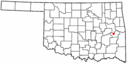 Location of Whitefield, Oklahoma | |
| Coordinates: 35°15′12″N 95°14′16″W / 35.25333°N 95.23778°WCoordinates: 35°15′12″N 95°14′16″W / 35.25333°N 95.23778°W | |
| Country | United States |
| State | Oklahoma |
| County | Haskell |
| Area | |
| • Total | 2.6 sq mi (6.8 km2) |
| • Land | 2.4 sq mi (6.3 km2) |
| • Water | 0.2 sq mi (0.4 km2) |
| Elevation | 561 ft (171 m) |
| Population (2000) | |
| • Total | 231 |
| • Density | 94.4/sq mi (36.4/km2) |
| Time zone | Central (CST) (UTC-6) |
| • Summer (DST) | CDT (UTC-5) |
| ZIP code | 74472 |
| Area code(s) | 539/918 |
| FIPS code | 40-80800[1] |
| GNIS feature ID | 1099723[2] |
Whitefield is a town in northwestern Haskell County, Oklahoma, United States. The population was 391 at the 2010 census, compared with 231 at the 2000 census. It was named for a Methodist bishop, George Whitefield (1714 - 1770).[3]
History
Whitefield's history can be traced to the American Civil War], when the Confederate Army established Camp Pike for two thousand Confederate soldiers in 1861. The site was then in Indian Territory and within the boundaries of the Choctaw Nation. The camp was named for Confederate Brigadier General Albert Pike, who had persuaded the Five Civilized Tribes to ally with the Confederate States of America.[3]
After the end of the Civil War, Camp Pike became a Choctaw trading post. The trading post and the adjacent community were renamed as Oklahoma, Indian Territory. Its clientele were not only members of the Choctaw tribe, but also white settlers who had permits from the tribe to farm land in the Choctaw Nation. Occasionally, it was patronized by white outlaws such as Belle Starr, who were hiding from the law in the mountains of southern Oklahoma.The Post Office wanted to change the name because of confusion with another post office already known as Oklahoma Station. In 1888, the local residents voted to accept Whitfield as the name of the settlement and post office.[3]
Whitefield existed primarily as a town to support the nearby farms. By 1911, it counted approximately 500 residents. Improvements included two groceries, two general stores, a cotton gin and mill, a drugstore, a doctor, and a blacksmith. It had about 300 residents by 1920. Reportedly, the population declined sharply with the onset of the Great Depression.Whitfield incorporated in 1978, so its first Federal Census in 1980 recorded 240 people.[3] The population has trended upward since that year.
Geography
Whitefield is located at 35°15′12″N 95°14′16″W / 35.25333°N 95.23778°W (35.253403, -95.237879).[4] According to the United States Census Bureau, the town has a total area of 2.6 square miles (6.7 km2), of which, 2.5 square miles (6.5 km2) of it is land and 0.2 square miles (0.52 km2) of it (6.51%) is water.
Demographics
| Historical population | |||
|---|---|---|---|
| Census | Pop. | %± | |
| 1980 | 240 | — | |
| 1990 | 253 | 5.4% | |
| 2000 | 231 | −8.7% | |
| 2010 | 391 | 69.3% | |
| Est. 2015 | 391 | [5] | 0.0% |
As of the census[1] of 2000, there were 231 people, 99 households, and 73 families residing in the town. The population density was 94.4 people per square mile (36.4/km²). There were 110 housing units at an average density of 44.9 per square mile (17.3/km²). The racial makeup of the town was 77.92% White, 12.99% Native American, 0.43% Asian, and 8.66% from two or more races.
There were 99 households out of which 27.3% had children under the age of 18 living with them, 61.6% were married couples living together, 10.1% had a female householder with no husband present, and 25.3% were non-families. 24.2% of all households were made up of individuals and 15.2% had someone living alone who was 65 years of age or older. The average household size was 2.33 and the average family size was 2.74.
In the town the population was spread out with 22.1% under the age of 18, 6.5% from 18 to 24, 26.4% from 25 to 44, 28.1% from 45 to 64, and 16.9% who were 65 years of age or older. The median age was 41 years. For every 100 females there were 94.1 males. For every 100 females age 18 and over, there were 104.5 males.
The median income for a household in the town was $21,389, and the median income for a family was $33,125. Males had a median income of $26,786 versus $15,000 for females. The per capita income for the town was $14,306. About 15.7% of families and 23.2% of the population were below the poverty line, including 27.5% of those under the age of eighteen and 33.3% of those sixty five or over.
References
- 1 2 "American FactFinder". United States Census Bureau. Retrieved 2008-01-31.
- ↑ "US Board on Geographic Names". United States Geological Survey. 2007-10-25. Retrieved 2008-01-31.
- 1 2 3 4 Hyder, Glenn O. "Whitefield." Encyclopedia of Oklahoma History and Culture. Accessed October 18, 2016.
- ↑ "US Gazetteer files: 2010, 2000, and 1990". United States Census Bureau. 2011-02-12. Retrieved 2011-04-23.
- ↑ "Annual Estimates of the Resident Population for Incorporated Places: April 1, 2010 to July 1, 2015". Retrieved July 2, 2016.
- ↑ "Census of Population and Housing". Census.gov. Retrieved June 4, 2015.
External links
Municipalities and communities of Haskell County, Oklahoma, United States | ||
|---|---|---|
| City | 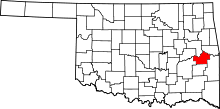 | |
| Towns | ||
| Unincorporated communities | ||