Winter, Wisconsin
| Winter, Wisconsin | |
|---|---|
| Village | |
|
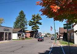
Winter in autumn | |
 Location of Winter, Wisconsin | |
| Coordinates: 45°49′15″N 91°0′40″W / 45.82083°N 91.01111°WCoordinates: 45°49′15″N 91°0′40″W / 45.82083°N 91.01111°W | |
| Country | United States |
| State | Wisconsin |
| County | Sawyer |
| Area[1] | |
| • Total | 0.80 sq mi (2.07 km2) |
| • Land | 0.80 sq mi (2.07 km2) |
| • Water | 0 sq mi (0 km2) |
| Elevation[2] | 1,401 ft (427 m) |
| Population (2010)[3] | |
| • Total | 313 |
| • Estimate (2012[4]) | 309 |
| • Density | 391.3/sq mi (151.1/km2) |
| Time zone | Central (CST) (UTC-6) |
| • Summer (DST) | CDT (UTC-5) |
| Area code(s) | 715 & 534 |
| FIPS code | 55-88000[5] |
| GNIS feature ID | 1584460[2] |
Winter is a village in Sawyer County, Wisconsin, United States. The population was 233 at the 2010 census. The village is within the Town of Winter.
History
Winter was founded in 1904.[6] It was named for W. C. Winter, a railroad official.[6] A post office has been in operation in Winter since 1904.[7]
Geography
Winter is located at 45°49′15″N 91°0′40″W / 45.82083°N 91.01111°W (45.821014, -91.011118).[8]
According to the United States Census Bureau, the village has a total area of 0.80 square miles (2.07 km2), all of it land.[1]
Demographics
| Historical population | |||
|---|---|---|---|
| Census | Pop. | %± | |
| 1980 | 376 | — | |
| 1990 | 383 | 1.9% | |
| 2000 | 344 | −10.2% | |
| 2010 | 313 | −9.0% | |
| Est. 2015 | 299 | [9] | −4.5% |
2010 census
As of the census[3] of 2010, there were 313 people, 153 households, and 75 families residing in the village. The population density was 391.3 inhabitants per square mile (151.1/km2). There were 209 housing units at an average density of 261.3 per square mile (100.9/km2). The racial makeup of the village was 91.7% White, 1.3% African American, 1.3% Native American, 0.3% Asian, 1.0% from other races, and 4.5% from two or more races. Hispanic or Latino of any race were 5.1% of the population.
There were 153 households of which 26.8% had children under the age of 18 living with them, 29.4% were married couples living together, 12.4% had a female householder with no husband present, 7.2% had a male householder with no wife present, and 51.0% were non-families. 43.1% of all households were made up of individuals and 22.3% had someone living alone who was 65 years of age or older. The average household size was 2.05 and the average family size was 2.87.
The median age in the village was 41.6 years. 25.6% of residents were under the age of 18; 5.5% were between the ages of 18 and 24; 22.7% were from 25 to 44; 25.2% were from 45 to 64; and 21.1% were 65 years of age or older. The gender makeup of the village was 51.4% male and 48.6% female.
2000 census
As of the census[5] of 2000, there were 344 people, 164 households, and 83 families residing in the village. The 2010 Census revealed the population to be 233 - a nearly 1/3 decline since 2000. The population density was 430.9 people per square mile (166.0/km²). There were 200 housing units at an average density of 250.5 per square mile (96.5/km²). The racial makeup of the village was 96.51% White, 0.58% Black or African American, 2.03% Native American, 0.29% from other races, and 0.58% from two or more races. 1.45% of the population were Hispanic or Latino of any race.
There were 164 households out of which 26.8% had children under the age of 18 living with them, 37.2% were married couples living together, 10.4% had a female householder with no husband present, and 48.8% were non-families. 44.5% of all households were made up of individuals and 23.2% had someone living alone who was 65 years of age or older. The average household size was 2.10 and the average family size was 2.92.
In the village the population was spread out with 24.1% under the age of 18, 6.7% from 18 to 24, 24.7% from 25 to 44, 20.9% from 45 to 64, and 23.5% who were 65 years of age or older. The median age was 40 years. For every 100 females there were 111.0 males. For every 100 females age 18 and over, there were 102.3 males.
The median income for a household in the village was $22,955, and the median income for a family was $25,625. Males had a median income of $23,333 versus $15,000 for females. The per capita income for the village was $15,404. About 13.2% of families and 17.5% of the population were below the poverty line, including 15.4% of those under age 18 and 25.0% of those age 65 or over.
References
- 1 2 "US Gazetteer files 2010". United States Census Bureau. Retrieved 2012-11-18.
- 1 2 "US Board on Geographic Names". United States Geological Survey. 2007-10-25. Retrieved 2008-01-31.
- 1 2 "American FactFinder". United States Census Bureau. Retrieved 2012-11-18.
- ↑ "Population Estimates". United States Census Bureau. Retrieved 2013-06-24.
- 1 2 "American FactFinder". United States Census Bureau. Retrieved 2008-01-31.
- 1 2 Chicago and North Western Railway Company (1908). A History of the Origin of the Place Names Connected with the Chicago & North Western and Chicago, St. Paul, Minneapolis & Omaha Railways. p. 197.
- ↑ "Sawyer County". Jim Forte Postal History. Retrieved 5 April 2015.
- ↑ "US Gazetteer files: 2010, 2000, and 1990". United States Census Bureau. 2011-02-12. Retrieved 2011-04-23.
- ↑ "Annual Estimates of the Resident Population for Incorporated Places: April 1, 2010 to July 1, 2015". Retrieved July 2, 2016.
- ↑ "Census of Population and Housing". Census.gov. Retrieved June 4, 2015.
External links
Municipalities and communities of Sawyer County, Wisconsin, United States | ||
|---|---|---|
| City | 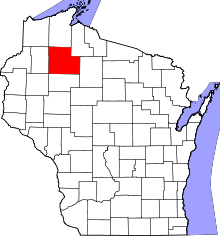 | |
| Villages | ||
| Towns | ||
| CDPs | ||
| Unincorporated communities | ||
| Indian reservation | ||
| Footnotes | ‡This populated place also has portions in an adjacent county or counties | |