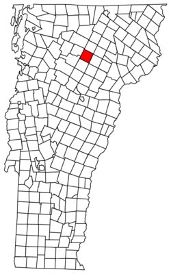
Wolcott, Vermont
| Wolcott, Vermont | |
|---|---|
| Town | |
|
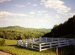
Pierce Cemetery in Wolcott, Vermont | |
 Wolcott, Vermont | |
 Wolcott, Vermont Location in the United States | |
| Coordinates: 44°34′32″N 72°28′32″W / 44.57556°N 72.47556°WCoordinates: 44°34′32″N 72°28′32″W / 44.57556°N 72.47556°W | |
| Country | United States |
| State | Vermont |
| County | Lamoille |
| Area | |
| • Total | 39.2 sq mi (101.5 km2) |
| • Land | 39.0 sq mi (101.1 km2) |
| • Water | 0.2 sq mi (0.4 km2) |
| Elevation | 1,319 ft (402 m) |
| Population (2010)[1] | |
| • Total | 1,676 |
| • Density | 43.2/sq mi (16.5/km2) |
| Time zone | Eastern (EST) (UTC-5) |
| • Summer (DST) | EDT (UTC-4) |
| ZIP code | 05680 |
| Area code(s) | 802 Exchanges: 472, 888 |
| FIPS code | 50-85375[2] |
| GNIS feature ID | 1462269[3] |
Wolcott is a town in Lamoille County, Vermont, United States. The town was named for General Oliver Wolcott, a signer of the Declaration of Independence.[4] The population was 1,676 at the 2010 census.
Geography
According to the United States Census Bureau, the town has a total area of 39.2 square miles (101.5 km2), of which 39.0 square miles (101.1 km2) is land and 0.2 square mile (0.4 km2) (0.38%) is water.
Government
Legislators
The Essex-Orleans Senate district includes the town of Wolcott, as well as parts or all of Essex County, Orleans County, Franklin County and Lamoille County. It is represented in the Vermont Senate by Linda J. Martin (D) and Mark Woodward (D).[5]
Demographics
| Historical population | |||
|---|---|---|---|
| Census | Pop. | %± | |
| 1790 | 32 | — | |
| 1800 | 47 | 46.9% | |
| 1810 | 124 | 163.8% | |
| 1820 | 123 | −0.8% | |
| 1830 | 492 | 300.0% | |
| 1840 | 824 | 67.5% | |
| 1850 | 909 | 10.3% | |
| 1860 | 1,161 | 27.7% | |
| 1870 | 1,132 | −2.5% | |
| 1880 | 1,166 | 3.0% | |
| 1890 | 1,158 | −0.7% | |
| 1900 | 1,066 | −7.9% | |
| 1910 | 1,049 | −1.6% | |
| 1920 | 932 | −11.2% | |
| 1930 | 831 | −10.8% | |
| 1940 | 772 | −7.1% | |
| 1950 | 766 | −0.8% | |
| 1960 | 633 | −17.4% | |
| 1970 | 676 | 6.8% | |
| 1980 | 986 | 45.9% | |
| 1990 | 1,229 | 24.6% | |
| 2000 | 1,456 | 18.5% | |
| 2010 | 1,676 | 15.1% | |
| Est. 2014 | 1,721 | [6] | 2.7% |
| U.S. Decennial Census[7] | |||
As of the census[2] of 2000, there were 1,456 people, 552 households, and 401 families residing in the town. The population density was 37.3 people per square mile (14.4/km2). There were 646 housing units at an average density of 16.6 per square mile (6.4/km2). The racial makeup of the town was 98.83% White, 0.07% Black or African American, 0.27% Native American, 0.07% Asian, 0.14% Pacific Islander, and 0.62% from two or more races. Hispanic or Latino of any race were 0.34% of the population.
There were 552 households out of which 39.9% had children under the age of 18 living with them, 58.2% were married couples living together, 7.4% had a female householder with no husband present, and 27.2% were non-families. 18.8% of all households were made up of individuals and 5.8% had someone living alone who was 65 years of age or older. The average household size was 2.63 and the average family size was 2.99.
In the town the population was spread out with 28.4% under the age of 18, 7.3% from 18 to 24, 34.0% from 25 to 44, 23.4% from 45 to 64, and 6.9% who were 65 years of age or older. The median age was 33 years. For every 100 females there were 105.6 males. For every 100 females age 18 and over, there were 102.3 males.
Economy
Personal income
The median income for a household in the town was $34,760, and the median income for a family was $38,056. Males had a median income of $27,898 versus $21,905 for females. The per capita income for the town was $15,198. About 10.2% of families and 14.6% of the population were below the poverty line, including 24.8% of those under age 18 and 18.6% of those age 65 or over.
Recreation
Fisher Covered Bridge is the easternmost access point for the Lamoille River Paddlers Trail in Wolcott. You can also access the Paddlers Trail a bit downstream at the Elmore Road Bridge to avoid a portage around the Wolcott Dam.[8]
 Lamoille River
Notable people
David Budbill American poet and playwright.
References
- ↑ http://www.census.gov/prod/cen2010/cph-2-47.pdf
- 1 2 "American FactFinder". United States Census Bureau. Retrieved 2008-01-31.
- ↑ "US Board on Geographic Names". United States Geological Survey. 2007-10-25. Retrieved 2008-01-31.
- ↑ "Profile for Wolcott, Vermont". ePodunk. Retrieved 2010-05-09.
- ↑ "Vermont Legislature: Home | Vermont General Assembly." 20 Sep. 2016<http://legislature.vermont.gov/>
- ↑ "Annual Estimates of the Resident Population for Incorporated Places: April 1, 2010 to July 1, 2014". Retrieved June 4, 2015.
- ↑ "U.S. Decennial Census". United States Census Bureau. Retrieved June 18, 2015.
- ↑ "Lamoille River Paddlers Trail | A community effort to develop and ..." 2015. 20 Sep. 2016 <http://www.lamoilleriverpaddlerstrail.org/>
Municipalities and communities of Lamoille County, Vermont, United States | ||
|---|---|---|
| Towns | 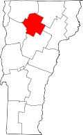 | |
| Villages | ||
| CDP | ||
| Unincorporated community | ||