Cambridge, Vermont
| Cambridge, Vermont | |
|---|---|
| Town | |
 Cambridge, Vermont | |
 Cambridge, Vermont Location in the United States | |
| Coordinates: 44°38′28″N 72°50′7″W / 44.64111°N 72.83528°WCoordinates: 44°38′28″N 72°50′7″W / 44.64111°N 72.83528°W | |
| Country | United States |
| State | Vermont |
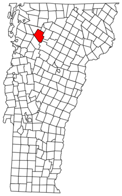
| County | Lamoille |
| Chartered | 1781 |
| Area | |
| • Total | 63.7 sq mi (164.9 km2) |
| • Land | 63.7 sq mi (164.9 km2) |
| • Water | 0.0 sq mi (0.0 km2) |
| Elevation | 758 ft (231 m) |
| Population (2010) | |
| • Total | 3,659 |
| • Density | 57.44/sq mi (22.19/km2) |
| Time zone | Eastern (EST) (UTC-5) |
| • Summer (DST) | EDT (UTC-4) |
| ZIP code | 05444 |
| Area code(s) | 802 |
| FIPS code | 50-11500[1] |
| GNIS feature ID | 1462063[2] |
Cambridge is a town in Lamoille County, Vermont, United States. The population was 3,659 at the 2010 U.S. Census. Cambridge includes the villages of Jeffersonville and Cambridge.
History
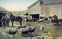
Granted on November 7, 1780, Cambridge was chartered on August 13, 1781 to Samuel Robinson, John Fassett, Jr., Jonathan Frost and 64 others. It was first settled in 1783 by John Safford from Piermont, New Hampshire.[3] The intervales proved good but rough, best for grazing livestock. By 1839, the town had about 7,000 sheep.[4] The Lamoille River offered water power for watermills. Industries included one woolen factory, one tannery, one gristmill, plus several sawmills and cabinet shops.[5]
Cambridge and neighboring Johnson were together known as the King's College Tract, being created by Lieutenant Governor Cadwallader Colden by authority of British King George III in 1764. The King's College Tract was reserved for the eventual establishment of a university on the site. The place name Cambridge suggests Cambridge University in England. Johnson, the other town in the King's College Grant, was named for William Samuel Johnson.[6]
Both the St. Johnsbury & Lake Champlain Railroad and the Burlington & Lamoille Railroad passed through the town. The former is now the Lamoille Valley Rail Trail.[7]
Geography
According to the United States Census Bureau, the town has a total area of 63.7 square miles (164.9 km2), of which 63.7 square miles (164.9 km2) is land and 0.02% is water. Cambridge is drained by the Lamoille River.
The town is crossed by Vermont Route 15, Vermont Route 104, Vermont Route 108 and Vermont Route 109.
Economy
The largest employer in the town is Smugglers' Notch Resort.
Demographics
| Historical population | |||
|---|---|---|---|
| Census | Pop. | %± | |
| 1790 | 359 | — | |
| 1800 | 733 | 104.2% | |
| 1810 | 990 | 35.1% | |
| 1820 | 1,176 | 18.8% | |
| 1830 | 1,613 | 37.2% | |
| 1840 | 1,790 | 11.0% | |
| 1850 | 1,849 | 3.3% | |
| 1860 | 1,784 | −3.5% | |
| 1870 | 1,651 | −7.5% | |
| 1880 | 1,750 | 6.0% | |
| 1890 | 1,689 | −3.5% | |
| 1900 | 1,606 | −4.9% | |
| 1910 | 1,696 | 5.6% | |
| 1920 | 1,593 | −6.1% | |
| 1930 | 1,402 | −12.0% | |
| 1940 | 1,383 | −1.4% | |
| 1950 | 1,435 | 3.8% | |
| 1960 | 1,295 | −9.8% | |
| 1970 | 1,528 | 18.0% | |
| 1980 | 2,019 | 32.1% | |
| 1990 | 2,667 | 32.1% | |
| 2000 | 3,186 | 19.5% | |
| 2010 | 3,659 | 14.8% | |
| Est. 2015 | 238 | [8] | −93.5% |
| U.S. Decennial Census[9] | |||
As of the census[1] of 2000, there were 3,186 people, 1,266 households, and 886 families residing in the town. The population density was 50.0 people per square mile (19.3/km2). There were 1,363 housing units at an average density of 21.4 per square mile (8.3/km2). The racial makeup of the town was 96.52% White, 0.25% Black or African American, 0.56% Native American, 0.13% Asian, 0.06% from other races, and 2.48% from two or more races. Hispanic or Latino of any race were 0.75% of the population.
There were 1,266 households out of which 32.8% had children under the age of 18 living with them, 60.3% were married couples living together, 6.9% had a female householder with no husband present, and 30.0% were non-families. 20.1% of all households were made up of individuals and 5.5% had someone living alone who was 65 years of age or older. The average household size was 2.51 and the average family size was 2.91.
In the town the population was spread out with 24.4% under the age of 18, 7.6% from 18 to 24, 35.9% from 25 to 44, 23.6% from 45 to 64, and 8.6% who were 65 years of age or older. The median age was 36 years. For every 100 females there were 101.3 males. For every 100 females age 18 and over, there were 102.3 males.
The median income for a household in the town was $44,950, and the median income for a family was $49,274. Males had a median income of $35,264 versus $23,199 for females. The per capita income for the town was $20,527. About 2.9% of families and 5.2% of the population were below the poverty line, including 2.3% of those under age 18 and 5.9% of those age 65 or over.
Sites of interest
- Cambridge Junction Covered Bridge
- Gates Farm Covered Bridge
- Lamoille Valley Rail Trail
- Scott Covered Bridge
- Smugglers' Notch
- Smugglers Notch
- Smugglers' Notch State Park
Notable people
- John Fassett, Jr., Vermont Supreme Court Justice, 1778-1786
- Anson D. Morse, educator and historian
- Lucy Wheelock, educator and Wheelock College founder
References
- 1 2 "American FactFinder". United States Census Bureau. Archived from the original on 2013-09-11. Retrieved 2008-01-31.
- ↑ "US Board on Geographic Names". United States Geological Survey. 2007-10-25. Retrieved 2008-01-31.
- ↑ History of the Town of Cambridge, Vermont
- ↑ Hayward's New England Gazetteer of 1839
- ↑ Austin J. Coolidge & John B. Mansfield, A History and Description of New England; Boston, Massachusetts 1859
- ↑ Virtual Vermont -- Cambridge, Vermont
- ↑ Lamoille Valley Rail Trail
- ↑ "Annual Estimates of the Resident Population for Incorporated Places: April 1, 2010 to July 1, 2015". Retrieved July 2, 2016.
- ↑ "U.S. Decennial Census". United States Census Bureau. Archived from the original on May 11, 2015. Retrieved May 16, 2015.
Further reading
- Swift, Esther Monroe. Vermont Place Names: Footprints of History. The Stephen Greene Press: 1996 ISBN 0-8289-0291-7.
External links
Municipalities and communities of Lamoille County, Vermont, United States | ||
|---|---|---|
| Towns | 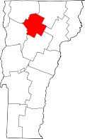 | |
| Villages | ||
| CDP | ||
| Unincorporated community | ||