Woodrow, Texas
| Woodrow, Texas | |
|---|---|
| community | |
|
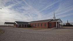
One of four churches in Woodrow | |
 Woodrow  Woodrow | |
| Coordinates: 33°26′48″N 101°50′39″W / 33.44667°N 101.84417°WCoordinates: 33°26′48″N 101°50′39″W / 33.44667°N 101.84417°W[1] | |
| Country |
|
| State |
|
| County | Lubbock |
| Physiographic region | Llano Estacado |
| Founded | 1910s |
| Elevation[1] | 3,182 ft (970 m) |
| Time zone | Central (CST) (UTC-6) |
| • Summer (DST) | CDT (UTC-5) |
| Area code | 806 |
| Website | Handbook of Texas |
Woodrow is an unincorporated community in southern Lubbock County, Texas, United States. It lies on U.S. Route 87, ten miles south of Lubbock, and has an estimated population of 85. It is part of the Lubbock Metropolitan Statistical Area.
History
Established in the mid 1910s, Woodrow is one of the newest communities in Lubbock County. Upon its establishment, a bit of controversy arose over the new community's name. It was agreed to name it after President Woodrow Wilson, but there was argument over whether the name was to be "Woodrow" or "Wilson". The choice of Woodrow was finally settled on, possibly because there was already a Wilson in neighboring Lynn County.[2]
The community's first school opened in 1917. As the twentieth century progressed the need arose to improve Lubbock County's rural schools, an as a result the Cooper School was built in Woodrow in 1936. Originally a combined elementary/middle/high school, the Cooper School evolved into the Lubbock-Cooper Independent School District which serves much of rural southern Lubbock County.
Education
Woodrow is served by the Lubbock-Cooper Independent School District.
See also
References
- 1 2 "Woodrow". Geographic Names Information System. United States Geological Survey.
- ↑ "Woodrow, TX". The Handbook of Texas online. Retrieved 2012-12-06.
External links
- U.S. Geological Survey Geographic Names Information System: Woodrow, Texas
- Woodrow, TX from the Handbook of Texas Online
- Photos of the Llano Estacado
Municipalities and communities of Lubbock County, Texas, United States | ||
|---|---|---|
| Cities | 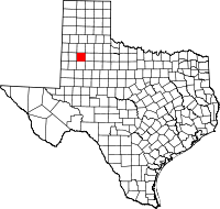 | |
| Towns | ||
| Village | ||
| Unincorporated communities | ||
| Ghost town | ||
| Footnotes | ‡This populated place also has portions in an adjacent county or counties | |