Wyandotte, Oklahoma
| Wyandotte, Oklahoma | |
|---|---|
| Town | |
| Motto: " Preserving The Future Of Our Past " | |
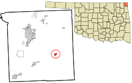 Location within Ottawa County and the state of Oklahoma | |
| Coordinates: 36°47′41″N 94°43′25″W / 36.79472°N 94.72361°WCoordinates: 36°47′41″N 94°43′25″W / 36.79472°N 94.72361°W | |
| Country | United States |
| State | Oklahoma |
| County | Ottawa |
| Area | |
| • Total | 0.5 sq mi (1.3 km2) |
| • Land | 0.5 sq mi (1.3 km2) |
| • Water | 0.0 sq mi (0.0 km2) |
| Elevation | 761 ft (232 m) |
| Population (2000) | |
| • Total | 333 |
| • Density | 739.6/sq mi (285.5/km2) |
| Time zone | Central (CST) (UTC-6) |
| • Summer (DST) | CDT (UTC-5) |
| ZIP code | 74370 |
| Area code(s) | 539/918 |
| FIPS code | 40-82250[1] |
| GNIS feature ID | 1100025[2] |
Wyandotte is a town in Ottawa County, Oklahoma, United States. The population was 333 at the 2010 census, a decline of 8.26 percent from 363 at the 2000 census.[3] The town is the tribal headquarters of the Wyandotte Nation of Oklahoma, for which the town was named.[4] Wyandotte is part of the Joplin, Missouri metropolitan area.
History
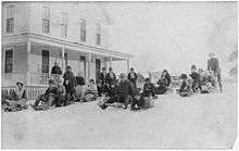
The Wyandotte tribe was removed to this area in 1867. The Society of Friends (Quakers) established a mission here in 1869, and the Wyandotte Tribal Council donated land for the Quakers to establish a boarding school for Seneca, Shawnee and Wyandotte children. Construction of the school began in 1871 and classes began in 1872.[4]
In the late 1930s, the Federal Government built Pensacola Dam, which created Grand Lake o' the Cherokees. Although the lake took away part of Wyandotte's land, it added business in the form of residential development and tourist industry. This caused a resumption of population growth.[4]
In 1966, town officials discovered that Wyandotte had never filed incorporation papers. They petitioned the Ottawa County Board of Commissioners for an election, which was approved. A majority voted for incorporation, which became effective in April, 1966.[4]
| Historical population | |||
|---|---|---|---|
| Census | Pop. | %± | |
| 1900 | 224 | — | |
| 1910 | 255 | 13.8% | |
| 1920 | 274 | 7.5% | |
| 1930 | 271 | −1.1% | |
| 1940 | 348 | 28.4% | |
| 1950 | 242 | −30.5% | |
| 1960 | 226 | −6.6% | |
| 1970 | 297 | 31.4% | |
| 1980 | 336 | 13.1% | |
| 1990 | 356 | 6.0% | |
| 2000 | 363 | 2.0% | |
| 2010 | 333 | −8.3% | |
| Est. 2015 | 333 | [5] | 0.0% |
Geography
Wyandotte is located at 36°47′41″N 94°43′25″W / 36.79472°N 94.72361°W (36.794770, -94.723488).[6] It is 12 miles (19 km) southeast of Miami, Oklahoma.[4]
According to the United States Census Bureau, the town has a total area of 0.5 square miles (1.3 km2), all of it land.
Demographics
| Historical population | |||
|---|---|---|---|
| Census | Pop. | %± | |
| 2000 | 363 | — | |
| 2010 | 333 | −8.3% | |
| Est. 2014 | 334 | 0.3% | |
As of the census[1] of 2000, there were 363 people, 128 households, and 93 families residing in the town. The population density was 739.6 people per square mile (286.0/km²). There were 148 housing units at an average density of 301.5 per square mile (116.6/km²). The racial makeup of the town was 63.36% White, 29.75% Native American, 0.28% Asian, 1.10% from other races, and 5.51% from two or more races. Hispanic or Latino of any race were 2.20% of the population.
There were 128 households out of which 39.8% had children under the age of 18 living with them, 53.1% were married couples living together, 12.5% had a female householder with no husband present, and 27.3% were non-families. 25.0% of all households were made up of individuals and 17.2% had someone living alone who was 65 years of age or older. The average household size was 2.84 and the average family size was 3.39.
In the town the population was spread out with 35.5% under the age of 18, 5.2% from 18 to 24, 24.8% from 25 to 44, 20.7% from 45 to 64, and 13.8% who were 65 years of age or older. The median age was 32 years. For every 100 females there were 90.1 males. For every 100 females age 18 and over, there were 87.2 males.
The median income for a household in the town was $23,281, and the median income for a family was $27,321. Males had a median income of $25,938 versus $15,625 for females. The per capita income for the town was $10,315. About 17.2% of families and 22.8% of the population were below the poverty line, including 35.9% of those under age 18 and 8.2% of those age 65 or over.
Oklahoma D-Day
Every year in June, Wyandotte hosts one of the largest scenario paintball games in the world; up to 5,000 players attend annually. It is played at the D-Day Adventure Park, a privately owned 740 acres (3.0 km2) of thickly wooded terrain.
References
| Wikimedia Commons has media related to Wyandotte, Oklahoma. |
- 1 2 "American FactFinder". United States Census Bureau. Retrieved 2008-01-31.
- ↑ "US Board on Geographic Names". United States Geological Survey. 2007-10-25. Retrieved 2008-01-31.
- ↑ CensusViewer: Population of the City of Wyandotte, Oklahoma
- 1 2 3 4 5 6 Larry O'Dell, 'Wyandotte", Encyclopedia of Oklahoma History and Culture. Accessed April 23, 2012.
- ↑ "Annual Estimates of the Resident Population for Incorporated Places: April 1, 2010 to July 1, 2015". Retrieved July 2, 2016.
- ↑ "US Gazetteer files: 2010, 2000, and 1990". United States Census Bureau. 2011-02-12. Retrieved 2011-04-23.
Municipalities and communities of Ottawa County, Oklahoma, United States | ||
|---|---|---|
| Cities |  | |
| Towns | ||
| CDPs | ||
| Unincorporated communities | ||
| Ghost towns | ||