Zangla
| Zangla Sangla | |
|---|---|
| Village | |
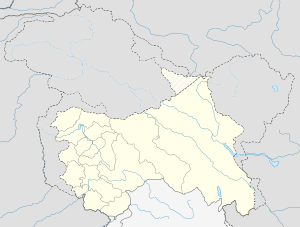 Zangla  Zangla Location in Jammu and Kashmir, India | |
| Coordinates: 33°40′N 76°59′E / 33.67°N 76.98°ECoordinates: 33°40′N 76°59′E / 33.67°N 76.98°E | |
| Country |
|
| State | Jammu and Kashmir |
| District | Kargil |
| Named for | Zangla fort |
| Government | |
| • Body | Sarpanch |
| Elevation | 3,931 m (12,897 ft) |
| Population (2014) | |
| • Total | 400 |
| Languages | |
| • Official | Bhoti |
| Time zone | IST (UTC+5:30) |
Zangla is a place in Zanskar tehsil of Kargil district, in the Indian state of Jammu and Kashmir. It is located 32 km from Padum. The town is the nodal point on the popular Padum-Strongdey-Zangla-Karsha-Padum round trip. Zangla Monastery is located on a hill top right side to village at a distance of one km belief of 11th century.
Geography
Zangla is located at 33°40′N 76°59′E / 33.67°N 76.98°E,[1] and has an average elevation of 3,931 metres (12,897 feet).
References
This article is issued from Wikipedia - version of the 9/8/2016. The text is available under the Creative Commons Attribution/Share Alike but additional terms may apply for the media files.