Šušara
| Šušara Шушара Fejértelep | |
|---|---|
| Village | |
|
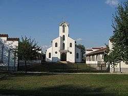
The Roman Catholic Church | |
 Šušara Location of Šušara within Serbia | |
| Coordinates: 44°56′17″N 21°07′18″E / 44.93806°N 21.12167°ECoordinates: 44°56′17″N 21°07′18″E / 44.93806°N 21.12167°E | |
| Country | Serbia |
| Province | Vojvodina |
| District | South Banat |
| Elevation | 169 m (554 ft) |
| Population (2002) | |
| • Šušara | 319 |
| Time zone | CET (UTC+1) |
| • Summer (DST) | CEST (UTC+2) |
| Area code(s) | +381(0)13 |
| Car plates | VŠ |
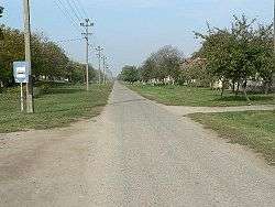
Susara Street detail.
from adobe

1902. Fejértelep
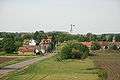
Šušara (Serbian: Šušara or Шушара, Hungarian: Fejértelep and in German: Schuschara) is a village in Serbia. It is situated in the Vršac municipality, in the South Banat District, Vojvodina province. The village has a Hungarian ethnic majority (64.09%) and its population numbering 319 people (2002 census).
Population
In the settlement Susara 296 adult inhabitants, the average age of the population live is 40.9 years (39.3 for men and 42.5 for women). The village has 139 households, the average number of members per household is 2.71. The population in this village is very inhomogeneous and in the last three censuses were registered a decline in the population.
- 1894: 1044
- 1910: 946
- 1921: 1016
- 1948: 748
- 1953: 851
- 1961: 819
- 1971: 648
- 1981: 496
- 1991: 472
- 2002: 416
- 2011: 319
 Šušara


See also
References
- Book 1, Population, national or ethnic origin, the data on settlements, the Republic Institute for Statistics, Belgrade, February 2003, ISBN 86-84433-00-9
- Book 2, population, gender and age, data on settlements, the Republican Institute for Statistics, Belgrade, February 2003, ISBN 86-84433-01-7
- Milan Marina, Historical population 1948 - 2002., (Broj stanovnistva, 1948–2002)
- Slobodan Ćurčić, Broj stanovnika Vojvodine, Novi Sad, 1996.
External links
| Wikimedia Commons has media related to Šušara. |
This article is issued from Wikipedia - version of the 6/10/2016. The text is available under the Creative Commons Attribution/Share Alike but additional terms may apply for the media files.