Ždiar
| Ždiar | |
| Municipality | |
 | |
| Country | Slovakia |
|---|---|
| Region | Prešov |
| District | Poprad |
| Elevation | 896 m (2,940 ft) |
| Coordinates | 49°16′15″N 20°15′55″E / 49.27083°N 20.26528°ECoordinates: 49°16′15″N 20°15′55″E / 49.27083°N 20.26528°E |
| Area | 27.32 km2 (11 sq mi) |
| Population | 1,377 (2010-12-31) |
| Postal code | 059 55 |
| Area code | +421-52 |
| Car plate | PP |
  Location of Ždiar in Slovakia | |
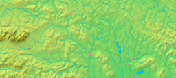  Location of Ždiar in the Prešov Region | |
| Wikimedia Commons: Ždiar | |
| Statistics: | |
| Website: www.zdiar.sk | |
Ždiar (former name Žjár) is a village and municipality in the Poprad District in the Prešov Region in Spiš in northern Slovakia.
History
In historical records the village was first mentioned in 1409. Its first name had been Stragan. Locals had been engaged in agriculture, pasturage and charcoal production. From the end of 19th century they began to be employed in tourism.
Geography
The municipality lies at an elevation of 896 meters at the base of the High Tatras and covers an area of 27.323 km². It has a population of about 1,340 people.
Recreation
Ždiar is located at the base of Strednica alpine and cross country Ski resort. Several hiking trails into the High Tatras begin in the village.
External links
- Official website of Ždiar
- Tourist website of Ždiar
- www.zdiar.net - tourist information about Zdiar and area (maps, videos) SK/PL/EN
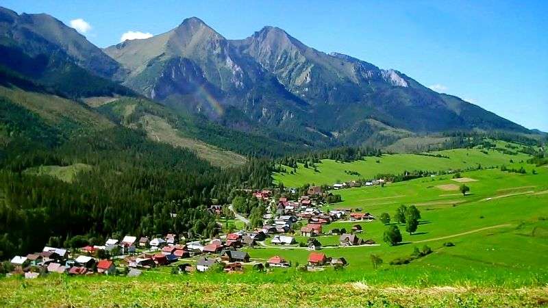
Zdiar and Bielianske Tatras
| Wikivoyage has a travel guide for Ždiar. |
Municipalities of Poprad District | ||
|---|---|---|
This article is issued from Wikipedia - version of the 12/20/2015. The text is available under the Creative Commons Attribution/Share Alike but additional terms may apply for the media files.