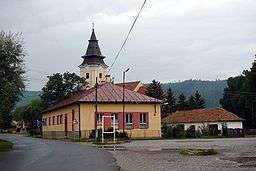
Spišský Štiavnik
| Spišský Štiavnik | |
| Municipality | |
 | |
| Country | Slovakia |
|---|---|
| Region | Prešov |
| District | Poprad |
| Elevation | 567 m (1,860 ft) |
| Coordinates | 48°59′42″N 20°21′36″E / 48.99500°N 20.36000°ECoordinates: 48°59′42″N 20°21′36″E / 48.99500°N 20.36000°E |
| Area | 18.36 km2 (7 sq mi) |
| Population | 2,648 (2010-12-31) |
| Density | 144/km2 (373/sq mi) |
| First mentioned | 1246 |
| Postal code | 059 14 |
| Car plate | PP |
  Location of Spišský Štiavnik in Slovakia | |
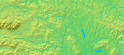  Location of Spišský Štiavnik in the Prešov Region | |
| Statistics: MOŠ/MIS | |
| Website: www.spisskystiavnik.e-obce.sk | |
Spišský Štiavnik is a village and municipality in Poprad District in the Prešov Region of northern Slovakia.
Geography
The municipality lies at an altitude of 567 metres and covers an area of 18.364 km². It has a population of about 2150 people.
History
In historical records the village was first mentioned in 1246.
Famous people
- Tibor Frešo, composer and conductor
- Prof. Martin Slivka, ethnography director
Infrastructure and economy
Cultural sightseeing is a building of former spas from the 19th century. In the Spišský Štiavnik is multi course as well as football and horse racing clubs.
External links
Municipalities of Poprad District | ||
|---|---|---|
This article is issued from Wikipedia - version of the 2/26/2013. The text is available under the Creative Commons Attribution/Share Alike but additional terms may apply for the media files.