Adiaké Department
| Adiaké Department Département d'Adiaké | |
|---|---|
| Department | |
 Location in Ivory Coast. Adiaké Department has had these boundaries since 2008. | |
| Country |
|
| District | Comoé |
| Region | Sud-Comoé |
| 1998 | Established as a second-level subdivision via a division of Aboisso Dept |
| 2008 | Divided to create Tiapoum Dept |
| 2011 | Converted to a third-level subdivision |
| Departmental seat | Adiaké |
| Government[1] | |
| • Prefect | Touré Kanandiénantiori |
| Area[2] | |
| • Total | 1,088 km2 (420 sq mi) |
| • Land | 798 km2 (308 sq mi) |
| Population (2014)[3] | |
| • Total | 83,547 |
| • Density | 77/km2 (200/sq mi) |
| Time zone | GMT (UTC+0) |
Adiaké Department is a department of Sud-Comoé Region in Comoé District, Ivory Coast. In 2014, its population was 83,547 and its seat is the settlement of Adiaké. The sub-prefectures of the department are Adiaké, Assinie-Mafia, and Etuéboué.
History
.jpg)
Adiaké Department was created in 1998 as a second-level subdivision via a split-off from Aboisso Department.[4] At its creation, it was part of Sud-Comoé Region.
Adiaké Department was divided in 2008 with the split-off creation of Tiapoum Department.[5]
In 2011, districts were introduced as new first-level subdivisions of Ivory Coast. At the same time, regions were reorganised and became second-level subdivisions and all departments were converted into third-level subdivisions. At this time, Adiaké Department remained part of the retained Sud-Comoé Region in the new Comoé District.
Notes
- ↑ "Préfets de Région et de Préfets de Département (Conseil des ministres du mercredi 26 septembre 2012)", abidjan.net, 2 October 2012.
- ↑ "Monographie du département d’Adiaké", abidjan.net, 3 September 2015.
- ↑ "Côte d'Ivoire". geohive.com. Retrieved 6 December 2015.
- ↑ "Regions of Côte d'Ivoire (Ivory Coast)", statoids.com, accessed 16 February 2016.
- ↑ Décret n° 2008-96 du 5 mars 2008 portant création des départements de Bettié, Botro, Guéyo, Koro, Kouto, Ouangolodougou, Sinématiali, Tiapoum, Yakassé-Attobrou et Zoukougbeu.
Regional seat: Aboisso | ||
| Aboisso Department | 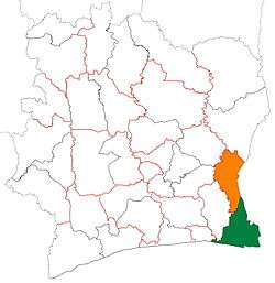 | |
| Adiaké Department | ||
| Grand-Bassam Department | ||
| Tiapoum Department | ||
* also a commune | ||
Coordinates: 5°17′N 3°18′W / 5.283°N 3.300°W