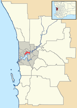
Alexander Heights, Western Australia
| Alexander Heights Perth, Western Australia | |||||||||||||
|---|---|---|---|---|---|---|---|---|---|---|---|---|---|
 Alexander Heights | |||||||||||||
| Coordinates | 31°49′37″S 115°52′16″E / 31.827°S 115.871°ECoordinates: 31°49′37″S 115°52′16″E / 31.827°S 115.871°E | ||||||||||||
| Population | 7,695 (2011 census)[1] | ||||||||||||
| • Density | 2,400/km2 (6,230/sq mi) | ||||||||||||
| Established | 1980s | ||||||||||||
| Postcode(s) | 6064 | ||||||||||||
| Area | 3.2 km2 (1.2 sq mi) | ||||||||||||
| Location | 14 km (9 mi) NNE of Perth CBD | ||||||||||||
| LGA(s) | City of Wanneroo | ||||||||||||
| State electorate(s) | Nollamara | ||||||||||||
| Federal Division(s) | Cowan | ||||||||||||
| |||||||||||||
Alexander Heights is a suburb of Perth, Western Australia within the City of Wanneroo.
Originally named "Alinjarra", an Aboriginal word for 'north' in 1977, this suburb was renamed Alexander Heights in 1987. The name is derived from Alexander Drive, the main arterial road into the area which forms the suburb's eastern boundary. The road was in turn named after Mr S.B. Alexander, a former Wanneroo Road Board member.[2]
The suburb contains the Alinjarra Primary School which covers from years kindergarten to year 6. It hosts a range of sports programs and English courses to help the large number of recent immigrants, mostly of African, Arabic, Irish or English descent, moving into the area.
References
- ↑ Australian Bureau of Statistics (31 October 2012). "State Suburbs: Alexander Heights". 2011 Census QuickStats. Retrieved 4 July 2012.
- ↑ Western Australian Land Information Authority. "History of metropolitan suburb names – A". Retrieved 2008-02-15.
This article is issued from Wikipedia - version of the 4/8/2016. The text is available under the Creative Commons Attribution/Share Alike but additional terms may apply for the media files.
