Tapping, Western Australia
| Tapping Perth, Western Australia | |||||||||||||
|---|---|---|---|---|---|---|---|---|---|---|---|---|---|
 Tapping | |||||||||||||
| Coordinates | 31°43′08″S 115°47′42″E / 31.719°S 115.795°ECoordinates: 31°43′08″S 115°47′42″E / 31.719°S 115.795°E | ||||||||||||
| Population | 8,946 (2011 census)[1] | ||||||||||||
| • Density | 7,460/km2 (19,300/sq mi) | ||||||||||||
| Postcode(s) | 6065 | ||||||||||||
| Area | 1.2 km2 (0.5 sq mi) | ||||||||||||
| Location | 27 km (17 mi) N of Perth CBD | ||||||||||||
| LGA(s) | City of Wanneroo | ||||||||||||
| State electorate(s) | Wanneroo | ||||||||||||
| Federal Division(s) | Cowan | ||||||||||||
| |||||||||||||
Tapping is a suburb of Perth, Western Australia, located within the City of Wanneroo. It came into being in the early 1990s as a subdivision of Wanneroo, originally as part of the Carramar estate.
Tapping was chosen as the suburb name in honour of an early settler family in the Wanneroo area. Mr William Tapping arrived in 1886 and Molly and Dolly Tapping were long time Postmistresses in Wanneroo. The name for the suburb was approved in 1997.[2]
Geography
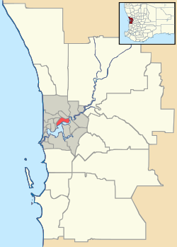
Tapping is bounded by Joondalup Drive to the north, Pinjar Road to the east, Conti Road to the south, and Wanneroo Road to the west.[3]
Demographics
At the 2006 census, Tapping had a population of 3,113, an increase of 2,884 persons in comparison to the 2001 census, which had the population at 229.[1][4] This increase can be directly attributed to continued housing development within the suburb on previously undeveloped land previously used for farming and horticulture activities. The median age of Tapping residents was 30, and median individual incomes were $586.[1] 0.8% of the population identified themselves as Indigenous persons.[1]
The top popular religious affiliations in descending order in the 2006 census were Anglican 27.5%, No Religion 23.5%, Catholic 19.2%, Uniting Church 3.4% and Christian, not further described 3.2%.[1]
Education
Tapping contains one private School, St Stephen's School, Carramar Campus, an extension of the original St Stephens School in Duncraig. The school supports both primary and secondary education. Tapping also has a public school, Tapping Primary School which opened at the start of 2007. The school provides education for Kindergarten through to Year 7.
Both of these schools are located on St Stephens Crescent.
Tapping does not contain a public high school. High school studies are provided through Wanneroo Senior High School and Kinross College.
Transport
The suburb is served by bus links which provides connections back to the Joondalup Line via either the Whitfords or Joondalup railway stations.[5][6]
Bus routes
- 390 Joondalup - Banksia Grove
- 391 Joondalup - Banksia Grove
- 467 Whitfords - Joondalup
- 468 Whitfords - Joondalup
References
- 1 2 3 4 5 Australian Bureau of Statistics (31 October 2012). "2011 Community Profiles: State Suburbs: Tapping". 2011 Census of Population and Housing. Retrieved 4 July 2012.
- ↑ Western Australian Land Information Authority. "History of metropolitan suburb names – T". Retrieved 2007-06-27.
- ↑ Maps 165-166, 2007 UBD Directory (49th Edition), Universal Publishers Limited, Perth.
- ↑ Australian Bureau of Statistics (19 November 2002). "Community Profile Series : Tapping (State Suburb)". 2001 Census of Population and Housing. Retrieved 2007-06-27.
- ↑ Route 390 and 391 timetables. Transperth. Retrieved on 10 April 2007.
- ↑ Route 468 timetable. Transperth. Retrieved on 10 April 2007.
Suburbs and localities of the City of Wanneroo, Perth, Western Australia | ||
|---|---|---|
| North West |  | |
| North East | ||
| South | ||
¹ Suburb shared with the City of Joondalup | ||