Alexandria, Missouri
| Alexandria, Missouri | |
|---|---|
| City | |
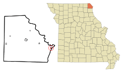 Location of Alexandria, Missouri | |
| Coordinates: 40°21′35″N 91°27′28″W / 40.35972°N 91.45778°WCoordinates: 40°21′35″N 91°27′28″W / 40.35972°N 91.45778°W | |
| Country | United States |
| State | Missouri |
| County | Clark |
| Area[1] | |
| • Total | 0.39 sq mi (1.01 km2) |
| • Land | 0.38 sq mi (0.98 km2) |
| • Water | 0.01 sq mi (0.03 km2) |
| Elevation | 489 ft (149 m) |
| Population (2010)[2] | |
| • Total | 159 |
| • Estimate (2012[3]) | 156 |
| • Density | 418.4/sq mi (161.5/km2) |
| Time zone | Central (CST) (UTC-6) |
| • Summer (DST) | CDT (UTC-5) |
| ZIP code | 63430 |
| Area code(s) | 660 |
| FIPS code | 29-00604[4] |
| GNIS feature ID | 0735484[5] |
Alexandria is a city in Clark County, Missouri, USA. The population was 159 at the 2010 census.
Alexandria is part of the Fort Madison–Keokuk, IA-MO Micropolitan Statistical Area.
History
Alexandria was founded in the 1830s.[6] The community was named after John Alexander, the proprietor of a nearby ferry.[7] A post office called Alexandria has been in operation since 1840.[8]
Geography
Alexandria is located at 40°21′35″N 91°27′28″W / 40.35972°N 91.45778°W (40.359770, -91.457749).[9]
According to the United States Census Bureau, the city has a total area of 0.39 square miles (1.01 km2), of which, 0.38 square miles (0.98 km2) is land and 0.01 square miles (0.03 km2) is water.[1]

Located along the Mississippi River, Alexandria is prone to flooding with large swaths of the area under water during the Great Flood of 1993.
Demographics
| Historical population | |||
|---|---|---|---|
| Census | Pop. | %± | |
| 1860 | 952 | — | |
| 1870 | 688 | −27.7% | |
| 1880 | 760 | 10.5% | |
| 1890 | 536 | −29.5% | |
| 1950 | 465 | — | |
| 1960 | 452 | −2.8% | |
| 1970 | 453 | 0.2% | |
| 1980 | 417 | −7.9% | |
| 1990 | 341 | −18.2% | |
| 2000 | 166 | −51.3% | |
| 2010 | 159 | −4.2% | |
| Est. 2015 | 153 | [10] | −3.8% |
2010 census
As of the census[2] of 2010, there were 159 people, 67 households, and 45 families residing in the city. The population density was 418.4 inhabitants per square mile (161.5/km2). There were 77 housing units at an average density of 202.6 per square mile (78.2/km2). The racial makeup of the city was 96.9% White, 0.6% African American, and 2.5% from two or more races.
There were 67 households of which 31.3% had children under the age of 18 living with them, 50.7% were married couples living together, 13.4% had a female householder with no husband present, 3.0% had a male householder with no wife present, and 32.8% were non-families. 28.4% of all households were made up of individuals and 7.5% had someone living alone who was 65 years of age or older. The average household size was 2.37 and the average family size was 2.93.
The median age in the city was 41.5 years. 24.5% of residents were under the age of 18; 5% were between the ages of 18 and 24; 26.4% were from 25 to 44; 32% were from 45 to 64; and 11.9% were 65 years of age or older. The gender makeup of the city was 54.1% male and 45.9% female.
2000 census
As of the census[4] of 2000, there were 166 people, 70 households, and 45 families residing in the city. The population density was 443.7 people per square mile (173.2/km²). There were 79 housing units at an average density of 211.2 per square mile (82.4/km²). The racial makeup of the city was 98.80% White and 1.20% African American.
There were 70 households out of which 31.4% had children under the age of 18 living with them, 55.7% were married couples living together, 2.9% had a female householder with no husband present, and 35.7% were non-families. 31.4% of all households were made up of individuals and 11.4% had someone living alone who was 65 years of age or older. The average household size was 2.37 and the average family size was 2.91.
In the city the population was spread out with 24.7% under the age of 18, 7.2% from 18 to 24, 31.3% from 25 to 44, 21.1% from 45 to 64, and 15.7% who were 65 years of age or older. The median age was 39 years. For every 100 females there were 104.9 males. For every 100 females age 18 and over, there were 104.9 males.
The median income for a household in the city was $30,000, and the median income for a family was $32,000. Males had a median income of $30,000 versus $20,833 for females. The per capita income for the city was $13,404. About 6.7% of families and 6.4% of the population were below the poverty line, including none of those under the age of 18 and 16.7% of those 65 or over.
References
- 1 2 "US Gazetteer files 2010". United States Census Bureau. Archived from the original on 2012-01-24. Retrieved 2012-07-08.
- 1 2 "American FactFinder". United States Census Bureau. Retrieved 2012-07-08.
- ↑ "Population Estimates". United States Census Bureau. Archived from the original on 2013-06-17. Retrieved 2013-05-30.
- 1 2 "American FactFinder". United States Census Bureau. Archived from the original on 2013-09-11. Retrieved 2008-01-31.
- ↑ "US Board on Geographic Names". United States Geological Survey. 2007-10-25. Retrieved 2008-01-31.
- ↑ Eaton, David Wolfe (1916). How Missouri Counties, Towns and Streams Were Named. The State Historical Society of Missouri. p. 276.
- ↑ "Clark County Place Names, 1928–1945 (archived)". The State Historical Society of Missouri. Archived from the original on 24 June 2016. Retrieved 18 September 2016.
- ↑ "Post Offices". Jim Forte Postal History. Retrieved 18 September 2016.
- ↑ "US Gazetteer files: 2010, 2000, and 1990". United States Census Bureau. 2011-02-12. Retrieved 2011-04-23.
- ↑ "Annual Estimates of the Resident Population for Incorporated Places: April 1, 2010 to July 1, 2015". Retrieved July 2, 2016.
- ↑ "Census of Population and Housing". Census.gov. Archived from the original on May 11, 2015. Retrieved June 4, 2015.
Municipalities and communities of Clark County, Missouri, United States | ||
|---|---|---|
| Cities | 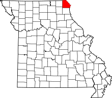 | |
| Villages | ||
| Townships | ||
| CDP | ||
| Other unincorporated communities | ||