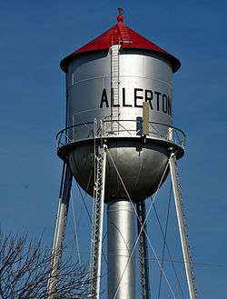
Allerton, Iowa
| Allerton, Iowa | |
|---|---|
| City | |
 | |
 Location of Allerton, Iowa | |
| Coordinates: 40°42′26″N 93°22′2″W / 40.70722°N 93.36722°WCoordinates: 40°42′26″N 93°22′2″W / 40.70722°N 93.36722°W | |
| Country |
|
| State |
|
| County | Wayne |
| Area[1] | |
| • Total | 1.14 sq mi (2.95 km2) |
| • Land | 1.14 sq mi (2.95 km2) |
| • Water | 0 sq mi (0 km2) |
| Elevation | 1,099 ft (335 m) |
| Population (2010)[2] | |
| • Total | 501 |
| • Estimate (2012[3]) | 495 |
| • Density | 439.5/sq mi (169.7/km2) |
| Time zone | Central (CST) (UTC-6) |
| • Summer (DST) | CDT (UTC-5) |
| ZIP code | 50008 |
| Area code(s) | 641 |
| FIPS code | 19-01270 |
| GNIS feature ID | 0454140 |
Allerton is a city in Wayne County, Iowa, United States. The population was 501 at the 2010 census.
Geography
Allerton is located at 40°42′26″N 93°22′2″W / 40.70722°N 93.36722°W (40.707108, -93.367263).[4]
According to the United States Census Bureau, the city has a total area of 1.14 square miles (2.95 km2), all of it land.[1] About three miles to the west is the Allerton reservoir and Bob White State Park
Transportation
Allerton was served by Iowa Highway 40 until it was turned over to Wayne County and made a county road. There is a network of paved farm to market roads radiating out from Allerton and connecting with the surrounding towns.
Allerton was a division point on the Chicago, Rock Island & Pacific Railroad until the bankruptcy of the line in 1980. The old Golden State Route that took off east from Allerton through Seymour, Fairfield and Chicago was then abandoned. There had been some talk of relaying the track from Allerton to Seymour on the old Rock Island right of way to provide a connection between the Canadian Pacific (old Milwaukee Road) and the Union Pacific. This idea has since been dropped due to the objections of the adjacent landowners. The remaining line is now known as Union Pacific's Spine Line. It was purchased by the Chicago & Northwestern after the bankruptcy as a direct line between Kansas City and Minneapolis. It has seen a marked increase in traffic since the Chicago & Northwestern merger with Union Pacific. The last passenger train on the old Rock Island system through Allerton was the Plainsman from Kansas City to Des Moines and Minneapolis. It was discontinued in 1970.
History
Allerton was platted by the Rock Island Railroad in when it came through the area in 1870. It became a legal town in 1874 and had a peak population of 1,600 in 1913.[5] Allerton and Corydon were rivals for the Wayne County seat. Several times, during the early establishment of the two towns, county records were moved back and forth, sometimes illegally, before Corydon was declared the county seat.
Allerton used to have its own school system and then merged with Lineville and Clio to form ACL Community School. In 1966, Allerton voted to leave ACL and merge with Cambria-Corydon to form Wayne Community School. Classes were held for different grades at the Allerton school until the school house was deemed deficient in the latter part of the 20th century. Classes are now held in Corydon.
Demographics
| Historical populations | ||
|---|---|---|
| Year | Pop. | ±% |
| 1880 | 888 | — |
| 1890 | 807 | −9.1% |
| 1900 | 950 | +17.7% |
| 1910 | 862 | −9.3% |
| 1920 | 954 | +10.7% |
| 1930 | 784 | −17.8% |
| 1940 | 782 | −0.3% |
| 1950 | 761 | −2.7% |
| 1960 | 692 | −9.1% |
| 1970 | 643 | −7.1% |
| 1980 | 670 | +4.2% |
| 1990 | 599 | −10.6% |
| 2000 | 559 | −6.7% |
| 2010 | 501 | −10.4% |
| 2014 | 497 | −0.8% |
| 2015 | 495 | −0.4% |
| Source:"American FactFinder". United States Census Bureau. and Iowa Data Center Source: | ||
2010 census
As of the census[2] of 2010, there were 501 people, 217 households, and 146 families residing in the city. The population density was 439.5 inhabitants per square mile (169.7/km2). There were 250 housing units at an average density of 219.3 per square mile (84.7/km2). The racial makeup of the city was 99.2% White, 0.2% Native American, and 0.6% from two or more races. Hispanic or Latino of any race were 0.2% of the population.
There were 217 households of which 28.1% had children under the age of 18 living with them, 52.1% were married couples living together, 10.1% had a female householder with no husband present, 5.1% had a male householder with no wife present, and 32.7% were non-families. 28.1% of all households were made up of individuals and 13.4% had someone living alone who was 65 years of age or older. The average household size was 2.31 and the average family size was 2.77.
The median age in the city was 44.6 years. 21.6% of residents were under the age of 18; 6.2% were between the ages of 18 and 24; 23% were from 25 to 44; 31.6% were from 45 to 64; and 17.8% were 65 years of age or older. The gender makeup of the city was 47.9% male and 52.1% female.
2000 census
As of the census[7] of 2000, there were 559 people, 231 households, and 155 families residing in the city. The population density was 490.4 people per square mile (189.3/km²). There were 287 housing units at an average density of 251.8 per square mile (97.2/km²). The racial makeup of the city was 99.28% White, 0.18% Asian, and 0.54% from two or more races. Hispanic or Latino of any race were 0.89% of the population.
There were 231 households out of which 34.6% had children under the age of 18 living with them, 51.9% were married couples living together, 12.1% had a female householder with no husband present, and 32.5% were non-families. 30.7% of all households were made up of individuals and 17.3% had someone living alone who was 65 years of age or older. The average household size was 2.42 and the average family size was 2.99.
27.5% are under the age of 18, 5.9% from 18 to 24, 26.8% from 25 to 44, 23.3% from 45 to 64, and 16.5% who were 65 years of age or older. The median age was 38 years. For every 100 females there were 94.8 males. For every 100 females age 18 and over, there were 91.9 males.
The median income for a household in the city was $28,929, and the median income for a family was $35,000. Males had a median income of $23,854 versus $17,614 for females. The per capita income for the city was $12,218. About 17.6% of families and 18.5% of the population were below the poverty line, including 23.5% of those under age 18 and 15.0% of those age 65 or over.
References
- 1 2 "US Gazetteer files 2010". United States Census Bureau. Archived from the original on 2012-01-24. Retrieved 2012-05-11.
- 1 2 "American FactFinder". United States Census Bureau. Retrieved 2012-05-11.
- ↑ "Population Estimates". United States Census Bureau. Archived from the original on 2013-06-17. Retrieved 2013-05-23.
- ↑ "US Gazetteer files: 2010, 2000, and 1990". United States Census Bureau. 2011-02-12. Retrieved 2011-04-23.
- ↑ Pictorial Review of Wayne County, Wayne County Historical Society, 1968
- ↑ "Census of Population and Housing". Census.gov. Archived from the original on May 11, 2015. Retrieved June 4, 2015.
- ↑ "American FactFinder". United States Census Bureau. Archived from the original on 2013-09-11. Retrieved 2008-01-31.
Municipalities and communities of Wayne County, Iowa, United States | ||
|---|---|---|
| Cities | ||
| Townships | ||
| Unincorporated communities | ||
| Ghost town | ||