Anchor Point, Alaska
| Anchor Point, Alaska | |
|---|---|
| CDP | |
 | |
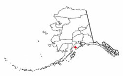 Location of Anchor Point, Alaska | |
| Coordinates: 59°46′39″N 151°46′13″W / 59.77750°N 151.77028°W | |
| Country | United States |
| State | Alaska |
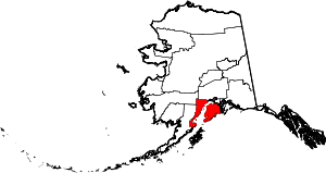
| Borough | Kenai Peninsula |
| Government | |
| • Borough mayor | Mike Navarre[1] |
| • State senator | Gary Stevens (R) |
| • State rep. | Paul Seaton (R) |
| Area | |
| • Total | 90.9 sq mi (235.4 km2) |
| • Land | 90.8 sq mi (235.1 km2) |
| • Water | 0.1 sq mi (0.3 km2) |
| Elevation | 118 ft (36 m) |
| Population (2000) | |
| • Total | 1,845 |
| Time zone | Alaska (AKST) (UTC-9) |
| • Summer (DST) | AKDT (UTC-8) |
| ZIP code | 99556 |
| Area code(s) | 907 |
| FIPS code | 02-03110 |
| GNIS feature ID | 1412516 |
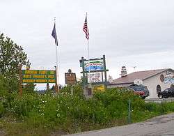
Anchor Point is an unincorporated community and census-designated place (CDP) in Kenai Peninsula Borough, in the U.S. state of Alaska. As of the 2000 census the population was 1,845. The community is located along the Sterling Highway, part of Alaska State Route 1. Anchor Point is the westernmost point in the North American highway system.

History
The name Anchor Point comes from a legend that when James Cook discovered the area, he lost an anchor. Settlers came beginning in the early 1900s.[2]
Geography
Anchor Point is located at 59°46′39″N 151°46′13″W / 59.77750°N 151.77028°W (59.777468, -151.770220).[3]
The town is the furthest west on the U.S. highway system. According to the United States Census Bureau, the CDP has a total area of 90.9 square miles (235 km2), of which 90.8 square miles (235 km2) is land and 0.1 square miles (0.26 km2) (0.13%) is water.
Economy
A large portion of the Anchor Point economy relies on the Anchor River. Tourists come to fish the river during salmon runs in the summer. The river is also a source of coal. Along the coast, there are good spots for clam-digging, which draws tourists.
KNLS shortwave transmitter site
Anchor Point is the location of the KNLS shortwave transmitter site run by World Christian Broadcasting in Franklin, Tennessee. The station broadcasts a variety of Christian radio programming in Mandarin, Russian and English to audiences in China, the Russian Far East and the Pacific Rim.
Education
Anchor Point is in the Kenai Peninsula Borough School District. The Chapman School is a pre-kindergarten through eighth grade school off the main highway.[4] Older students generally attend Homer High School.
The Anchor Point Public Library has one employee and its collection includes approximately 12,269 items.[5]
Demographics
As of the census[6] of 2000, there were 1,845 people, 711 households, and 467 families residing in the CDP. The population density was 20.3 people per square mile (7.8/km²). There were 979 housing units at an average density of 10.8/sq mi (4.2/km²).
The racial makeup of the CDP was 91.82% White, 3.36% Native American, 0.33% Asian, 0.11% Black or African American, 0.60% from other races, and 3.79% from two or more races. 1.73% of the population were Hispanic or Latino of any race.
There were 711 households out of which 35.6% had children under the age of 18 living with them, 54.3% were married couples living together, 6.5% had a female householder with no husband present, and 34.3% were non-families. 25.6% of all households were made up of individuals and 4.5% had someone living alone who was 65 years of age or older. The average household size was 2.59 and the average family size was 3.19.
In the CDP the population was spread out with 29.3% under the age of 18, 7.1% from 18 to 24, 25.4% from 25 to 44, 31.3% from 45 to 64, and 7.0% who were 65 years of age or older. The median age was 39 years. For every 100 females there were 115.3 males. For every 100 females age 18 and over, there were 113.2 males.
The median income for a household in the CDP was $41,094, and the median income for a family was $49,821. Males had a median income of $39,688 versus $26,731 for females. The per capita income for the CDP was $18,668. About 8.2% of families and 11.9% of the population were below the poverty line, including 14.9% of those under age 18 and 1.5% of those age 65 or over.
References
- ↑ 2015 Alaska Municipal Officials Directory. Juneau: Alaska Municipal League. 2015. p. 9.
- ↑ Alaska Division of Parks and Outdoor Recreation: "Anchor River State Recreation Area and Stariski State Recreation Site"
- ↑ "US Gazetteer files: 2010, 2000, and 1990". United States Census Bureau. 2011-02-12. Retrieved 2011-04-23.
- ↑ Chapman School page at KPBSD website
- ↑ Breeding, Marshall. "Anchor Point Public Library". LibraryTechnology.org. Retrieved 2015-03-04.
- ↑ "American FactFinder". United States Census Bureau. Archived from the original on 2013-09-11. Retrieved 2008-01-31.
External links
| Wikivoyage has a travel guide for Anchor Point. |
| Wikimedia Commons has media related to Anchor Point, Alaska. |
- Anchor Point at the Community Database Online from the Alaska Division of Community and Regional Affairs
- Maps from the Alaska Department of Labor and Workforce Development: 2000, 2010
Coordinates: 59°46′39″N 151°46′13″W / 59.777468°N 151.77022°W