Homer, Alaska
Homer is a city located in Kenai Peninsula Borough in the U.S. state of Alaska. It is two hundred and eighteen miles southwest of Anchorage. According to the 2010 Census, the population is 5,003. Long known as The "Halibut Fishing Capital of the World." Homer is also nicknamed "the end of the road," and more recently, "the cosmic hamlet by the sea."
Geography
Homer is located at 59°38'35" North, 151°31'33" West (59.643059, −151.525900).[3] The only road into Homer is the Sterling Highway.[4]
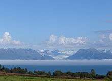
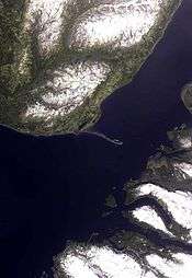
Homer is on the shore of Kachemak Bay on the southwest side of the Kenai Peninsula. Its distinguishing feature is the Homer Spit, a narrow 4.5 mi (7.2 km)) long gravel bar that extends into the bay, on which is located the Homer Harbor.
Much of the coastline as well as the Homer Spit sank dramatically during the Good Friday earthquake in March 1964. After the earthquake, very little vegetation was able to survive on the Homer Spit.
According to the United States Census Bureau, the town has a total area of 22.4 square miles (58 km2), of which 10.6 square miles (27 km2) is land and 11.9 square miles (31 km2) is water. The total area is 52.83% water.
Climate
As with much of South Central Alaska, Homer has a moderate subarctic coastal climate (Köppen Dsc) which causes its weather to be moderate compared to interior Alaska. Winters are snowy and long but not particularly cold, considering the latitude, with the average January high only slightly below freezing. Snow averages 50 inches (127 cm) per season, falling primarily from November through March, with some accumulation in October and April, and rarely in May. Homer receives only about 25 inches of rainfall annually due to the influence of the Chugach Mountains to the southeast which shelter it from the Gulf of Alaska. There are 7 nights of sub-0 °F (−18 °C) lows annually, and the area straddles the border between USDA Plant Hardiness Zones 5B and 6A, indicating an average annual minimum of around −10 °F (−23 °C). Summers are cool due to the marine influence, with 75 °F (24 °C) highs or 55 °F (13 °C) lows being extremely rare. Extreme temperatures have ranged from −24 °F (−31 °C) on January 28–29, 1989 up to 84 °F (29 °C) on July 22, 2011.
| Climate data for Homer, Alaska (Airport), 1981–2010 normals | |||||||||||||
|---|---|---|---|---|---|---|---|---|---|---|---|---|---|
| Month | Jan | Feb | Mar | Apr | May | Jun | Jul | Aug | Sep | Oct | Nov | Dec | Year |
| Record high °F (°C) | 51 (11) |
56 (13) |
53 (12) |
65 (18) |
71 (22) |
80 (27) |
84 (29) |
78 (26) |
69 (21) |
64 (18) |
58 (14) |
51 (11) |
84 (29) |
| Average high °F (°C) | 30.8 (−0.7) |
32.7 (0.4) |
36.5 (2.5) |
44.0 (6.7) |
51.8 (11) |
57.7 (14.3) |
61.2 (16.2) |
60.9 (16.1) |
55.0 (12.8) |
44.6 (7) |
35.4 (1.9) |
32.9 (0.5) |
45.3 (7.4) |
| Daily mean °F (°C) | 24.8 (−4) |
26.2 (−3.2) |
29.9 (−1.2) |
37.0 (2.8) |
44.5 (6.9) |
50.6 (10.3) |
54.6 (12.6) |
53.9 (12.2) |
48.1 (8.9) |
38.1 (3.4) |
29.5 (−1.4) |
27.1 (−2.7) |
38.7 (3.7) |
| Average low °F (°C) | 18.9 (−7.3) |
20.0 (−6.7) |
23.4 (−4.8) |
30.0 (−1.1) |
37.2 (2.9) |
43.7 (6.5) |
48.3 (9.1) |
47.1 (8.4) |
41.3 (5.2) |
31.8 (−0.1) |
23.7 (−4.6) |
21.2 (−6) |
32.2 (0.1) |
| Record low °F (°C) | −24 (−31) |
−19 (−28) |
−21 (−29) |
−9 (−23) |
6 (−14) |
27 (−3) |
34 (1) |
31 (−1) |
20 (−7) |
0 (−18) |
−7 (−22) |
−16 (−27) |
−24 (−31) |
| Average precipitation inches (mm) | 2.61 (66.3) |
1.72 (43.7) |
1.66 (42.2) |
1.01 (25.7) |
0.81 (20.6) |
0.82 (20.8) |
1.55 (39.4) |
2.33 (59.2) |
3.31 (84.1) |
2.57 (65.3) |
2.79 (70.9) |
3.07 (78) |
24.26 (616.2) |
| Average snowfall inches (cm) | 9.3 (23.6) |
11.1 (28.2) |
7.6 (19.3) |
1.9 (4.8) |
0 (0) |
0 (0) |
0 (0) |
0 (0) |
0 (0) |
2.6 (6.6) |
7.0 (17.8) |
10.3 (26.2) |
49.9 (126.7) |
| Average precipitation days (≥ 0.01 in) | 14.8 | 11.5 | 10.7 | 9.6 | 9.3 | 9.4 | 11.9 | 13.8 | 15.9 | 14.3 | 13.8 | 15.8 | 150.8 |
| Average snowy days (≥ 0.1 in) | 8.1 | 6.5 | 5.3 | 1.9 | 0.1 | 0 | 0 | 0 | 0 | 2.2 | 5.4 | 7.6 | 37.0 |
| Source: NOAA (extremes 1933–present)[5] | |||||||||||||
History


Tiller digs indicate that early Alutiiq people probably camped in the Homer area although their villages were on the far side of Kachemak Bay.
Coal was discovered in the area in the 1890s. The Cook Inlet Coal Fields Company built a town, dock, coal mine, and a railroad at Homer. Coal mining in the area continued until World War II. There are an estimated 400 million tons of coal deposits still in the area.
Homer was named for Homer Pennock, a gold-mining company promoter, who arrived in 1896 on the Homer Spit and built living quarters for his crew of 50 men. However, gold mining was never profitable in the area.
Another earlier settlement was Miller's Landing. Miller's Landing is named after a Charles Miller who homesteaded in the neighborhood around 1915. According to local historian Janet Klein, he was an employee of the Alaska Railroad and had wintered company horses on the beach grasses on the Homer Spit. He built a landing site in a small bight in Kachemak Bay where supply barges from Seldovia could land and offload their cargos.[6] Miller's landing was legally considered a census-designated place separate from Homer until it was annexed in 2002, but has always been locally considered part of Homer.
Halibut and salmon sport fishing, along with tourism and commercial fishing are the dominant industries. Homer co-hosted the 2006 Arctic Winter Games. The Alaska Maritime National Wildlife Refuge and the Kachemak Bay Research Reserve co-host a visitor center with interpretive displays known as the "Alaska Islands and Ocean Visitor Center",[7] and there is a cultural and historical museum called "The Pratt Museum".
Demographics
As of the 2010 United States Census, there were 5,003 people, 2,235 households, and 1,296 families residing in the city. The population density was 361.7 people per square mile (139.8/km²). There were 2,692 housing units at an average density of 194.6 per square mile (75.2/km²). The racial makeup of the city was 89.3% White, 4.1% American Indian and Alaska Native, 1.0% Asian, 0.4% African American, 0.1% Pacific Islander, 0.6% from other races, and 4.5% from two or more races. Hispanics and Latinos of any race were 2.1% of the population.[8]
There were 2,235 households of which 27.2% had children under the age of 18 living with them, 44.3% were married couples living together, 9.3% had a female householder with no husband present, 4.3% had a male householder with no wife present, and 42.0% were non-families. 33.7% of all households were made up of individuals, and 11.0% had someone living alone who was 65 years of age or older. The average household size was 2.21, and the average family size was 2.83.[8]
The median age in the city was 44.0 years. 21.9% of residents were under the age of 18; 6.9% were between the ages of 18 and 24; 22.2% were from 25 to 44; 34.5% were from 45 to 64; and 14.5% were 65 years of age or older. The gender makeup of the city was 49.5% male and 50.5% female.[8]
The median income for a household was $52,057, and the median income for a family was $68,455. Males had a median income of $41,581 versus $37,679 for females. The per capita income for the city was $32,035. About 3.8% of families and 7.9% of the population were below the poverty line, including 11.2% of those under age 18 and 1.4% of those age 65 or over.[8]
| Historical population | |||
|---|---|---|---|
| Census | Pop. | %± | |
| 1940 | 325 | — | |
| 1950 | 307 | −5.5% | |
| 1960 | 1,247 | 306.2% | |
| 1970 | 1,083 | −13.2% | |
| 1980 | 2,209 | 104.0% | |
| 1990 | 3,660 | 65.7% | |
| 2000 | 3,946 | 7.8% | |
| 2010 | 5,003 | 26.8% | |
| Est. 2015 | 5,515 | [9] | 10.2% |
Education
The Kenai Peninsula Borough School District provides primary and secondary education to the community of Homer. These schools are:
- Homer High School (9-12)
- Homer Flex High School (9-12)
- Homer Middle School (7-8)
- West Homer Elementary (3-6)
- Paul Banks Elementary (K-2)
- McNeil Canyon Elementary (K-6)
- Fireweed Academy (K-6)
- Connections Homeschool Program (K-12)
The Kachemak Bay Campus of Kenai Peninsula College provides post-secondary education, as well as ESL and GED training to the community of Homer.
The Homer Public Library has enthusiastic support from the Friends of the Homer Library, established in 1948, which raised funds and support for a new library building, opened on September 16, 2006.
Media
Homer has two newspapers, the Homer Tribune, an independent weekly paper established in 1991, and the Homer News, a weekly founded in 1964 and bought in 2000 by Morris Communications.
Homer has a number of radio stations including commercial stations KWVV-FM at 103.5 FM, KMJG at 88.9 FM, KGTL at 620 AM, and public radio KBBI at 890 AM.[10]
Homer receives 7 analog television stations:[11] Because the stations are rebroadcast into Homer using repeaters, their channel numbers are not the same in Homer and they were not required to participate in the transition to digital television.
- KTUU-TV Channel 2 - NBC
- KTBY Channel 4 - Fox
- KAKM Channel 7 - PBS
- KYES Channel 9 - MyNetworkTV
- KTVA Channel 11 - CBS
- KYUR Channel 13 - ABC
Transportation

Homer is the southernmost town on the contiguous Alaska highway system. It is also part of the Alaska Marine Highway (the Alaskan ferry system). The regional airport lies near the coast as well, with local air taxis and regular scheduled commercial flights to Anchorage. Homer erected its first traffic light in 2005.[12]
The United States Coast Guard currently stations six Island Class cutters in Alaska, including one in Homer.[13][14] From February 7, 1992, to June 4, 2015, the USCGC Roanoke Island was assigned to Homer. She was retired early, and was replaced by the Sapelo. The Sapelo is scheduled to be replaced by a more modern Sentinel-class cutter.
The Coast Guard leases an anchorage on the Homer Spit.[13] The Coast Guard renewed its lease for 20 years in 2015.
Notable people from Homer

Notable people from or living in Homer include:
- Tom Bodett, writer. Bodett is known for the Motel 6 "We'll leave the light on for you" advertisements, and the whimsical book about Homer, As Far as You Can go Without a Passport.
- Lincoln Brewster, Christian Worship musician
- Hazel P. Heath (1909–1998), businesswoman; mayor of Homer, 1968–1976
- Andy and John Hillstrand, captains of the F/V Time Bandit crab boat on the television series Deadliest Catch, Scott Hillstrand, John's son and a deckhand on the same boat, and Russell Newberry, who was a deckhand on several boats on the program.
- Jewel, singer/songwriter.
- Jean Keene (died January 2009), the "Eagle Lady" of Homer, known for her decades-long history of feeding bald eagles on Homer Spit.
- Andre Marrou was a resident of Homer when he was elected as a Libertarian to the Alaska House of Representatives in 1984.
- Shannyn Moore, political writer based in Alaska.
- Ambrose Olsen, male fashion model (1985–2010)
- Tela O'Donnell, Olympic female wrestler.
- The Kilcher Family, Featured in the Discovery reality television series Alaska: The Last Frontier.
See also
References

- ↑ 1996 Alaska Municipal Officials Directory. Juneau: Alaska Municipal League/Alaska Department of Community and Regional Affairs. January 1996. p. 65.
- ↑ 2015 Alaska Municipal Officials Directory. Juneau: Alaska Municipal League. 2015. p. 71.
- ↑ "US Gazetteer files: 2010, 2000, and 1990". United States Census Bureau. 2011-02-12. Retrieved 2011-04-23.
- ↑ "From Ketchikan to Barrow". Alaska Magazine. 81 (5): 19. June 2015.
- ↑ "NowData - NOAA Online Weather Data". National Oceanic and Atmospheric Administration. Retrieved 2012-03-31.
- ↑ Klein, Janet (1981). A History of Kachemak Bay. Homer, Alaska: Homer Society of Natural History.
- ↑ http://www.islandsandocean.org/ Islands and Oceans homepage
- 1 2 3 4 "American FactFinder 2". United States Census Bureau. Retrieved 2012-10-16.
- ↑ "Annual Estimates of the Resident Population for Incorporated Places: April 1, 2010 to July 1, 2015". Retrieved July 2, 2016.
- ↑ List of radio stations in Alaska
- ↑ TV Station List
- ↑ Homer News Online - News
- 1 2 Michael Armstrong (2015-06-04). "Coast Guard cutter forced into retirement". Homer News. Archived from the original on 2015-06-04.
Homer won’t lose the 18 crewmembers and their families, however. An Island Class patrol boat, the 110-foot Roanoke Island will be replaced in Homer by a sister ship, the U.S. Coast Guard Cutter Sapelo, now stationed in Sector San Juan, Puerto Rico.
- ↑ David Mosely (2012-10-25). "Cutter crew maintains operational readiness". Coast Guard Alaska. Retrieved 2015-06-05.
The 110-foot Island-class patrol boat, homeported in Homer, Alaska, just completed a major, 135-day long, maintenance overhaul at the Coast Guard dry dock in Ketchikan. This overhaul updated the ships systems to ensure it can continue to meet its mission requirements until its scheduled replacement by one of the Coast Guard’s new fast response cutters.
External links
| Wikimedia Commons has media related to Homer, Alaska. |
| Wikivoyage has a travel guide for Homer. |
- City of Homer official home page
- Live Webcams of Homer Harbor and Homer Spit
- Homer, Alaska at DMOZ
- Homer Chamber of Commerce Webpage
- 2015 Homer News Visitors Guide

