Ardoch, North Dakota
| Ardoch, North Dakota | |
|---|---|
| City | |
|
City Hall in Ardoch | |
 Location of Ardoch, North Dakota | |
| Coordinates: 48°12′20″N 97°20′24″W / 48.20556°N 97.34000°WCoordinates: 48°12′20″N 97°20′24″W / 48.20556°N 97.34000°W | |
| Country | United States |
| State | North Dakota |
| County | Walsh |
| Area[1] | |
| • Total | 0.26 sq mi (0.67 km2) |
| • Land | 0.26 sq mi (0.67 km2) |
| • Water | 0 sq mi (0 km2) |
| Elevation | 827 ft (252 m) |
| Population (2010)[2] | |
| • Total | 67 |
| • Estimate (2014)[3] | 67 |
| • Density | 257.7/sq mi (99.5/km2) |
| Time zone | Central (CST) (UTC-6) |
| • Summer (DST) | CDT (UTC-5) |
| ZIP code | 58261 |
| Area code(s) | 701 |
| FIPS code | 38-02860 |
| GNIS feature ID | 1027725[4] |

Ardoch is a city in Walsh County, North Dakota, United States. The population was 67 at the 2010 census.[5] Ardoch, named for the community of Ardoch, Ontario,[6] was founded in 1881.
Geography
Ardoch is located at 48°12′20″N 97°20′24″W / 48.20556°N 97.34000°W (48.205505, −97.340060).[7]
According to the United States Census Bureau, the city has a total area of 0.26 square miles (0.67 km2), all of it land.[1]
Demographics
| Historical population | |||
|---|---|---|---|
| Census | Pop. | %± | |
| 1890 | 214 | — | |
| 1900 | 298 | 39.3% | |
| 1910 | 271 | −9.1% | |
| 1920 | 153 | −43.5% | |
| 1930 | 110 | −28.1% | |
| 1940 | 119 | 8.2% | |
| 1950 | 137 | 15.1% | |
| 1960 | 106 | −22.6% | |
| 1970 | 70 | −34.0% | |
| 1980 | 78 | 11.4% | |
| 1990 | 49 | −37.2% | |
| 2000 | 61 | 24.5% | |
| 2010 | 67 | 9.8% | |
| Est. 2015 | 66 | [8] | −1.5% |
| U.S. Decennial Census[9] 2014 Estimate[3] | |||
2010 census
As of the census[2] of 2010, there were 67 people, 19 households, and 15 families residing in the city. The population density was 257.7 inhabitants per square mile (99.5/km2). There were 39 housing units at an average density of 150.0 per square mile (57.9/km2). The racial makeup of the city was 91.0% White, 6.0% from other races, and 3.0% from two or more races. Hispanic or Latino of any race were 44.8% of the population.
There were 19 households of which 47.4% had children under the age of 18 living with them, 47.4% were married couples living together, 26.3% had a female householder with no husband present, 5.3% had a male householder with no wife present, and 21.1% were non-families. 15.8% of all households were made up of individuals and 5.3% had someone living alone who was 65 years of age or older. The average household size was 3.53 and the average family size was 3.87.
The median age in the city was 29.5 years. 29.9% of residents were under the age of 18; 16.4% were between the ages of 18 and 24; 13.5% were from 25 to 44; 38.8% were from 45 to 64; and 1.5% were 65 years of age or older. The gender makeup of the city was 53.7% male and 46.3% female.
2000 census
As of the census of 2000, there were 61 people, 18 households, and 12 families residing in the city. The population density was 235.0 people per square mile (90.6/km²). There were 41 housing units at an average density of 157.9 per square mile (60.9/km²). The racial makeup of the city was 60.66% White, 24.59% from other races, and 14.75% from two or more races. Hispanic or Latino of any race were 54.10% of the population.
There were 18 households out of which 38.9% had children under the age of 18 living with them, 50.0% were married couples living together, 5.6% had a female householder with no husband present, and 33.3% were non-families. 27.8% of all households were made up of individuals and 5.6% had someone living alone who was 65 years of age or older. The average household size was 3.39 and the average family size was 4.00.
In the city the population was spread out with 45.9% under the age of 18, 1.6% from 18 to 24, 37.7% from 25 to 44, 9.8% from 45 to 64, and 4.9% who were 65 years of age or older. The median age was 28 years. For every 100 females there were 134.6 males. For every 100 females age 18 and over, there were 135.7 males.
The median income for a household in the city was $21,250, and the median income for a family was $23,750. Males had a median income of $41,875 versus $18,750 for females. The per capita income for the city was $7,306. There were 35.7% of families and 31.4% of the population living below the poverty line, including 21.9% of under eighteens and 58.3% of those over 64.
References
- 1 2 "US Gazetteer files 2010". United States Census Bureau. Archived from the original on 2012-01-24. Retrieved 2012-06-14.
- 1 2 "American FactFinder". United States Census Bureau. Retrieved 2012-06-14.
- 1 2 "Population Estimates". United States Census Bureau. Retrieved June 6, 2015.
- ↑ "US Board on Geographic Names". United States Geological Survey. 2007-10-25. Retrieved 2008-01-31.
- ↑ "2010 Census Redistricting Data (Public Law 94-171) Summary File". American FactFinder. United States Census Bureau. Archived from the original on 26 July 2011. Retrieved 2 May 2011.
- ↑ Federal Writer's Project of the Works Progress Administration for the State of North Dakota (1977). The WPA Guide To 1930s North Dakota (2nd ed.). State Historical Society of North Dakota. p. 189. ISBN 1891419145.
- ↑ "US Gazetteer files: 2010, 2000, and 1990". United States Census Bureau. 2011-02-12. Retrieved 2011-04-23.
- ↑ "Annual Estimates of the Resident Population for Incorporated Places: April 1, 2010 to July 1, 2015". Retrieved July 2, 2016.
- ↑ United States Census Bureau. "Census of Population and Housing". Archived from the original on May 11, 2015. Retrieved January 19, 2014.
Municipalities and communities of Walsh County, North Dakota, United States | ||
|---|---|---|
| Cities | 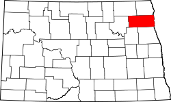 | |
| Townships |
| |
| CDPs | ||
| Unincorporated communities | ||