Argyle, Wisconsin
| Argyle, Wisconsin | |
|---|---|
| Village | |
|
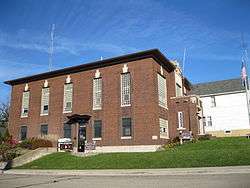
Argyle Community Building and Public Library | |
 | |
| Coordinates: 42°44′13″N 89°54′5″W / 42.73694°N 89.90139°WCoordinates: 42°44′13″N 89°54′5″W / 42.73694°N 89.90139°W | |
| Country | United States |
| State | Wisconsin |
| County | Lafayette |
| Area[1] | |
| • Total | 0.62 sq mi (1.61 km2) |
| • Land | 0.62 sq mi (1.61 km2) |
| • Water | 0 sq mi (0 km2) |
| Elevation[2] | 807 ft (246 m) |
| Population (2010)[3] | |
| • Total | 857 |
| • Estimate (2012[4]) | 854 |
| • Density | 1,382.3/sq mi (533.7/km2) |
| Time zone | Central (CST) (UTC-6) |
| • Summer (DST) | CDT (UTC-5) |
| Area code(s) | 608 |
| FIPS code | 55-02675[5] |
| GNIS feature ID | 1582711[2] |
Argyle is a village in Lafayette County, Wisconsin, United States. The population was 857 at the 2010 census, up from 823 at the 2000 census. The village is located within the Town of Argyle.
Geography
Argyle is located at 42°42′07″N 89°51′59″W / 42.701827°N 89.866408°W (42.701827, -89.866408).[6]
According to the United States Census Bureau, the village has a total area of 0.62 square miles (1.61 km2), all of it land.[1] The East Branch Pecatonica River flows through this area.
History
The village has its origins from its being a convenient ford for crossing the East Branch Pecatonica River. The first settler named it for the Duke of Argyll who had sponsored his coming to the United States.[7] The village's original settlers were dominantly from New England, Norway and Ireland, which is reflected in the village's three oldest churches, Argyle Methodist Church (UMC), Argyle Lutheran Church (ELCA), and St. Joseph's Catholic Church.
Demographics
| Historical population | |||
|---|---|---|---|
| Census | Pop. | %± | |
| 1880 | 322 | — | |
| 1890 | 411 | 27.6% | |
| 1910 | 603 | — | |
| 1920 | 701 | 16.3% | |
| 1930 | 692 | −1.3% | |
| 1940 | 735 | 6.2% | |
| 1950 | 702 | −4.5% | |
| 1960 | 786 | 12.0% | |
| 1970 | 673 | −14.4% | |
| 1980 | 720 | 7.0% | |
| 1990 | 798 | 10.8% | |
| 2000 | 823 | 3.1% | |
| 2010 | 857 | 4.1% | |
| Est. 2015 | 848 | [8] | −1.1% |
2010 census
As of the census[3] of 2010, there were 857 people, 366 households, and 223 families residing in the village. The population density was 1,382.3 inhabitants per square mile (533.7/km2). There were 393 housing units at an average density of 633.9 per square mile (244.8/km2). The racial makeup of the village was 99.1% White, 0.1% African American, 0.4% Native American, 0.1% from other races, and 0.4% from two or more races. Hispanic or Latino of any race were 2.0% of the population.
There were 366 households of which 31.7% had children under the age of 18 living with them, 46.2% were married couples living together, 9.0% had a female householder with no husband present, 5.7% had a male householder with no wife present, and 39.1% were non-families. 33.3% of all households were made up of individuals and 15.1% had someone living alone who was 65 years of age or older. The average household size was 2.34 and the average family size was 3.00.
The median age in the village was 39.6 years. 24.9% of residents were under the age of 18; 8.9% were between the ages of 18 and 24; 23.6% were from 25 to 44; 25.5% were from 45 to 64; and 17.3% were 65 years of age or older. The gender makeup of the village was 51.8% male and 48.2% female.
2000 census
As of the census[5] of 2000, there were 823 people, 343 households, and 214 families residing in the village. The population density was 1,361.0 people per square mile (529.6/km2). There were 365 housing units at an average density of 603.6 per square mile (234.9/km2). The racial makeup of the village was 99.88% White and 0.12% Black or African American. 0.73% of the population were Hispanic or Latino of any race.
There were 343 households out of which 30.0% had children under the age of 18 living with them, 49.0% were married couples living together, 9.3% had a female householder with no husband present, and 37.6% were non-families. 31.2% of all households were made up of individuals and 16.9% had someone living alone who was 65 years of age or older. The average household size was 2.40 and the average family size was 3.01.
In the village the population was spread out with 25.8% under the age of 18, 6.2% from 18 to 24, 28.7% from 25 to 44, 19.7% from 45 to 64, and 19.7% who were 65 years of age or older. The median age was 39 years. For every 100 females there were 103.2 males. For every 100 females age 18 and over, there were 99.0 males.
The median income for a household in the village was $36,103, and the median income for a family was $44,063. Males had a median income of $28,029 versus $22,434 for females. The per capita income for the village was $15,974. About 6.7% of families and 8.7% of the population were below the poverty line, including 9.5% of those under age 18 and 10.1% of those age 65 or over.
Education
The elementary school, middle school, and high school in Argyle are in one building located in the northwest part of the village. Enrollment in the elementary school is about 120 students, with about 180 students in the middle and high school.[10]
Historic landmarks
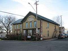
The Star Theatre in Argyle is on the National Register of Historic Places.
Notable people
- Robert La Follette, Sr., 20th Governor of Wisconsin and United States Senators, lived in Argyle.[11]
- Martin O. Monson, Wisconsin State Assemblyman, was born in Argyle.[12]
- S. Dell Penniston, Wisconsin State Assemblyman, was born in Argyle.[13]
References
- 1 2 "US Gazetteer files 2010". United States Census Bureau. Archived from the original on 2012-01-24. Retrieved 2012-11-18.
- 1 2 "US Board on Geographic Names". United States Geological Survey. 2007-10-25. Retrieved 2008-01-31.
- 1 2 "American FactFinder". United States Census Bureau. Retrieved 2012-11-18.
- ↑ "Population Estimates". United States Census Bureau. Archived from the original on 2013-06-17. Retrieved 2013-06-24.
- 1 2 "American FactFinder". United States Census Bureau. Archived from the original on 2013-09-11. Retrieved 2008-01-31.
- ↑ "US Gazetteer files: 2010, 2000, and 1990". United States Census Bureau. 2011-02-12. Retrieved 2011-04-23.
- ↑ "Archived copy" (PDF). Archived from the original (PDF) on 2011-07-20. Retrieved 2009-08-18.
- ↑ "Annual Estimates of the Resident Population for Incorporated Places: April 1, 2010 to July 1, 2015". Retrieved July 2, 2016.
- ↑ "Census of Population and Housing". Census.gov. Archived from the original on May 11, 2015. Retrieved June 4, 2015.
- ↑ "Argyle School District". Archived from the original on 6 May 2009. Retrieved 2009-05-15.
- ↑ Village of Argyle, Wisconsin-community
- ↑ 'Wisconsin Blue Book 1952,' Biographical Sketch of Martin O. Monson, pg. 32
- ↑ 'Wisconsin Blue Book 1931,' Biographical Sketch od S. Dell Penniston, pg. 226
External links
- Village of Argyle, Wisconsin website
- Sanborn fire insurance maps: 1894 1900 1908 1915
Municipalities and communities of Lafayette County, Wisconsin, United States | ||
|---|---|---|
| Cities |  | |
| Villages | ||
| Towns | ||
| CDP | ||
| Unincorporated communities | ||
| Footnotes | ‡This populated place also has portions in an adjacent county or counties | |