Arkansas Highway 131
| ||||
|---|---|---|---|---|
 | ||||
| Route information | ||||
| Maintained by AHTD | ||||
| Section 1 | ||||
| Length: | 5.51 mi[1] (8.87 km) | |||
| South end: |
| |||
| North end: |
| |||
| Section 2 | ||||
| Length: | 9.57 mi[1] (15.40 km) | |||
| North end: |
| |||
| South end: |
| |||
| Section 3 | ||||
| Length: | 8.74 mi[1] (14.07 km) | |||
| South end: |
| |||
| North end: |
| |||
| Section 4 | ||||
| Length: | 3.11 mi[1] (5.01 km) | |||
| South end: | Proctor Road in Edmondson | |||
| North end: |
| |||
| Location | ||||
| Counties: | Lee, Crittenden | |||
| Highway system | ||||
| ||||

Highway 131 (AR 131, Ark. 131, and Hwy. 131) is a designation for five north–south state highways in northeast Arkansas. One route of 5.51 miles (8.87 km) runs from Highway 1 in Haynes east to Lee County Road 719.[2] A second route of 9.57 miles (15.40 km) begins at US Route 79 (US 79) near Brickeys and runs south[a 1] to the Mississippi River levee.[2] A third route of 8.74 miles (14.07 km) forms a semicircle around Horseshoe Lake and Porter Lake, connecting to Highway 147 at both ends.[4] A fourth route of 3.11 miles (5.01 km) begins at Highway 147 and runs through Edmondson.[4] A fifth route begins at Interstate 55/US 61/US 64/US 79 (I-55/US 61/US 64/US 79) in West Memphis and runs north to Martin Luther King Jr. Drive/Mound City Road in West Memphis.[4] All routes are maintained by the Arkansas State Highway and Transportation Department (AHTD).
Route description
Haynes to Lee County Wildlife Management Area
Highway 131 begins in Haynes at Highway 1/Crowley's Ridge Parkway and runs east to Lee County Wildlife Management Area. The highway continues slightly further east to terminate at Lee County Road 719 at the St. Francis County line. A segment of this route was discovered to be part of the state highway system in 2011.[1]
Brickeys to Mississippi River
The second segment of Highway 131 begins at US 79 near the unincorporated community of Brickeys. Highway 131 winds south around Raggio and Park Place before terminating at the Mississippi River levee.
Bruins to Thompson Grove

Highway 131 begins at Highway 147 at Bruins near Porter Lake and runs clockwise through the town of Horseshoe Lake. The road continues around the Horseshoe Lake to terminate at Highway 147 at Thompson Grove.
Edmondson route
A fourth segment of Highway 131 begins at Proctor Road at the southern city limits of Edmondson. The highway runs north through downtown Edmondson before turning east and terminating at Highway 147.
West Memphis route
Highway 131 begins at Interstate 55/US 61/US 64/US 79 in West Memphis at exit 3A. The route runs north at a junction with incomplete access to I-40 exit 281. Highway 131 continues north to a fork in the road, continuing north at Mound City Road and south as Martin Luther King Jr. Drive.
Major intersections
| County | Location | mi[1] | km | Destinations | Notes | ||
|---|---|---|---|---|---|---|---|
| Lee | Haynes | 0.00 | 0.00 | Southern terminus | |||
| | 5.51 | 8.87 | Northern terminus | ||||
| Gap in route | |||||||
| Brickeys | 0.00 | 0.00 | Northern terminus | ||||
| | 9.57 | 15.40 | Southern terminus | ||||
| Gap in route | |||||||
| Crittenden | Bruins | 0.00 | 0.00 | Southern terminus | |||
| Thompson Grove | 8.74 | 14.07 | Northern terminus | ||||
| Gap in route | |||||||
| Edmondson | 0.00 | 0.00 | Proctor Road | Southern terminus | |||
| 3.11 | 5.01 | Northern terminus | |||||
| Gap in route | |||||||
| West Memphis | 0.00 | 0.00 | I-55 north exit 3A; southern terminus. | ||||
| 0.67 | 1.08 | I-40 exit 281; eastbound entrance, westbound exit. | |||||
| 1.29 | 2.08 | Martin Luther King Jr. Drive/Mound City Road | Northern terminus | ||||
| 1.000 mi = 1.609 km; 1.000 km = 0.621 mi | |||||||
See also
-
 Arkansas portal
 -
 U.S. Roads portal
Notes
- ↑ Although Arkansas highways normally run from south to north and from west to east, the Lee County Route and Sections Map[3] indicates that Highway 131 begins at US 79 and runs south.
References
- 1 2 3 4 5 6 Planning and Research Division (March 28, 2012). "Arkansas Road Log Database" (MBD). Arkansas State Highway and Transportation Department. Retrieved April 13, 2012.
- 1 2 General Highway Map, Lee County, Arkansas (PDF) (Map). 1:62500. Cartography by Planning and Research Division. Arkansas State Highway and Transportation Department. December 29, 2008. Retrieved April 15, 2012.
- ↑ Lee County Route and Section Map (PDF) (Map). Cartography by Planning and Research Division. Arkansas State Highway and Transportation Department. Retrieved April 15, 2012.
- 1 2 3 General Highway Map, Crittenden County, Arkansas (PDF) (Map). 1:62500. Cartography by Planning and Research Division. Arkansas State Highway and Transportation Department. May 13, 2009. Retrieved April 15, 2012.
Roads of Memphis | |||||||||||
|---|---|---|---|---|---|---|---|---|---|---|---|
| Interstate Highways | 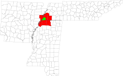 | ||||||||||
| U.S. Highways | |||||||||||
| State Highways |
| ||||||||||
| Other Highways | |||||||||||