Mississippi Highway 305
| ||||
|---|---|---|---|---|
| Route information | ||||
| Maintained by MDOT | ||||
| Length: | 28.643 mi[1] (46.096 km) | |||
| Major junctions | ||||
| South end: |
| |||
|
| ||||
| North end: | State Line Road/Germantown Road in Olive Branch | |||
| Highway system | ||||
| ||||

Mississippi Highway 305 is a north-south highway in DeSoto and Tate counties. It runs from Mississippi Highway 4, just east of the community of Looxahoma, north through eastern DeSoto and Tate counties to its northern terminus at the Mississippi/Tennessee state line.
Route description
Mississippi Highway 305 begins as a two-lane highway at Mississippi Highway 4 east of the community of Looxahoma. From there, the route runs north through the community of Independence to the Desoto/Tate county line.
From the Desoto/Tate county line, the route continues north through the community of Cockrum and crosses the Coldwater River before passing through the communities of Lewisburg and Cedarview.
After the intersection with Church Road, MS 305 widens to five lanes and passes through a grade-separated interchange with U.S. Route 78. As it approaches enters the Olive Branch city limits, the route narrows to three lanes (two travel lanes with a center turn lane) and is signed as Cockrum Road.
After an interchange with Mississippi Highway 302, the route widens back to five lanes and is signed as Germantown Road. Mississippi Route 305 terminates at State Line Road, but continues into Shelby County, Tennessee as Riverdale Road. [2]
Major intersections
| County | Location | mi[2] | km | Destinations | Notes |
|---|---|---|---|---|---|
| Tate | | 0.0 | 0.0 | ||
| Independence | 5.6 | 9.0 | Mount Zion Road / | ||
| Desoto | Olive Branch | 23.1– 23.3 | 37.2– 37.5 | interchange; US-78 exit 4 | |
| 24.6– 24.9 | 39.6– 40.1 | interchange | |||
| 26.6 | 42.8 | Stateline Road / Riverdale Road | |||
| 1.000 mi = 1.609 km; 1.000 km = 0.621 mi | |||||
References
- ↑ "Mississippi Public Roads Selected Statistics" (PDF). Mississippi Department of Transportation. 2008. Retrieved 2010-06-03.
- 1 2 Google (December 18, 2014). "Mississippi Highway 305" (Map). Google Maps. Google. Retrieved December 18, 2014.
Roads of Memphis | |||||||||||
|---|---|---|---|---|---|---|---|---|---|---|---|
| Interstate Highways | 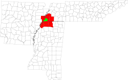 | ||||||||||
| U.S. Highways | |||||||||||
| State Highways |
| ||||||||||
| Other Highways | |||||||||||