Ashland, Oklahoma
| Ashland, Oklahoma | |
|---|---|
| Town | |
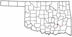 Location of Ashland, Oklahoma | |
| Coordinates: 34°46′5″N 96°4′11″W / 34.76806°N 96.06972°WCoordinates: 34°46′5″N 96°4′11″W / 34.76806°N 96.06972°W | |
| Country | United States |
| State | Oklahoma |
| County | Pittsburg |
| Area | |
| • Total | 0.2 sq mi (0.5 km2) |
| • Land | 0.2 sq mi (0.5 km2) |
| • Water | 0.0 sq mi (0.0 km2) |
| Elevation | 774 ft (236 m) |
| Population (2000)[1] | |
| • Total | 66 |
| • Density | 330/sq mi (130/km2) |
| Time zone | Central (CST) (UTC-6) |
| • Summer (DST) | CDT (UTC-5) |
| FIPS code | 40-03050[2] |
| GNIS feature ID | 1089732[3] |
Ashland is a town in Pittsburg County, Oklahoma, United States. The population was 66 at the 2010 census.[1]
Geography
Ashland is located at 34°46′5″N 96°4′11″W / 34.76806°N 96.06972°W (34.768133, -96.069752).[4] According to the United States Census Bureau, the town has a total area of 0.2 square miles (0.52 km2), all of it land.
Demographics
| Historical population | |||
|---|---|---|---|
| Census | Pop. | %± | |
| 1930 | 131 | — | |
| 1940 | 142 | 8.4% | |
| 1950 | 104 | −26.8% | |
| 1960 | 87 | −16.3% | |
| 1970 | 73 | −16.1% | |
| 1980 | 72 | −1.4% | |
| 1990 | 56 | −22.2% | |
| 2000 | 53 | −5.4% | |
| 2010 | 66 | 24.5% | |
| Est. 2015 | 63 | [5] | −4.5% |
As of the census of 2010, there were 66 people residing in the town.[1] The population density was 273.3 people per square mile (107.7/km²). There were 27 housing units at an average density of 139.2 per square mile (54.9/km²). The racial makeup of the town was 60.38% White, 26.42% Native American, and 13.21% from two or more races. Hispanic or Latino of any race were 5.66% of the population.
There were 19 households out of which 47.4% had children under the age of 18 living with them, 57.9% were married couples living together, 21.1% had a female householder with no husband present, and 21.1% were non-families. 15.8% of all households were made up of individuals and 10.5% had someone living alone who was 65 years of age or older. The average household size was 2.79 and the average family size was 3.07.
In the town the population was spread out with 30.2% under the age of 18, 13.2% from 18 to 24, 26.4% from 25 to 44, 15.1% from 45 to 64, and 15.1% who were 65 years of age or older. The median age was 30 years. For every 100 females there were 130.4 males. For every 100 females age 18 and over, there were 117.6 males.
The median income for a household in the town was $30,833, and the median income for a family was $30,417. Males had a median income of $24,375 versus $0 for females. The per capita income for the town was $6,981. There were 20.0% of families and 19.2% of the population living below the poverty line, including 26.7% of under eighteens and 16.7% of those over 64.
References
- 1 2 3 "2010 City Population and Housing Occupancy Status". U.S. Census Bureau. Archived from the original on July 26, 2011. Retrieved October 18, 2013.
- ↑ "American FactFinder". United States Census Bureau. Archived from the original on 2013-09-11. Retrieved 2008-01-31.
- ↑ "US Board on Geographic Names". United States Geological Survey. 2007-10-25. Retrieved 2008-01-31.
- ↑ "US Gazetteer files: 2010, 2000, and 1990". United States Census Bureau. 2011-02-12. Retrieved 2011-04-23.
- ↑ "Annual Estimates of the Resident Population for Incorporated Places: April 1, 2010 to July 1, 2015". Retrieved July 2, 2016.
- ↑ "Census of Population and Housing". Census.gov. Archived from the original on May 11, 2015. Retrieved June 4, 2015.
External links
Municipalities and communities of Pittsburg County, Oklahoma, United States | ||
|---|---|---|
| Cities | 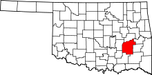 | |
| Towns | ||
| CDPs |
| |
| Unincorporated communities | ||
| Ghost town | ||