Quinton, Oklahoma
| Quinton, Oklahoma | |
|---|---|
| Town | |
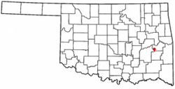 Location of Quinton, Oklahoma | |
| Coordinates: 35°7′33″N 95°22′3″W / 35.12583°N 95.36750°WCoordinates: 35°7′33″N 95°22′3″W / 35.12583°N 95.36750°W | |
| Country | United States |
| State | Oklahoma |
| County | Pittsburg |
| Area | |
| • Total | 1.1 sq mi (2.9 km2) |
| • Land | 1.1 sq mi (2.9 km2) |
| • Water | 0.0 sq mi (0.0 km2) |
| Elevation | 610 ft (186 m) |
| Population (2000) | |
| • Total | 1,071 |
| • Density | 954.8/sq mi (368.6/km2) |
| Time zone | Central (CST) (UTC-6) |
| • Summer (DST) | CDT (UTC-5) |
| ZIP code | 74561 |
| Area code(s) | 539/918 |
| FIPS code | 40-61550[1] |
| GNIS feature ID | 1096996[2] |
Quinton is a town in Pittsburg County, Oklahoma, United States. The population was 1,071 at the 2000 census. The town was named for Elizabeth Quinton who lived to be 116 years old. Her family still resides in and around the town of Quinton.
Geography
Quinton is located at 35°7′33″N 95°22′3″W / 35.12583°N 95.36750°W (35.125904, -95.367470).[3] According to the United States Census Bureau, the town has a total area of 1.1 square miles (2.8 km2), of which, 1.1 square miles (2.8 km2) of it is land and 0.88% is water.
Demographics
| Historical population | |||
|---|---|---|---|
| Census | Pop. | %± | |
| 1910 | 697 | — | |
| 1920 | 1,557 | 123.4% | |
| 1930 | 1,804 | 15.9% | |
| 1940 | 1,245 | −31.0% | |
| 1950 | 951 | −23.6% | |
| 1960 | 898 | −5.6% | |
| 1970 | 1,262 | 40.5% | |
| 1980 | 1,228 | −2.7% | |
| 1990 | 1,133 | −7.7% | |
| 2000 | 1,071 | −5.5% | |
| 2010 | 1,051 | −1.9% | |
| Est. 2015 | 1,009 | [4] | −4.0% |
As of the census[1] of 2000, there were 1,071 people, 446 households, and 293 families residing in the town. The population density was 954.8 people per square mile (369.2/km²). There were 509 housing units at an average density of 453.8 per square mile (175.5/km²). The racial makeup of the town was 79.93% White, 0.19% African American, 16.15% Native American, 0.19% Asian, 0.19% from other races, and 3.36% from two or more races. Hispanic or Latino of any race were 0.93% of the population.
There were 446 households out of which 28.3% had children under the age of 18 living with them, 46.2% were married couples living together, 16.4% had a female householder with no husband present, and 34.1% were non-families. 31.8% of all households were made up of individuals and 18.4% had someone living alone who was 65 years of age or older. The average household size was 2.33 and the average family size was 2.94.
In the town the population was spread out with 24.9% under the age of 18, 7.6% from 18 to 24, 25.1% from 25 to 44, 19.2% from 45 to 64, and 23.2% who were 65 years of age or older. The median age was 40 years. For every 100 females there were 94.7 males. For every 100 females age 18 and over, there were 85.7 males.
The median income for a household in the town was $19,531, and the median income for a family was $26,912. Males had a median income of $28,056 versus $16,797 for females. The per capita income for the town was $15,143. About 18.3% of families and 22.8% of the population were below the poverty line, including 29.3% of those under age 18 and 24.3% of those age 65 or over.
References
- 1 2 "American FactFinder". United States Census Bureau. Archived from the original on September 11, 2013. Retrieved 2008-01-31.
- ↑ "US Board on Geographic Names". United States Geological Survey. 2007-10-25. Retrieved 2008-01-31.
- ↑ "US Gazetteer files: 2010, 2000, and 1990". United States Census Bureau. 2011-02-12. Retrieved 2011-04-23.
- ↑ "Annual Estimates of the Resident Population for Incorporated Places: April 1, 2010 to July 1, 2015". Retrieved July 2, 2016.
- ↑ "Census of Population and Housing". Census.gov. Archived from the original on May 11, 2015. Retrieved June 4, 2015.
Municipalities and communities of Pittsburg County, Oklahoma, United States | ||
|---|---|---|
| Cities | 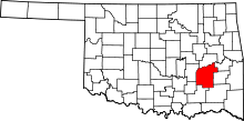 | |
| Towns | ||
| CDPs |
| |
| Unincorporated communities | ||
| Ghost town | ||