Avon, Massachusetts
| Avon, Massachusetts | ||
|---|---|---|
| Town | ||
|
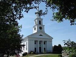
Avon Baptist Church | ||
| ||
 Location in Norfolk County in Massachusetts | ||
| Coordinates: 42°07′50″N 71°02′30″W / 42.13056°N 71.04167°WCoordinates: 42°07′50″N 71°02′30″W / 42.13056°N 71.04167°W | ||
| Country | United States | |
| State | Massachusetts | |
| County | Norfolk | |
| Settled | 1700 | |
| Incorporated | 1888 | |
| Government | ||
| • Type | Open town meeting | |
| • Town Administrator | Michael W. McCue | |
| • Board of Selectmen |
Francis A. Hegarty, Chair Wayne M. Phillips Steven P. Rose | |
| Area | ||
| • Total | 4.6 sq mi (11.8 km2) | |
| • Land | 4.4 sq mi (11.3 km2) | |
| • Water | 0.2 sq mi (0.5 km2) | |
| Elevation | 219 ft (67 m) | |
| Population (2010)[1] | ||
| • Total | 4,356 | |
| • Density | 990.0/sq mi (385.5/km2) | |
| Time zone | Eastern (UTC-5) | |
| • Summer (DST) | Eastern (UTC-4) | |
| ZIP code | 02322 | |
| Area code(s) | 508 / 774 | |
| FIPS code | 25-02935 | |
| GNIS feature ID | 0618314 | |
| Website | www.avonmass.org | |
Avon is a town in Norfolk County, Massachusetts, United States. The population was 4,356 at the 2010 census.[1]
History
Avon separated from Stoughton in 1888.
Geography
According to the United States Census Bureau, the town has a total area of 4.6 square miles (12 km2), of which, 4.4 square miles (11 km2) of it is land and 0.2 square miles (0.52 km2) of it (4.16%) is water. Avon is bordered by the City of Brockton on the south, Stoughton on the west, Randolph on the northeast, and Holbrook on the east. Avon is 17 miles (27 km) south of Boston; 27 miles (43 km) northeast of Providence, Rhode Island; and 211 miles (340 km) from New York City.
Demographics
| Historical population | ||
|---|---|---|
| Year | Pop. | ±% |
| 1890 | 1,384 | — |
| 1900 | 1,741 | +25.8% |
| 1910 | 2,013 | +15.6% |
| 1920 | 2,176 | +8.1% |
| 1930 | 2,414 | +10.9% |
| 1940 | 2,335 | −3.3% |
| 1950 | 2,666 | +14.2% |
| 1960 | 4,301 | +61.3% |
| 1970 | 5,295 | +23.1% |
| 1980 | 5,026 | −5.1% |
| 1990 | 4,558 | −9.3% |
| 2000 | 4,443 | −2.5% |
| 2010 | 4,356 | −2.0% |
| 2012 | 4,349 | −0.2% |
| * = population estimate. Source: United States Census records and Population Estimates Program data.[2][3][4][5][6][7][8] | ||
At the 2000 census,[9] there were 4,443 people, 1,705 households and 1,220 families residing in the town. The population density was 1,014.7 per square mile (391.7/km²). There were 1,740 housing units at an average density of 397.4 per square mile (153.4/km2). The racial makeup of the town was 93.45% White, 3.74% African American, 0.27% Native American, 0.92% Asian, 0.77% from other races, and 0.86% from two or more races. Hispanic or Latino of any race were 1.44% of the population. In 2010, Avon was 92.37% Non-Hispanic White, down from 99.8% in 1990.
There were 1,705 households of which 26.7% had children under the age of 18 living with them, 55.5% were married couples living together, 12.0% had a female householder with no husband present, and 28.4% were non-families. 23.5% of all households were made up of individuals and 12.3% had someone living alone who was 65 years of age or older. The average household size was 2.61 and the average family size was 3.13.
Age distribution was 22.5% under the age of 18, 7.0% from 18 to 24, 28.8% from 25 to 44, 24.2% from 45 to 64, and 17.6% who were 65 years of age or older. The median age was 40 years. For every 100 females there were 91.8 males. For every 100 females age 18 and over, there were 88.0 males.
The median household income was $50,305, and the median family income was $60,625. Males had a median income of $41,582 versus $32,837 for females. The per capita income for the town was $24,410. About 4.3% of families and 6.6% of the population were below the poverty line, including 12.5% of those under age 18 and 4.2% of those age 65 or over.
Government
Avon is governed by a three-person Board of Selectmen who appoint a Town Administrator to carry out the day to day executive functions of the Board. Legislation is enacted in an Open Town Meeting.
Education
The Avon School District serves Avon.
Transportation
The town is served by the Brockton Area Transit Authority and the Massachusetts Bay Transportation Authority (MBTA), which provide public transit service to Brockton and Boston.
References
- 1 2 "Population and Housing Occupancy Status: 2010 - State -- County Subdivision, 2010 Census Redistricting Data (Public Law 94-171) Summary File". U.S. Census Bureau. Archived from the original on 21 July 2011. Retrieved 2011-06-26.
- ↑ "TOTAL POPULATION (P1), 2010 Census Summary File 1, All County Subdivisions within Massachusetts". United States Census Bureau. Retrieved September 13, 2011.
- ↑ "Massachusetts by Place and County Subdivision - GCT-T1. Population Estimates". United States Census Bureau. Archived from the original on January 6, 2012. Retrieved July 12, 2011.
- ↑ "1990 Census of Population, General Population Characteristics: Massachusetts" (PDF). US Census Bureau. December 1990. Table 76: General Characteristics of Persons, Households, and Families: 1990. 1990 CP-1-23. Archived from the original (PDF) on December 7, 2013. Retrieved July 12, 2011.
- ↑ "1980 Census of the Population, Number of Inhabitants: Massachusetts" (PDF). US Census Bureau. December 1981. Table 4. Populations of County Subdivisions: 1960 to 1980. PC80-1-A23. Archived from the original on August 5, 2010. Retrieved July 12, 2011.
- ↑ "1950 Census of Population" (PDF). 1: Number of Inhabitants. Bureau of the Census. 1952. Section 6, Pages 21-10 and 21-11, Massachusetts Table 6. Population of Counties by Minor Civil Divisions: 1930 to 1950. Retrieved July 12, 2011.
- ↑ "1920 Census of Population" (PDF). Bureau of the Census. Number of Inhabitants, by Counties and Minor Civil Divisions. Pages 21-5 through 21-7. Massachusetts Table 2. Population of Counties by Minor Civil Divisions: 1920, 1910, and 1920. Retrieved July 12, 2011.
- ↑ "1890 Census of the Population" (PDF). Department of the Interior, Census Office. Pages 179 through 182. Massachusetts Table 5. Population of States and Territories by Minor Civil Divisions: 1880 and 1890. Retrieved July 12, 2011.
- ↑ "American FactFinder". United States Census Bureau. Archived from the original on 2013-09-11. Retrieved 2008-01-31.
External links
| Wikimedia Commons has media related to Avon, Massachusetts. |
- Wicked Local Avon (published by GateHouse Media of Perinton, New York)
- Avon Municipal Web Site
- Answer Book/Avon: “Everything you need to know”
Municipalities and communities of Norfolk County, Massachusetts, United States | ||
|---|---|---|
| Cities | 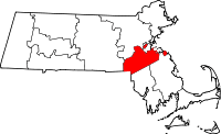 | |
| Towns | ||
| CDPs | ||
| Other village | ||