Canton, Massachusetts
| Canton, Massachusetts | ||
|---|---|---|
| Town | ||
|
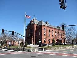
Town Hall | ||
| ||
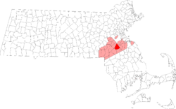 Location in Norfolk County in Massachusetts | ||
| Coordinates: 42°09′30″N 71°08′43″W / 42.15833°N 71.14528°W | ||
| Country | United States | |
| State | Massachusetts | |
| County | Norfolk | |
| Settled | 1630 | |
| Incorporated | 1797 | |
| Government | ||
| • Type | Open town meeting | |
| Area | ||
| • Total | 19.6 sq mi (50.7 km2) | |
| • Land | 18.9 sq mi (49.0 km2) | |
| • Water | 0.6 sq mi (1.7 km2) | |
| Elevation | 100 ft (30 m) | |
| Population (2010)[1] | ||
| • Total | 21,561 | |
| • Density | 1,140.8/sq mi (440.0/km2) | |
| Time zone | Eastern (UTC-5) | |
| • Summer (DST) | Eastern (UTC-4) | |
| ZIP code | 02021 | |
| Area code(s) | 781 / 339 | |
| FIPS code | 25-11315 | |
| GNIS feature ID | 0619457 | |
| Website | www.town.canton.ma.us | |

Canton is a town in Norfolk County, Massachusetts, United States. The population was 21,561 at the 2010 census. Canton is part of Greater Boston, about 15 miles (24 kilometers) southwest of downtown Boston.
History
Canton was officially incorporated on February 23, 1797 from the town of Stoughton, Massachusetts. The name "Canton" was suggested by Elijah Dunbar and comes from the early belief that Canton, China was on the complete opposite side of the earth (antipodal).[2] In addition to being a prominent Canton citizen, Elijah Dunbar was the first president of the Stoughton Musical Society from 1786 to 1808. This is now the oldest choral society in the United States.
Paul Revere built the nation's first copper rolling mill in Canton in 1801. His poem entitled Canton Dale expresses his affection for the town. Canton was the location of the Rising Sun Stove Polish Company, founded by Elijah Morse, a wealthy merchant and creator of the pot-belly stove.
Commerce
Canton is the headquarters of Reebok, Dunkin' Donuts, Computershare (North American HQ), Organogenesis, Inc., Interpolymer Corporation, Casual Male Retail Group, and formerly, Tweeter. It is also home to the Massachusetts Division headquarters of the Salvation Army.
Top employers
According to the Town's 2011 Comprehensive Annual Financial Report,[3] the top employers in the city are:
| # | Employer | # of Employees |
|---|---|---|
| 1 | Reebok | 1,124 |
| 2 | Computershare | 830 |
| 3 | MEDITECH | 702 |
| 4 | Dunkin' Brands | 576 |
| 5 | Destination XL Group | 468 |
| 6 | OneBeacon | 435 |
| 7 | Organogenesis | 291 |
| 8 | Pollak Engineering Products | 288 |
| 9 | Boston Mutual Life Insurance Company | 256 |
| 10 | Tower Group Companies | 200 |
Geography
According to the United States Census Bureau, the town has a total area of 19.6 square miles (51 km2), of which, 18.9 square miles (49 km2) of it is land and 0.6 square miles (1.6 km2) of it (3.27%) is water.
Canton lies at the foot of Great Blue Hill. The Canton River flows through the center of the town, linking a chain of small lakes including Bolivar and Forge Ponds and flowing into the Neponset River. The Neponset River forms the boundary between Canton and its western neighbors: Norwood, Westwood, and Dedham. In addition to wooded land, the area includes wetlands, particularly in the eastern part along Route 138 near the Randolph and Stoughton borders, and in the western part along I-95.
Canton borders the towns of Dedham, Milton, Norwood, Randolph, Sharon, Stoughton, Westwood and the Hyde Park neighborhood in the city of Boston.
| Climate data for Blue Hills Reservation (Blue Hill Meteorological Observatory), 1891−2010 normals, extremes 1885−present | |||||||||||||
|---|---|---|---|---|---|---|---|---|---|---|---|---|---|
| Month | Jan | Feb | Mar | Apr | May | Jun | Jul | Aug | Sep | Oct | Nov | Dec | Year |
| Record high °F (°C) | 68 (20) |
68 (20) |
89 (32) |
94 (34) |
94 (34) |
99 (37) |
100 (38) |
101 (38) |
99 (37) |
88 (31) |
81 (27) |
74 (23) |
101 (38) |
| Average high °F (°C) | 33.6 (0.9) |
34.8 (1.6) |
43.4 (6.3) |
54.9 (12.7) |
66.3 (19.1) |
74.6 (23.7) |
80.0 (26.7) |
77.9 (25.5) |
70.9 (21.6) |
60.5 (15.8) |
48.8 (9.3) |
37.4 (3) |
56.92 (13.85) |
| Daily mean °F (°C) | 25.7 (−3.5) |
26.4 (−3.1) |
34.4 (1.3) |
44.7 (7.1) |
55.3 (12.9) |
64.1 (17.8) |
69.7 (20.9) |
68.1 (20.1) |
61.2 (16.2) |
51.1 (10.6) |
40.6 (4.8) |
29.8 (−1.2) |
47.59 (8.66) |
| Average low °F (°C) | 18.4 (−7.6) |
18.9 (−7.3) |
27.0 (−2.8) |
36.5 (2.5) |
46.4 (8) |
55.4 (13) |
61.5 (16.4) |
60.3 (15.7) |
53.6 (12) |
43.4 (6.3) |
33.7 (0.9) |
22.9 (−5.1) |
39.83 (4.33) |
| Record low °F (°C) | −16 (−27) |
−21 (−29) |
−5 (−21) |
6 (−14) |
27 (−3) |
36 (2) |
44 (7) |
39 (4) |
28 (−2) |
21 (−6) |
5 (−15) |
−19 (−28) |
−21 (−29) |
| Average precipitation inches (mm) | 4.24 (107.7) |
3.95 (100.3) |
4.61 (117.1) |
4.06 (103.1) |
3.70 (94) |
3.69 (93.7) |
3.64 (92.5) |
4.08 (103.6) |
3.94 (100.1) |
3.97 (100.8) |
4.36 (110.7) |
4.39 (111.5) |
48.63 (1,235.1) |
| Average snowfall inches (cm) | 16.0 (40.6) |
16.1 (40.9) |
11.7 (29.7) |
2.9 (7.4) |
0.1 (0.3) |
0.0 (0) |
0.0 (0) |
0.0 (0) |
0.0 (0) |
0.3 (0.8) |
2.6 (6.6) |
11.4 (29) |
61.1 (155.3) |
| Mean monthly sunshine hours | 132.1 | 146.7 | 174.0 | 185.6 | 220.2 | 231.8 | 258.1 | 242.5 | 204.1 | 182.1 | 133.3 | 125.9 | 2,236.4 |
| Percent possible sunshine | 46.3 | 50.9 | 48.5 | 47.9 | 50.4 | 52.7 | 58.0 | 58.7 | 56.7 | 55.1 | 47.0 | 45.9 | 51.51 |
| Source: Blue Hill Observatory & Science Center [4][5] | |||||||||||||
Demographics
| Historical population | ||
|---|---|---|
| Year | Pop. | ±% |
| 1850 | 2,598 | — |
| 1860 | 3,242 | +24.8% |
| 1870 | 2,130 | −34.3% |
| 1880 | 4,510 | +111.7% |
| 1890 | 4,538 | +0.6% |
| 1900 | 4,584 | +1.0% |
| 1910 | 4,797 | +4.6% |
| 1920 | 5,945 | +23.9% |
| 1930 | 5,816 | −2.2% |
| 1940 | 6,381 | +9.7% |
| 1950 | 7,465 | +17.0% |
| 1960 | 12,771 | +71.1% |
| 1970 | 17,100 | +33.9% |
| 1980 | 18,182 | +6.3% |
| 1990 | 18,530 | +1.9% |
| 2000 | 20,775 | +12.1% |
| 2010 | 21,561 | +3.8% |
| * = population estimate. Source: United States Census records and Population Estimates Program data.[6][7][8][9][10][11][12][13][14][15] | ||
As of the 2010 [16] census, there were 21,561 people, 7,952 households, and 5,550 families residing in the town. The population density was 1,097.3 people per square mile (423.7/km²). There were 8,163 housing units at an average density of 431.1 per square mile (166.5/km²). The racial makeup of the town was 86.1% White, 6.96% African American, 0.05% Native American, 6.74% Asian, 0.02% Pacific Islander, 0.51% from other races, and 0.95% from two or more races. Hispanic or Latino of any race were 2.80% of the population. 83.3% of the population was non-Hispanic white in 2010, down from 98.0% in 1980.
There were 7,952 households out of which 30.9% had children under the age of 18 living with them, 58.4% were married couples living together, 8.9% had a female householder with no husband present, and 30.2% were non-families. 25.4% of all households were made up of individuals and 12.3% had someone living alone who was 65 years of age or older. The average household size was 2.56 and the average family size was 3.12.
In the town the population was spread out with 23.6% under the age of 18, 5.6% from 18 to 24, 29.9% from 25 to 44, 24.0% from 45 to 64, and 16.9% who were 65 years of age or older. The median age was 40 years. For every 100 females there were 89.4 males. For every 100 females age 18 and over, there were 85.2 males.
The median income for a household in the town was $109,260, and the median income for a family was $132,904. Males had a median income of $52,216 versus $40,755 for females. The per capita income for the town was $43,510. About 5.2% of families and 7.2% of the population were below the poverty line, including 4.7% of those under age 18 and 9.5% of those age 65 or over.
Education
The town of Canton has three public elementary schools, namely the John F. Kennedy School, Lt. Peter M. Hansen School, and Dean S. Luce School. The area in which one lives determines which elementary school one's children attend.
Canton has one public middle school, the William H. Galvin Middle School, where all of the three elementary schools combine. It provides grades 6-8 and is located next to the Peter M. Hansen Elementary School. Canton also has a public high school, Canton High School, that provides grades 9-12. There is one private school, St. John the Evangelist, which has been open since 1883 and serves students in grades Preschool-8. In addition, the state's Massachusetts Hospital School is in Canton.[17]
The Blue Hills Regional Technical School and the Canton campus of Massasoit Community College are located within the town as well.[18]
Clarke Schools for Hearing and Speech, formerly Clarke School for the Deaf, operates a satellite school, "Clarke Boston", in Canton for children who are diagnosed with deafness at an early age and then are mainstreamed to a public school. Clarke is the oldest school for the deaf in the country that teaches children to lip-read and speak orally, rather than use sign language; its main campus is located 80 miles to the west in Northampton, Massachusetts.
- CHS Awards
- Canton High Boys Varsity Hockey team won the Division II State Championships at the TD North Garden in Boston in 2010.
- 2011 Hockomock Davenport Champions in Field Hockey, Girls Soccer, Volleyball, Boys Soccer
- 2011 Hock Golf Championships: 1st Place
- 2011 Hockomock Classic Cup Champions in Field Hockey, Girls Soccer, Boys Soccer
- 2011 South Sectional Champions in Field Hockey & Girls Soccer
- 2011 EMASS Champions: Girls Soccer
- Also, The CHS Math Team is one of the top teams in their league.
Government
Canton has the open town meeting form of government. Annually each spring, and as necessary, the voters gather to discuss matters such as zoning, schools, public works, recreational facilities, the budget, taxes and bond issues.
Property taxes on residential and other land, buildings and improvements, and transfers from the state government, are two important sources of revenue for the town.
The five elected members of the Board of Selectmen oversee the day-to-day operations of the town government.
The Planning Board approves new town subdivisions, reviews site plans for commercial development, oversees the towns scenic ways, drafts and approves a town wide master plan, and statutorily provides recommendations to Town Meeting regarding zoning and development.
The Finance Committee studies the financial affairs of the town, advises and make recommendations to the Town Meeting on the budget and other areas with fiscal implications and serves as the fiscal watchdog for the voters.
Transportation
Interstates 93, 95, and Massachusetts Route 128 diverge in Canton. I-93 goes east, then north into Boston, from which it continues north into New Hampshire. I-95 is locally a beltway that skirts Boston to the west, continues circling Boston until it is north of the city, then goes north through New Hampshire and ends in Maine. South of Canton, it leads to Providence, Rhode Island, Connecticut, New York City, Washington, D.C. and ultimately to Miami, Florida.
Route 138 has a cloverleaf interchange with Route 93 in Canton near Great Blue Hill. From Canton, it goes north into Milton, then enters Boston in the Mattapan section. South of Canton, it travels to Stoughton, continuing into Rhode Island, through Newport and ending in southwest RI.
Route 24 is a divided, limited-access highway that originates at Route 93 in Randolph, just east of Canton. From there, it goes south through the easternmost corner of Canton, running roughly parallel to Route 138 as far as Portsmouth, Rhode Island.
MBTA commuter rail trains on the Providence/Stoughton Line pass through Canton. Some stop at Canton Junction. This line crosses the Neponset River on the Canton Viaduct, a prominent local landmark. Route 128 Station in neighboring Westwood also carries many Canton commuters into Boston. Amtrak trains (including the Acela Express high-speed trains) also stop at Route 128, but pass through Canton without stopping. Of note, on March 25, 2008 a runaway box car crashed into a MBTA train at Canton Junction station injuring 150 people on board.[19][20]
Another line branches into Stoughton, stopping at Canton Center.
Bus service is available to Mattapan Station in the MBTA system.[21]
Although Canton once had an airfield, it no longer does. Norwood Memorial Airport is the closest airport to Canton. For scheduled air service, residents go to Boston's Logan International Airport or to T. F. Green Airport in Rhode Island.
Points of interest

- The Canton Viaduct built in 1835 is one of the two oldest surviving multiple arch stone railroad bridges still in active mainline use in the United States. Tsar Nicholas I of Russia sent workmen to draw extensive diagrams of it in order to duplicate its design for the construction of two bridges on the Moscow–Saint Petersburg Railway.
- Canton Corner Historic District
- The David Tilden House, a nearly 300-year-old house located within the Canton Corner Historic District. Undergoing a major preservation effort. One of the oldest houses in America.
- The Massachusetts Audubon Society's Visual Arts Center, where the Mildred Morse Allen Wildlife Sanctuary is located, houses extensive collections of natural history art and photography. Public programs integrating art and nature, and changing exhibitions in the gallery, provide opportunities for visitors to view featured works from the collections.
- The Eleanor Cabot Bradley Estate, a non-profit museum, is a country house designed by Charles A. Platt with garden grounds located at 2468B Washington Street (Route 138). In 1902 Dr. Arthur Tracey Cabot hired Platt to design a country house with landscaping and outlying farm buildings, with formal grounds include lawns, a walled garden, and a parterre. In 1945, Cabot's niece, Eleanor Cabot Bradley, added ponds, a camellia house and greenhouse, and planted specimen trees. The land includes more than 60 acres (240,000 m2) of meadows and woods, with some 3 miles (4.8 km) of walking trails.
- Acambis, one of the few smallpox vaccine producers contracted by the United States Government, makes its vaccine at the Shawmut Industrial Park in Canton. In the many months after the September 11, 2001 attacks, Army National Guard units were stationed around the factory and now the Canton Police has a regular patrol of the park.
- The non-profit Friends of Prowse Farm, in collaboration with the present property owner, Meditech, Inc., preserve the historical Prowse Farm property and make the 44 acres and mansion available for indoor and/or outdoor events including party and wedding rentals, corporate functions, recreational and educational programs and fund-raising events. The Friends of Prowse Farm are a true non-profit volunteer organization, celebrating their 35th year in 2010—without any salaries taken by its officers or staff. Fund-raising events hosted by various charitable organizations at the farm have raised an estimated $20 million.
- The Paul Revere Heritage Site, a nine-acre public site dedicated to protecting, preserving and interpreting the work of Paul Revere as an American pioneer in the invention of the copper industry.
Notable people
- Bill Burr, actor/comedian
- Scott Chandler, New England Patriots
- Chris Hogan, New England Patriots
- Commodore John Downes, U.S. Navy officer who fought in the War with Tripoli and the War of 1812 and commanded a punitive expedition to Sumatra in the 1830s
- Paul Guilfoyle, actor, CSI:Crime Scene Investigation
- Augustus Hemenway, philanthropist, public servant
- Harriett Lawrence Hemenway, co-founder of Massachusetts Audubon Society
- William Augustus Hinton, American physician and pioneering bacteriologist
- Chuck Hogan, novelist
- Rob Mariano, a.k.a. "Boston Rob", reality TV personality (four-time Survivor and two-time The Amazing Race contestant)
- Paul Revere, Patriot and Entrepreneur
- Steve Rooney, NHL 1986 Stanley Cup Champion of the Montreal Canadiens
- Stephen Schnetzer, actor
- James B. Sumner, co-recipient of 1946 Nobel Prize in Chemistry
Sister cities
-
 Finglas, Dublin, Ireland
 -
 Bocholt, Germany. Exchange students from there spend three weeks in the United States studying at Canton High School and living with families of students at Canton High School who take German. Canton High students then have the opportunity to travel and live in Bocholt for three weeks in the spring. The program is organized by the Canton High School German Department and, as of 2012, is in its 29th year.
References
- ↑ "Population and Housing Occupancy Status: 2010 - State -- County Subdivision, 2010 Census Redistricting Data (Public Law 94-171) Summary File". U.S. Census Bureau. Retrieved 2011-06-26.
- ↑ Canton (Massachusetts, United States) – Britannica Online Encyclopedia (Retrieved on April 21, 2009)
- ↑ Town of Canton CAFR Archived July 22, 2012, at the Wayback Machine.
- ↑ "Blue Hill Meteorological Observatory 1891-2010 Means and Extremes". Blue Hill Meteorological Observatory. 7 May 2013. Retrieved 11 October 2015.
- ↑ "Blue Hill Observatory daily sunshine data". Blue Hill Meteorological Observatory. Retrieved 11 October 2015.
- ↑ "TOTAL POPULATION (P1), 2010 Census Summary File 1". American FactFinder, All County Subdivisions within Massachusetts. United States Census Bureau. 2010.
- ↑ "Massachusetts by Place and County Subdivision - GCT-T1. Population Estimates". United States Census Bureau. Retrieved July 12, 2011.
- ↑ "1990 Census of Population, General Population Characteristics: Massachusetts" (PDF). US Census Bureau. December 1990. Table 76: General Characteristics of Persons, Households, and Families: 1990. 1990 CP-1-23. Retrieved July 12, 2011.
- ↑ "1980 Census of the Population, Number of Inhabitants: Massachusetts" (PDF). US Census Bureau. December 1981. Table 4. Populations of County Subdivisions: 1960 to 1980. PC80-1-A23. Retrieved July 12, 2011.
- ↑ "1950 Census of Population" (PDF). Bureau of the Census. 1952. Section 6, Pages 21-10 and 21-11, Massachusetts Table 6. Population of Counties by Minor Civil Divisions: 1930 to 1950. Retrieved July 12, 2011.
- ↑ "1920 Census of Population" (PDF). Bureau of the Census. Number of Inhabitants, by Counties and Minor Civil Divisions. Pages 21-5 through 21-7. Massachusetts Table 2. Population of Counties by Minor Civil Divisions: 1920, 1910, and 1920. Retrieved July 12, 2011.
- ↑ "1890 Census of the Population" (PDF). Department of the Interior, Census Office. Pages 179 through 182. Massachusetts Table 5. Population of States and Territories by Minor Civil Divisions: 1880 and 1890. Retrieved July 12, 2011.
- ↑ "1870 Census of the Population" (PDF). Department of the Interior, Census Office. 1872. Pages 217 through 220. Table IX. Population of Minor Civil Divisions, &c. Massachusetts. Retrieved July 12, 2011.
- ↑ "1860 Census" (PDF). Department of the Interior, Census Office. 1864. Pages 220 through 226. State of Massachusetts Table No. 3. Populations of Cities, Towns, &c. Retrieved July 12, 2011.
- ↑ "1850 Census" (PDF). Department of the Interior, Census Office. 1854. Pages 338 through 393. Populations of Cities, Towns, &c. Retrieved July 12, 2011.
- ↑ http://www.zip-codes.com/zip-code/02021/zip-code-02021-2010-census.asp
- ↑ Massachusetts Hospital School Bureau of Public Health Facilities, Department of Public Health, Commonwealth of Massachusetts (Retrieved on March 15, 2009)
- ↑ Massasoit – Directions to our Campuses Massasoit Community College (Retrieved on March 15, 2009)
- ↑ Scores injured in Canton commuter rail crash – BostonHerald.com Archived April 16, 2009, at the Wayback Machine. Retrieved September 14, 2008
- ↑ Equipment, Personnel Eyed In Train, Boxcar Crash – Boston News Story – WCVB Boston Retrieved September 14, 2008
- ↑ MBTA website.mbta.com. Accessed May 25, 2008.
External links
| Wikimedia Commons has media related to Canton, Massachusetts. |
- Canton Historical Society
- Music in Early Canton
- David Tilden House
- Town of Canton
- Town Meeting
- Canton Public Library
- Answer Book/Canton: Everything you need to know
- Canton School System
Municipalities and communities of Norfolk County, Massachusetts, United States | ||
|---|---|---|
| Cities |  | |
| Towns | ||
| CDPs | ||
| Other village | ||