Bagnaria Arsa
| Bagnaria Arsa | |
|---|---|
| Comune | |
| Comune di Bagnaria Arsa | |
 Bagnaria Arsa Location of Bagnaria Arsa in Italy | |
| Coordinates: 45°53′N 13°17′E / 45.883°N 13.283°ECoordinates: 45°53′N 13°17′E / 45.883°N 13.283°E | |
| Country | Italy |
| Region | Friuli-Venezia Giulia |
| Province / Metropolitan city | Province of Udine (UD) |
| Frazioni | Campolonghetto, Castions delle Mura, Privano, Sevegliano |
| Area | |
| • Total | 19.1 km2 (7.4 sq mi) |
| Highest elevation | 22 m (72 ft) |
| Lowest elevation | 3 m (10 ft) |
| Population (Dec. 2004) | |
| • Total | 3,491 |
| • Density | 180/km2 (470/sq mi) |
| Demonym(s) | Bagnaresi |
| Time zone | CET (UTC+1) |
| • Summer (DST) | CEST (UTC+2) |
| Postal code | 33050 |
| Dialing code | 0432 |
| Website | Official website |
Bagnaria Arsa (Friulian: Bagnarie) is a comune (municipality) in the Province of Udine in the Italian region Friuli-Venezia Giulia, located about 50 kilometres (31 mi) northwest of Trieste and about 20 kilometres (12 mi) south of Udine. As of 31 December 2004, it had a population of 3,491 and an area of 19.1 square kilometres (7.4 sq mi).[1]
The municipality of Bagnaria Arsa contains the frazioni (subdivisions, mainly villages and hamlets) Campolonghetto, Castions delle Mura, Privano, and Sevegliano.
Bagnaria Arsa borders the following municipalities: Aiello del Friuli, Cervignano del Friuli, Gonars, Palmanova, Torviscosa, Visco.
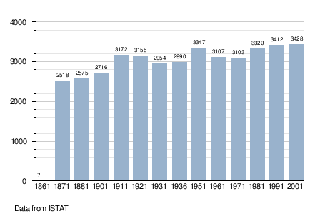
Demographic evolution
References
External links
This article is issued from Wikipedia - version of the 11/29/2016. The text is available under the Creative Commons Attribution/Share Alike but additional terms may apply for the media files.