Basse-Goulaine
| Basse-Goulaine | ||
|---|---|---|
|
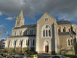
The church in Basse-Goulaine | ||
| ||
 Basse-Goulaine | ||
|
Location within Pays de la Loire region  Basse-Goulaine | ||
| Coordinates: 47°12′58″N 1°27′51″W / 47.2161°N 1.4642°WCoordinates: 47°12′58″N 1°27′51″W / 47.2161°N 1.4642°W | ||
| Country | France | |
| Region | Pays de la Loire | |
| Department | Loire-Atlantique | |
| Arrondissement | Nantes | |
| Canton | Vertou-Vignoble | |
| Intercommunality | Nantes Métropole | |
| Government | ||
| • Mayor (2008–2014) | Alain Vey | |
| Area1 | 13.74 km2 (5.31 sq mi) | |
| Population (2009)2 | 7,995 | |
| • Density | 580/km2 (1,500/sq mi) | |
| Time zone | CET (UTC+1) | |
| • Summer (DST) | CEST (UTC+2) | |
| INSEE/Postal code | 44009 / 44115 | |
| Elevation | 1–44 m (3.3–144.4 ft) | |
|
1 French Land Register data, which excludes lakes, ponds, glaciers > 1 km² (0.386 sq mi or 247 acres) and river estuaries. 2 Population without double counting: residents of multiple communes (e.g., students and military personnel) only counted once. | ||

Basse-Goulaine is a commune in the Loire-Atlantique department in western France.
Population
| Historical population | ||
|---|---|---|
| Year | Pop. | ±% |
| 1793 | 1,153 | — |
| 1800 | 776 | −32.7% |
| 1806 | 1,006 | +29.6% |
| 1821 | 1,180 | +17.3% |
| 1831 | 1,218 | +3.2% |
| 1841 | 1,168 | −4.1% |
| 1846 | 1,220 | +4.5% |
| 1851 | 1,227 | +0.6% |
| 1856 | 1,294 | +5.5% |
| 1861 | 1,287 | −0.5% |
| 1866 | 1,255 | −2.5% |
| 1872 | 1,187 | −5.4% |
| 1876 | 1,226 | +3.3% |
| 1881 | 1,182 | −3.6% |
| 1886 | 1,189 | +0.6% |
| 1891 | 1,234 | +3.8% |
| 1896 | 1,259 | +2.0% |
| 1901 | 1,250 | −0.7% |
| 1906 | 1,264 | +1.1% |
| 1911 | 1,170 | −7.4% |
| 1921 | 1,105 | −5.6% |
| 1926 | 1,176 | +6.4% |
| 1931 | 1,103 | −6.2% |
| 1936 | 1,185 | +7.4% |
| 1946 | 1,333 | +12.5% |
| 1954 | 1,539 | +15.5% |
| 1962 | 1,853 | +20.4% |
| 1968 | 2,160 | +16.6% |
| 1975 | 3,036 | +40.6% |
| 1982 | 4,099 | +35.0% |
| 1990 | 5,910 | +44.2% |
| 1999 | 7,504 | +27.0% |
| 2006 | 7,883 | +5.1% |
| 2009 | 7,995 | +1.4% |
See also
References
External links
| Wikimedia Commons has media related to Basse-Goulaine. |
This article is issued from Wikipedia - version of the 9/16/2015. The text is available under the Creative Commons Attribution/Share Alike but additional terms may apply for the media files.