Boussay, Loire-Atlantique
| Boussay | ||
|---|---|---|
|
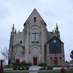
The church of Sainte-Radegonde-Saint-Sébastien, in Boussay | ||
| ||
 Boussay | ||
|
Location within Pays de la Loire region  Boussay | ||
| Coordinates: 47°02′42″N 1°11′07″W / 47.045°N 1.1853°WCoordinates: 47°02′42″N 1°11′07″W / 47.045°N 1.1853°W | ||
| Country | France | |
| Region | Pays de la Loire | |
| Department | Loire-Atlantique | |
| Arrondissement | Nantes | |
| Canton | Clisson | |
| Intercommunality | vallée de Clisson | |
| Government | ||
| • Mayor (2008–2014) | Gérard Esnault | |
| Area1 | 26.45 km2 (10.21 sq mi) | |
| Population (2009)2 | 2,652 | |
| • Density | 100/km2 (260/sq mi) | |
| Time zone | CET (UTC+1) | |
| • Summer (DST) | CEST (UTC+2) | |
| INSEE/Postal code | 44022 / 44190 | |
| Elevation | 27–111 m (89–364 ft) | |
|
1 French Land Register data, which excludes lakes, ponds, glaciers > 1 km² (0.386 sq mi or 247 acres) and river estuaries. 2 Population without double counting: residents of multiple communes (e.g., students and military personnel) only counted once. | ||
.svg.png)
Boussay is a commune in the Loire-Atlantique department in western France.
Population
| Historical population | ||
|---|---|---|
| Year | Pop. | ±% |
| 1793 | 4,000 | — |
| 1800 | 793 | −80.2% |
| 1806 | 1,688 | +112.9% |
| 1821 | 1,651 | −2.2% |
| 1831 | 1,799 | +9.0% |
| 1836 | 1,806 | +0.4% |
| 1841 | 1,846 | +2.2% |
| 1846 | 1,942 | +5.2% |
| 1851 | 2,050 | +5.6% |
| 1856 | 2,124 | +3.6% |
| 1861 | 2,137 | +0.6% |
| 1866 | 2,203 | +3.1% |
| 1872 | 2,047 | −7.1% |
| 1876 | 2,096 | +2.4% |
| 1881 | 2,079 | −0.8% |
| 1886 | 2,094 | +0.7% |
| 1891 | 2,062 | −1.5% |
| 1896 | 1,939 | −6.0% |
| 1901 | 1,811 | −6.6% |
| 1906 | 1,730 | −4.5% |
| 1911 | 1,750 | +1.2% |
| 1921 | 1,628 | −7.0% |
| 1926 | 1,637 | +0.6% |
| 1931 | 1,608 | −1.8% |
| 1936 | 1,591 | −1.1% |
| 1946 | 1,647 | +3.5% |
| 1954 | 1,806 | +9.7% |
| 1962 | 2,061 | +14.1% |
| 1968 | 2,106 | +2.2% |
| 1975 | 2,040 | −3.1% |
| 1982 | 2,161 | +5.9% |
| 1990 | 2,316 | +7.2% |
| 1999 | 2,361 | +1.9% |
| 2006 | 2,548 | +7.9% |
| 2009 | 2,652 | +4.1% |
See also
References
External links
| Wikimedia Commons has media related to Boussay (Loire-Atlantique). |
This article is issued from Wikipedia - version of the 2/12/2016. The text is available under the Creative Commons Attribution/Share Alike but additional terms may apply for the media files.