Saint-Brevin-les-Pins
| Saint-Brevin-les-Pins | ||
|---|---|---|
|
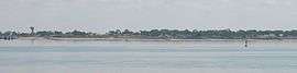
The coastline of Saint-Brevin-les-Pins, seen from Saint-Nazaire | ||
| ||
 Saint-Brevin-les-Pins | ||
|
Location within Pays de la Loire region  Saint-Brevin-les-Pins | ||
| Coordinates: 47°14′55″N 2°09′56″W / 47.2486°N 2.1656°WCoordinates: 47°14′55″N 2°09′56″W / 47.2486°N 2.1656°W | ||
| Country | France | |
| Region | Pays de la Loire | |
| Department | Loire-Atlantique | |
| Arrondissement | Saint-Nazaire | |
| Canton | Paimbœuf | |
| Intercommunality | Sud-Estuaire | |
| Government | ||
| • Mayor (2008–2014) | Yannick Haury | |
| Area1 | 19.29 km2 (7.45 sq mi) | |
| Population (2006)2 | 11,750 | |
| • Density | 610/km2 (1,600/sq mi) | |
| Time zone | CET (UTC+1) | |
| • Summer (DST) | CEST (UTC+2) | |
| INSEE/Postal code | 44154 / 44250 | |
| Elevation | 0–39 m (0–128 ft) | |
|
1 French Land Register data, which excludes lakes, ponds, glaciers > 1 km² (0.386 sq mi or 247 acres) and river estuaries. 2 Population without double counting: residents of multiple communes (e.g., students and military personnel) only counted once. | ||

Saint-Brevin-les-Pins is a commune in the Loire-Atlantique department in western France.
See also
References
| Wikimedia Commons has media related to Saint-Brevin-les-Pins. |
This article is issued from Wikipedia - version of the 2/18/2016. The text is available under the Creative Commons Attribution/Share Alike but additional terms may apply for the media files.