Bean Blossom Township, Monroe County, Indiana
| Bean Blossom Township | |
|---|---|
| Township | |
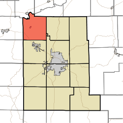 Location in Monroe County | |
| Coordinates: 39°17′46″N 86°37′18″W / 39.29611°N 86.62167°WCoordinates: 39°17′46″N 86°37′18″W / 39.29611°N 86.62167°W | |
| Country |
|
| State |
|
| County | Monroe |
| Government | |
| • Type | Indiana township |
| Area | |
| • Total | 36.35 sq mi (94.1 km2) |
| • Land | 36.34 sq mi (94.1 km2) |
| • Water | 0.01 sq mi (0.03 km2) 0.03% |
| Elevation | 748 ft (228 m) |
| Population (2010) | |
| • Total | 2,916 |
| • Density | 80.2/sq mi (31.0/km2) |
| ZIP codes | 47404, 47429, 47433, 47464 |
| GNIS feature ID | 0453100 |
Bean Blossom Township is one of eleven townships in Monroe County, Indiana, United States. As of the 2010 census, its population was 2,916 and it contained 1,184 housing units.[1]
History
Secrest Ferry Bridge was listed on the National Register of Historic Places in 1996.[2]
Geography
According to the 2010 census, the township has a total area of 36.35 square miles (94.1 km2), of which 36.34 square miles (94.1 km2) (or 99.97%) is land and 0.01 square miles (0.026 km2) (or 0.03%) is water.[1] The White River defines the northwest boundary of the township.
Cities, towns, villages
- Ellettsville (northwest edge)
- Stinesville
Unincorporated towns
Cemeteries
The township contains these four cemeteries: Ellett, King, Mount Carmel and Van Buskirk.
Major highways
School districts
- Richland-Bean Blossom Community School Corporation
Political districts
- Indiana's 4th congressional district
- State House District 46
- State Senate District 37
References
- "Bean Blossom Township, Monroe County, Indiana". Geographic Names Information System. United States Geological Survey. Retrieved 2009-09-27.
- United States Census Bureau 2008 TIGER/Line Shapefiles
- IndianaMap
- 1 2 "Population, Housing Units, Area, and Density: 2010 - County -- County Subdivision and Place -- 2010 Census Summary File 1". United States Census. Retrieved 2013-05-10.
- ↑ National Park Service (2010-07-09). "National Register Information System". National Register of Historic Places. National Park Service.
External links
- Indiana Township Association
- United Township Association of Indiana
- City-Data.com page for Bean Blossom Township

Municipalities and communities of Monroe County, Indiana, United States | ||
|---|---|---|
| City | ||
| Towns | ||
| Townships | ||
| CDPs | ||
| Other unincorporated communities |
| |
This article is issued from Wikipedia - version of the 11/1/2016. The text is available under the Creative Commons Attribution/Share Alike but additional terms may apply for the media files.