Handy, Monroe County, Indiana
| Handy | |
|---|---|
| Unincorporated community | |
|
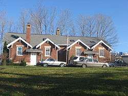
The former Handy School | |
 Handy  Handy | |
| Coordinates: 39°05′45″N 86°29′38″W / 39.09583°N 86.49389°WCoordinates: 39°05′45″N 86°29′38″W / 39.09583°N 86.49389°W | |
| Country | United States |
| State | Indiana |
| County | Monroe |
| Township | Perry |
| Elevation | 768 ft (234 m) |
| ZIP code | 47401 |
| FIPS code | 18-31108[1] |
| GNIS feature ID | 451004[2] |
Handy is an unincorporated community in Perry Township, Monroe County, Indiana.
According to Ronald L. Baker, the community was probably named after Joseph D. Handy,[3] a county commissioner.[4]
Geography
Handy is located at 39°05′45″N 86°29′38″W / 39.09583°N 86.49389°W.
References
- ↑ "American FactFinder". United States Census Bureau. Retrieved 2008-01-31.
- ↑ "Handy, Indiana". Geographic Names Information System. United States Geological Survey. Retrieved 2009-10-17.
- ↑ Baker, Ronald L. (October 1995). From Needmore to Prosperity: Hoosier Place Names in Folklore and History. Indiana University Press. p. 156. ISBN 978-0-253-32866-3.
The name probably honors Joseph D. Handy...
- ↑ Blanchard, Charles (1884). Counties of Morgan, Monroe and Brown, Indiana: Historical and Biographical. F.A. Battey & Company. p. 604.
Municipalities and communities of Monroe County, Indiana, United States | ||
|---|---|---|
| City | ||
| Towns | ||
| Townships | ||
| CDPs | ||
| Other unincorporated communities |
| |
This article is issued from Wikipedia - version of the 10/24/2016. The text is available under the Creative Commons Attribution/Share Alike but additional terms may apply for the media files.