Bellefonte, Arkansas
| Bellefonte, Arkansas | |
|---|---|
| Town | |
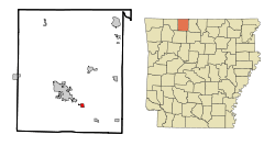 Location in Boone County and the state of Arkansas | |
| Coordinates: 36°12′0″N 93°2′49″W / 36.20000°N 93.04694°WCoordinates: 36°12′0″N 93°2′49″W / 36.20000°N 93.04694°W | |
| Country | United States |
| State | Arkansas |
| County | Boone |
| Initially Incorporated | 1882 |
| Re-Incorporated | 1963 |
| Area | |
| • Total | 0.6 sq mi (1.5 km2) |
| • Land | 0.6 sq mi (1.5 km2) |
| • Water | 0 sq mi (0 km2) |
| Elevation | 1,060 ft (323 m) |
| Population (2010) | |
| • Total | 530 |
| • Density | 666.7/sq mi (266.7/km2) |
| Time zone | Central (CST) (UTC-6) |
| • Summer (DST) | CDT (UTC-5) |
| FIPS code | 05-04900 |
| GNIS feature ID | 0076293 |
Bellefonte is a town in Boone County, Arkansas, United States. The population was 530 at the 2010 census. It is part of the Harrison Micropolitan Statistical Area. Bellefonte gained national attention in 2013 when the city's mayor, James Wiggs, was recognized as the oldest active mayor in the United States at 90 years of age.
Geography
Bellefonte is located at 36°12′0″N 93°2′49″W / 36.20000°N 93.04694°W (36.199865, -93.046975).[1]
According to the United States Census Bureau, the town has a total area of 1.5 km² (0.6 mi²), all land.
List of highways
History
The area known as Bellefonte was originally settled by a few families. The community expanded when two stores were established. The community got its name as campers noted the beautiful springs. It was suggested the area be called "Bellefonte" for "beautiful fountains."
As there were no church organizations in the settlement, services were originally held in private homes. Circuit riders generally provided the services.
Bellefonte grew quite a bit by the second half of the 1860s. A post office was established.
By the early 1870s, what was referred to as "North Arkansas College" (not to be confused with the modern community college by the same name in Harrison, Arkansas) was founded and students from all over the state attended. In modern times, this would be considered a high school. A grade school was also established in Bellefonte around the same time.
Bellefonte continued to grow, becoming a large town. A number of businesses developed and a town square was built. (By 1939, the town square was gone.) Businesses included doctors' offices, drugstores, a livery stable, various general stores, a leather factory, saloons, a cotton gin and a flour mill.
When Boone County was formed, Bellefonte was the largest town, larger than relatively new Harrison. Bellefonte expected it should have the county seat. After arguing and a vote, Harrison ultimately won.
Bellefonte became an incorporated town in 1882. In that year it was also damaged by a significant fire due to buildings being close together. In the same year, the North Arkansas College building burned. Bellefonte stopped being an incorporated town after this great fire, not re-incorporating until 1963.[2]
By 1898 things had gotten better. Around 1901, the Missouri and North Arkansas Railroad ran through Bellefonte. This temporarily brought in business. There were various fires in 1912, which stifled Bellefonte until 1929 when things began to pick up a bit.
The Depression was directly felt in Bellefonte from 1930 to 1933. It took until 1935 for signs of relief.[3]
Demographics
| Historical population | |||
|---|---|---|---|
| Census | Pop. | %± | |
| 1880 | 296 | — | |
| 1970 | 300 | — | |
| 1980 | 393 | 31.0% | |
| 1990 | 361 | −8.1% | |
| 2000 | 400 | 10.8% | |
| 2010 | 530 | 32.5% | |
| Est. 2015 | 478 | [4] | −9.8% |
2014 Estimate[6] | |||
As of the census[7] of 2010, there were 530 people, 197 households, and 124 families residing in the town. The population density was 261.8/km² (679.3/mi²). There were 173 housing units at an average density of 113.2/km² (293.8/mi²). The racial makeup of the town was 97.80% white and 1.30% of two or more races.
There were 157 households out of which 33.1% had children under the age of 18 living with them, 55.4% were married couples living together, 14.0% had a female householder with no husband present, and 26.8% were non-families. 24.2% of all households were made up of individuals and 6.4% had someone living alone who was 65 years of age or older. The average household size was 2.55 and the average family size was 3.02.
In the town the population was spread out with 29.3% under the age of 18, 9.5% from 18 to 24, 27.3% from 25 to 44, 21.8% from 45 to 64, and 12.3% who were 65 years of age or older. The median age was 31 years. For every 100 females there were 90.5 males. For every 100 females age 18 and over, there were 96.5 males.
The median income for a household in the town was $27,917, and the median income for a family was $30,729. Males had a median income of $24,500 versus $18,000 for females. The per capita income for the town was $12,958. About 13.7% of families and 18.2% of the population were below the poverty line, including 32.4% of those under age 18 and 3.6% of those age 65 or over.
In modern times, Bellefonte first appeared in the US Census in 1970. It also appeared in 1880. This says nothing about when the community began; it merely identifies when it was recognized in the US Census.
School district
Bellefonte, along with Everton and Valley Springs, is within the Valley Springs School District.[8]
References
- ↑ "US Gazetteer files: 2010, 2000, and 1990". United States Census Bureau. 2011-02-12. Retrieved 2011-04-23.
- ↑ "Bellefonte (Boone County)". Encyclopedia of Arkansas History and Culture. Central Arkansas Library System.
- ↑ Stark, Louise (1939), History of Bellefonte, pp. 1–8
- ↑ "Annual Estimates of the Resident Population for Incorporated Places: April 1, 2010 to July 1, 2015". Retrieved July 2, 2016.
- ↑ "Census of Population and Housing". Census.gov. Archived from the original on May 11, 2015. Retrieved June 4, 2015.
- ↑ "Annual Estimates of the Resident Population for Incorporated Places: April 1, 2010 to July 1, 2014". Retrieved June 4, 2015.
- ↑ "American FactFinder". United States Census Bureau. Archived from the original on 2013-09-11. Retrieved 2008-01-31.
- ↑ School District Reference Map (2010 Census): Boone County, AR (PDF) (Map). US Census Bureau. Retrieved 28 Jun 2011.
External links
- Encyclopedia of Arkansas History & Culture entry
- Map of Bellefonte (US Census Bureau)
- Boone County Historical and Railroad Society, Inc.
- Town government information
- Valley Springs School District
- Detailed 2000 US Census statistics
- Boone County School District Reference Map (US Census Bureau, 2010)
Municipalities and communities of Boone County, Arkansas, United States | ||
|---|---|---|
| Cities | 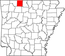 | |
| Towns | ||
| Townships | ||
| Unincorporated communities | ||
| Ghost town | ||
| Footnotes | ‡This populated place also has portions in an adjacent county or counties | |