Benton, Arkansas
| Benton, Arkansas | |
|---|---|
| City | |
|
Saline County Courthouse, located in the heart of downtown Benton. | |
 Location in Saline County and the state of Arkansas | |
 Benton, Arkansas Location in the United States | |
| Coordinates: 34°34′15″N 92°34′37″W / 34.57083°N 92.57694°WCoordinates: 34°34′15″N 92°34′37″W / 34.57083°N 92.57694°W | |
| Country |
|
| State |
|
| County | Saline |
| Government | |
| • Type | Mayor-Council |
| • Mayor | David Mattingly |
| • City Council |
Frank Baptist Kerry Murphy Charles Cunningham Joe Lee Richards Bill Donnor Jerry Ponder Brad Moore James Herzfeld Steve Lee Lori Terrell |
| Area | |
| • Total | 47.8 km2 (18.4 sq mi) |
| • Land | 46.5 km2 (17.9 sq mi) |
| • Water | 1.3 km2 (0.5 sq mi) |
| Elevation | 124 m (407 ft) |
| Population (2015) | |
| • Total | 34,177 |
| • Density | 458.3/km2 (1,190.5/sq mi) |
| Time zone | Central (CST) (UTC-6) |
| • Summer (DST) | CDT (UTC-5) |
| ZIP code | 72015, 72018-19, 72158 |
| Area code(s) | 501 |
| FIPS code | 05-05290[1] |
| GNIS feature ID | 0046394[2] |
| Website | Official website |

Benton is a city in and the county seat of Saline County, Arkansas, United States and a suburb of Little Rock. It was established in 1837.[3] According to a 2006 Special Census conducted at the request of the city government, the population of the city is 27,717, ranking it as the state's 16th largest city, behind Texarkana.[4] However in the 2010 census, the city population increased to 30,681, making it the 12th largest city in the state of Arkansas. In 2014, the population increased again to 33,625 It is part of the Little Rock–North Little Rock–Conway Metropolitan Statistical Area. The city of Benton, first settled in 1833 and named after Missouri Senator Thomas Hart Benton, was formally chartered in 1836 when Arkansas became a state.[5]
Geography
According to the United States Census Bureau, the city has a total area of 18.4 square miles (48 km2), of which 17.9 square miles (46 km2) is land and 0.5 square miles (1.3 km2) (2.71%) is water.

Demographics
| Historical population | |||
|---|---|---|---|
| Census | Pop. | %± | |
| 1880 | 452 | — | |
| 1890 | 647 | 43.1% | |
| 1900 | 1,025 | 58.4% | |
| 1910 | 1,708 | 66.6% | |
| 1920 | 2,933 | 71.7% | |
| 1930 | 3,445 | 17.5% | |
| 1940 | 3,502 | 1.7% | |
| 1950 | 6,277 | 79.2% | |
| 1960 | 10,399 | 65.7% | |
| 1970 | 16,499 | 58.7% | |
| 1980 | 17,717 | 7.4% | |
| 1990 | 18,177 | 2.6% | |
| 2000 | 21,906 | 20.5% | |
| 2010 | 30,681 | 40.1% | |
| Est. 2015 | 34,177 | [6] | 11.4% |
2015 Estimate[8] | |||
As of the census[1] of 2000, there were 21,906 people, 8,713 households, and 6,186 families residing in the city. The population density was 1,221.2 people per square mile (471.5/km²). There were 9,315 housing units at an average density of 519.3 per square mile (200.5/km²). The racial makeup of the city was 92.81% White, 4.46% Black or African American, 0.39% Native American, 0.56% Asian, 0.05% Pacific Islander, 0.75% from other races, and 1.19% from two or more races. 1.90% of the population were Hispanic or Latino of any race.
There were 8,713 households out of which 33.5% had children under the age of 18 living with them, 55.9% were married couples living together, 11.8% had a female householder with no husband present, and 29.0% were non-families. The average household size was 2.46 and the average family size was 2.95.
In the city the population was spread out with 25.3% under the age of 18, 8.8% from 18 to 24, 29.8% from 25 to 44, 21.5% from 45 to 64, and 14.7% who were 65 years of age or older. The median age was 36 years. For every 100 females there were 91.5 males. For every 100 females age 18 and over, there were 88.1 males.
The median income for a household in the city was $41,503, and the median income for a family was $51,064. Males had a median income of $32,493 versus $22,386 for females. The per capita income for the city was $19,797. About 5.8% of families and 8.6% of the population were below the poverty line, including 9.9% of those under age 18 and 11.5% of those age 65 or over.
Education
Public education for early childhood, elementary and secondary students is provided by:
- Benton School District, which leads to graduation from Benton High School.
- Harmony Grove School District, which leads to graduation from Benton Harmony Grove High School.
- Bryant School District, which leads to graduation from Bryant High School.
Notable people
- Ann Clemmer – Republican former member of the Arkansas House of Representatives for District 29 and then District 23 in Saline County
- Lanny Fite – Ann Clemmer's successor in the state House District 23; former Saline County county judge
- Wes Gardner – Former relief pitcher for the New York Mets, Boston Red Sox, and others
- Kim Hammer – Baptist clergyman from Benton and Republican member of the Arkansas House of Representatives from District 28 in Saline County
- Kenneth Henderson – Republican member of the Arkansas House for Pope County; real estate developer in Russellville; former Benton resident[9]
- Cliff Lee – Major League Baseball's 2008 American League Cy Young Award winner for the Cleveland Indians and current member of the Philadelphia Phillies
- Ewell Ross McCright – World War II POW
- Joe Purcell – Arkansas governor for six days in 1979; Democratic lieutenant governor and attorney general; lawyer in Benton
- Charlie Rich – Multiple Grammy Award winning country artist
- Willis Ricketts – Republican gubernatorial nominee in 1962; lost to Orval Faubus
- Billy Bob Thornton, writer, director, and star of the 1996 American drama film ‘’Sling Blade’’ used Benton as the location for many scenes.[10]
- Justin Moore country artist, born in nearby Poyen, currently resides in Benton
- Stuart Greer – Film & television actor, is a part-year resident
Climate
The climate in this area is characterized by hot, humid summers and generally mild to cool winters. According to the Köppen Climate Classification system, Benton has a humid subtropical climate, abbreviated "Cfa" on climate maps.[11]
References
- 1 2 "American FactFinder". United States Census Bureau. Archived from the original on 2013-09-11. Retrieved 2008-01-31.
- ↑ "US Board on Geographic Names". United States Geological Survey. 2007-10-25. Retrieved 2008-01-31.
- ↑ "Find a County". National Association of Counties. Archived from the original on 2011-05-31. Retrieved 2011-06-07.
- ↑ "Annual Estimates of the Population for All Incorporated Places in Arkansas" (CSV). 2005 Population Estimates. U.S. Census Bureau, Population Division. June 21, 2006. Retrieved November 16, 2006.
- ↑ "Benton (Saline County)". The Encyclopedia of Arkansas History & Culture. The Central Arkansas Library System. Retrieved 4 July 2014.
- ↑ "Annual Estimates of the Resident Population for Incorporated Places: April 1, 2010 to July 1, 2015". Retrieved July 2, 2016.
- ↑ "Census of Population and Housing". Census.gov. Archived from the original on May 11, 2015. Retrieved June 4, 2015.
- ↑ "Annual Estimates of the Resident Population for Incorporated Places: April 1, 2010 to July 1, 2015". Retrieved June 2, 2016.
- ↑ "Kenneth L. Henderson". intelius.com. Retrieved April 8, 2015.
- ↑ IMDb: Sling Blade, Locations
- ↑ Summary for Benton, Arkansas
External links
| Wikimedia Commons has media related to Benton, Arkansas. |
- Benton, Arkansas
- Encyclopedia of Arkansas History & Culture entry: Benton (Saline County)
- Benton, Arkansas Police Department
Municipalities and communities of Saline County, Arkansas, United States | ||
|---|---|---|
| Cities | 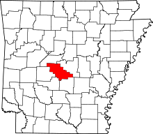 | |
| Towns | ||
| CDPs | ||
| Unincorporated communities | ||
| Footnotes | ‡This populated place also has portions in an adjacent county or counties | |