Benton Township, Lake County, Illinois
| Benton Township | |
|---|---|
| Township | |
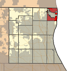
 Location in Lake County | |
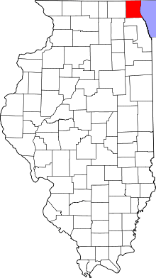
 Lake County's location in Illinois | |
| Coordinates: 42°27′50″N 87°50′35″W / 42.46389°N 87.84306°WCoordinates: 42°27′50″N 87°50′35″W / 42.46389°N 87.84306°W | |
| Country | United States |
| State | Illinois |
| County | Lake |
| Established | November 6, 1849 |
| Area | |
| • Total | 14.9 sq mi (38.5 km2) |
| • Land | 14.6 sq mi (37.8 km2) |
| • Water | 0.3 sq mi (0.7 km2) |
| Elevation | 666 ft (203 m) |
| Population (2010) | |
| • Total | 18,951 |
| • Density | 1,300/sq mi (490/km2) |
| Time zone | CST (UTC-6) |
| • Summer (DST) | CDT (UTC-5) |
| GNIS feature ID | 0428660 |
| Website |
www |
Benton Township is a township in Lake County, Illinois, United States, and includes all of the village of Winthrop Harbor, most of the village of Beach Park, and small portions of the cities of Zion and Waukegan. As of the 2010 census, its population was 18,951.[1] Zion Township was formed from Benton Township on September 12, 1930.
Geography
Benton Township covers an area of 14.9 square miles (38.5 km2); of this, 0.27 square miles (0.7 km2) or 1.92 percent is water.[1] Lakes in this township include Sand Pond. The streams of Bull Creek and Dead River run through this township.
Cities and towns
Adjacent townships
- Zion Township (southeast)
- Newport Township (west)
Cemeteries
The township contains nine cemeteries: Benton Greenwood, Briggs Family, Buffalo Grove Catholic, Catholic, Colchester, County Line, Cranberry Lake, Pineview and Rosecrans.
Major highways
Airports and landing strips
References
- 1 2 "Geographic Identifiers: 2010 Demographic Profile Data (G001): Benton township, Lake County, Illinois". U.S. Census Bureau, American Factfinder. Retrieved December 18, 2012.
External links
This article is issued from Wikipedia - version of the 10/31/2016. The text is available under the Creative Commons Attribution/Share Alike but additional terms may apply for the media files.