Deer Park, Illinois
| Deer Park, Illinois | |
|---|---|
| Village | |
| Village of Deer Park | |
 Deer Park | |
| Coordinates: 42°09′59″N 088°05′09″W / 42.16639°N 88.08583°WCoordinates: 42°09′59″N 088°05′09″W / 42.16639°N 88.08583°W | |
| Country | United States |
| State | Illinois |
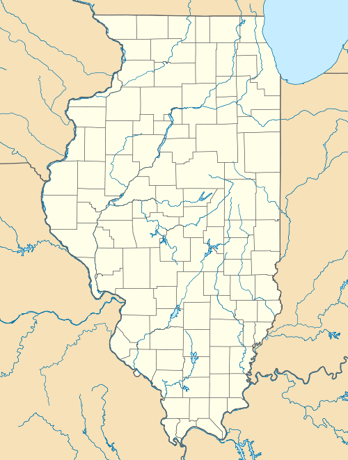
| Counties | Lake |
| Township | Ela |
| Incorporated | 1957 |
| Government | |
| • Type | Trustee-village |
| • President | Robert Kellermann |
| Area | |
| • Total | 3.83 sq mi (9.9 km2) |
| • Land | 3.71 sq mi (9.6 km2) |
| • Water | 0.12 sq mi (0.3 km2) 3.13% |
| Population (2010) | |
| • Total | 3,200 |
| • Density | 862.5/sq mi (333.0/km2) |
| Standard of living (2007-11) | |
| • Per capita income | $63,689 |
| • Median home value | $593,000 |
| ZIP code(s) | 60010 |
| Area code(s) | 847 & 224 |
| Geocode | 17-19083 |
| Website |
villageofdeerpark |
| Demographics (2010)[1] | |||
|---|---|---|---|
| White | Black | Asian | |
| 92.9% | 0.9% | 4.3% | |
| Islander | Native | Other | Hispanic (any race) |
| 0.03% | 0.0% | 2.0% | 3.4% |
Deer Park is a village in Lake County, Illinois. The population was 3,200 at the 2010 census.[2] The village is one of the few left in the Chicago area that enjoy a green belt which is bordered by two large natural areas providing outdoor recreation and open space. The village is home to popular shopping and dining destinations: Deer Park Town Center and the Town Center Promenade. The town is also home to the Vehe Farm, an Illinois Centennial Farm.
Residential zoning is mainly single family homes with lot of sizes of 1-acre (4,000 m2) or more. Upscale townhomes are available near the Deer Park Center. The Metra/Chicago & Northwestern train line provides commuter service to Chicago with stations in nearby Barrington and Palatine.
Geography
Deer Park is located at 42°09′59″N 88°05′09″W / 42.166458°N 88.085859°W.[3]
According to the 2010 census, Deer Park has a total area of 3.825 square miles (9.91 km2), of which 3.71 square miles (9.61 km2) (or 96.99%) is land and 0.115 square miles (0.30 km2) (or 3.01%) is water.[4]
Demographics
| Historical population | |||
|---|---|---|---|
| Census | Pop. | %± | |
| 1960 | 476 | — | |
| 1970 | 726 | 52.5% | |
| 1980 | 1,368 | 88.4% | |
| 1990 | 2,887 | 111.0% | |
| 2000 | 3,102 | 7.4% | |
| 2010 | 3,200 | 3.2% | |
| Est. 2015 | 3,759 | [5] | 17.5% |
As of the census[7] of 2000, there were 3,102 people, 989 households, and 899 families residing in the village. The population density was 850.7 people per square mile (328.1/km²). There were 1,010 housing units at an average density of 277.0 per square mile (106.8/km²). The racial makeup of the village was 95.97% White, 0.58% African American, 0.06% Native American, 2.42% Asian, 0.03% Pacific Islander, 0.26% from other races, and 0.68% from two or more races. Hispanic or Latino of any race were 1.52% of the population.
There were 989 households out of which 47.9% had children under the age of 18 living with them, 87.3% were married couples living together, 2.9% had a female householder with no husband present, and 9.1% were non-families. 7.0% of all households were made up of individuals and 2.3% had someone living alone who was 65 years of age or older. The average household size was 3.14 and the average family size was 3.31.
In the village the population was spread out with 30.8% under the age of 18, 5.0% from 18 to 24, 23.9% from 25 to 44, 33.7% from 45 to 64, and 6.7% who were 65 years of age or older. The median age was 40 years. For every 100 females there were 101.2 males. For every 100 females age 18 and over, there were 98.9 males.
The median income for a household in the village was $149,233, and the median income for a family was $166,838. Males had a median income over $100,000 versus $66,458 for females. The per capita income for the village was $61,429. About 0.8% of families and 0.6% of the population were below the poverty line, including none of those under the age of eighteen or sixty-five or over.
References
- ↑ "Profile of General Population and Housing Characteristics: 2010 Demographic Profile Data (DP-1): Deer Park village, Illinois". U.S. Census Bureau, American Factfinder. Retrieved February 21, 2013.
- ↑ "Geographic Identifiers: 2010 Demographic Profile Data (G001): Deer Park village, Illinois". U.S. Census Bureau, American Factfinder. Retrieved December 10, 2012.
- ↑ "US Gazetteer files: 2010, 2000, and 1990". United States Census Bureau. 2011-02-12. Retrieved 2011-04-23.
- ↑ "G001 - Geographic Identifiers - 2010 Census Summary File 1". United States Census Bureau. Retrieved 2015-08-02.
- ↑ "Annual Estimates of the Resident Population for Incorporated Places: April 1, 2010 to July 1, 2015". Retrieved July 2, 2016.
- ↑ "Census of Population and Housing". Census.gov. Retrieved June 4, 2015.
- ↑ "American FactFinder". United States Census Bureau. Retrieved 2008-01-31.
External links
Municipalities and communities of Lake County, Illinois, United States | ||
|---|---|---|
| Cities | ||
| Villages |
| |
| Townships | ||
| CDPs | ||
| Other unincorporated communities | ||
| Former settlement | ||
| Footnotes | ‡This populated place also has portions in an adjacent county or counties | |
| Major city |  | |
|---|---|---|
| Cities (over 30,000 in 2010) | ||
| Towns and villages (over 30,000 in 2010) |
| |
| Counties | ||
| Regions | ||
| Sub-regions | ||
