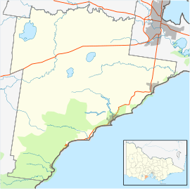
Big Hill, Victoria (Surf Coast Shire)
| Big Hill Victoria | |||||||||||||
|---|---|---|---|---|---|---|---|---|---|---|---|---|---|
 Big Hill | |||||||||||||
| Coordinates | 38°28′49″S 144°00′18″E / 38.48028°S 144.00500°ECoordinates: 38°28′49″S 144°00′18″E / 38.48028°S 144.00500°E | ||||||||||||
| Postcode(s) | 3231 | ||||||||||||
| LGA(s) | Surf Coast Shire | ||||||||||||
| State electorate(s) | Polwarth | ||||||||||||
| Federal Division(s) | Corangamite | ||||||||||||
| |||||||||||||
Big Hill is a coastal locality in the Surf Coast Shire, Victoria, Australia.[1] In the 2011 census, the population of Big Hill was too low to separately report; however in June 2014 the Victorian Electoral Commission recorded 17 enrolled voters in Big Hill, living in 14 properties.[2][3]
The locality was first developed with the construction of the Great Ocean Road over the eponymous hill in 1920-21, when 100 returned soldiers were employed cutting a road through the area.[4] The Great Ocean Road Trust opened up a subdivision of 140 allotments named the "Big Hill Estate" in 1924 to raise funding for the continued construction of the road; while these were sold, a township never developed.[5]
A guest house, "Iluka", was built on the new road, but burned down in 1926.[6][7] Nationally renowned landscape designer Edna Walling bought 12 acres of the Big Hill Estate in the late 1940s with a view to creating a village there, but decided that it would spoil the location, and built a home, "East Point", there instead. Walling moved to Queensland in 1967, and the house burned down in a bushfire the same year; the ruins are listed on the Surf Coast Shire heritage inventory.[5]
Big Hill today is a little-developed stretch of the Great Ocean Road, with much of the locality being within the Great Otway National Park. The House at Big Hill, which won numerous architecture awards, was built there in 2011. Although the Big Hill campsite is a popular camping destination in the area, it is formally in adjacent Lorne.
References
- ↑ "Big Hill (entry 100367)". VICNAMES. Government of Victoria. Retrieved 26 June 2014.
- ↑ "2011 Census QuickStats: Lorne". Australian Bureau of Statistics. Retrieved 10 July 2014.
- ↑ "Locality Finder" (PDF). Victorian Electoral Commission. 16 June 2014. Retrieved 10 July 2014.
- ↑ "Notes and notices". The Australasian. 10 April 1920. Retrieved 26 June 2014.
- 1 2 "East Point" (PDF). Surf Coast Places of Cultural Significance Study. Surf Coast Shire. Retrieved 26 June 2014.
- ↑ "Guest House Burnt". The Argus. 8 December 1926. Retrieved 26 June 2014.
- ↑ "History". aireys-inlet.net.au. Retrieved 26 June 2014.