Blackduck, Minnesota
| Blackduck, Minnesota | |
|---|---|
| City | |
| Motto: "A Great Place For Families"[1] | |
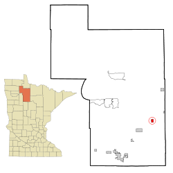 Location of Blackduck, Minnesota | |
 Blackduck Location in the United States | |
| Coordinates: 47°43′49″N 94°32′52″W / 47.73028°N 94.54778°W | |
| Country | United States |
| State | Minnesota |
| County | Beltrami |
| Area[2] | |
| • Total | 1.71 sq mi (4.43 km2) |
| • Land | 1.67 sq mi (4.33 km2) |
| • Water | 0.04 sq mi (0.10 km2) |
| Elevation | 1,398 ft (426 m) |
| Population (2010)[3] | |
| • Total | 785 |
| • Estimate (2012[4]) | 793 |
| • Density | 470.1/sq mi (181.5/km2) |
| Time zone | Central (CST) (UTC-6) |
| • Summer (DST) | CDT (UTC-5) |
| ZIP codes | 56630, 56663 |
| Area code(s) | 218 |
| FIPS code | 27-06256[5] |
| GNIS feature ID | 0655419[6] |
| Website | http://www.blackduckmn.com/ |
Blackduck is a city in Beltrami County, Minnesota, United States. The population was 785 as of the 2010 census.[7]
History
The village of Blackduck was organized in October 1900, and the town was incorporated in December 21, 1900.[8] The first settlers of this community came from Crookston, Minnesota. The town was founded because of the great logging potential of the area. The Continental Divide is located near the area, and provided good drainage which resulted in good logging because the land was not wet. The community was named for Blackduck Lake.[9]
Geography
According to the United States Census Bureau, the city has a total area of 1.71 square miles (4.43 km2), of which, 1.67 square miles (4.33 km2) is land and 0.04 square miles (0.10 km2) is water.[2]
Demographics
| Historical population | |||
|---|---|---|---|
| Census | Pop. | %± | |
| 1910 | 942 | — | |
| 1920 | 788 | −16.3% | |
| 1930 | 704 | −10.7% | |
| 1940 | 753 | 7.0% | |
| 1950 | 732 | −2.8% | |
| 1960 | 765 | 4.5% | |
| 1970 | 595 | −22.2% | |
| 1980 | 653 | 9.7% | |
| 1990 | 718 | 10.0% | |
| 2000 | 696 | −3.1% | |
| 2010 | 785 | 12.8% | |
| Est. 2015 | 779 | [10] | −0.8% |

2010 census
As of the census[3] of 2010, there were 785 people, 338 households, and 185 families residing in the city. The population density was 470.1 inhabitants per square mile (181.5/km2). There were 372 housing units at an average density of 222.8 per square mile (86.0/km2). The racial makeup of the city was 89.4% White, 0.4% African American, 4.6% Native American, 0.5% Asian, 0.1% Pacific Islander, 0.8% from other races, and 4.2% from two or more races. Hispanic or Latino of any race were 2.0% of the population.
There were 338 households of which 32.8% had children under the age of 18 living with them, 33.1% were married couples living together, 16.9% had a female householder with no husband present, 4.7% had a male householder with no wife present, and 45.3% were non-families. 41.1% of all households were made up of individuals and 22.1% had someone living alone who was 65 years of age or older. The average household size was 2.22 and the average family size was 2.97.
The median age in the city was 37.1 years. 27.1% of residents were under the age of 18; 9.3% were between the ages of 18 and 24; 23.1% were from 25 to 44; 19.6% were from 45 to 64; and 20.9% were 65 years of age or older. The gender makeup of the city was 45.9% male and 54.1% female.
2000 census
As of the census[5] of 2000, there were 696 people, 304 households, and 175 families residing in the city. The population density was 465.8 people per square mile (180.4/km²). There were 324 housing units at an average density of 216.8 per square mile (84.0/km²). The racial makeup of the city was 92.10% White, 0.86% African American, 3.45% Native American, 0.14% Asian, 0.14% from other races, and 3.30% from two or more races. Hispanic or Latino of any race were 0.72% of the population.
There were 304 households out of which 26.0% had children under the age of 18 living with them, 40.1% were married couples living together, 14.5% had a female householder with no husband present, and 42.4% were non-families. 37.8% of all households were made up of individuals and 19.7% had someone living alone who was 65 years of age or older. The average household size was 2.14 and the average family size was 2.81.
In the city the population was spread out with 24.6% under the age of 18, 9.1% from 18 to 24, 22.0% from 25 to 44, 15.8% from 45 to 64, and 28.6% who were 65 years of age or older. The median age was 40 years. For every 100 females there were 68.9 males. For every 100 females age 18 and over, there were 64.1 males.
The median income for a household in the city was $21,848, and the median income for a family was $29,750. Males had a median income of $28,594 versus $16,838 for females. The per capita income for the city was $12,536. About 11.6% of families and 16.9% of the population were below the poverty line, including 18.5% of those under age 18 and 15.8% of those age 65 or over.
Parks and recreation
Camp Rabideau is located six miles south of Blackduck. The camp is one of the 2,650 camps President Franklin D. Roosevelt opened during his New Deal Program. The camp is a National Historic Landmark, and is well preserved. The camp was opened to give jobs to young men between the ages of seventeen and twenty-one in hopes of helping the country get out of the depression.[12]
Blackduck Golf Course is located one mile west of Highway 71. This is a nine-hole course with cart rental provided. The golf course is located near the public access to Blackduck Lake. Pine Tree Park is just a short walk from the lake access. This is the closest camp ground to Blackduck. Blackduck Lake has numerous resorts that surround the lake.[1]
Education
Blackduck has one public school divided into an elementary and a high school. The school is located in the town of Blackduck at 156 First Street N.E. The following statistics are an average based on enrollment through the past five years.
Blackduck Elementary School
Number of Students: 329 Number of Teachers: 24 Student to Teacher Ratio: 14:1
Demographics: Asian/Pacific Islander: 0 American Indian/Alaska Native: 23 African American, non-Hispanic: 12 Hispanic: 6 White: 288
Blackduck High School
Number of Students: 373 Number of Teachers: 26 Student to Teacher Ratio: 15:1
Demographics: Asian/Pacific Islander: 3 American Indian/Alaska Native: 44 African American, non-Hispanic: 5 Hispanic: 5 White: 316 Blackduck School Website
Businesses
There are several establishments in Blackduck that serve food. These places include Hillcrest Supper Club, Countryside Restaurant, Timberline, and the Blackduck Bowling Alley all are located off of Highway 71, Duck In And Eat located on Main Street, Blackduck Family Foods and The Pond on Frontage Road. The town of Blackduck has two hotels. The Drake Motel is located across the street from The Pond.
Media
Radio stations
FM
- 92.1 WMIS-FM
- 95.5 KKZY
- 97.5 KDKK
- 98.3 WBJI
- 99.1 KLLZ-FM
- 101.1 KBHP
- 102.5 KKWB
- 103.7 KKBJ-FM
- 104.5 KBUN-FM
AM
References
- 1 2 "City of Blackduck Minnesota". City of Blackduck Minnesota. Retrieved October 14, 2012.
- 1 2 "US Gazetteer files 2010". United States Census Bureau. Archived from the original on 2012-01-24. Retrieved 2012-11-13.
- 1 2 "American FactFinder". United States Census Bureau. Retrieved 2012-11-13.
- ↑ "Population Estimates". United States Census Bureau. Archived from the original on 2013-06-17. Retrieved 2013-05-28.
- 1 2 "American FactFinder". United States Census Bureau. Archived from the original on 2013-09-11. Retrieved 2008-01-31.
- ↑ "US Board on Geographic Names". United States Geological Survey. 2007-10-25. Retrieved 2008-01-31.
- ↑ "2010 Census Redistricting Data (Public Law 94-171) Summary File". American FactFinder. U.S. Census Bureau, 2010 Census. Archived from the original on 21 July 2011. Retrieved 23 April 2011.
- ↑ "Area History". Blackduck Area History & Art Center. Retrieved October 14, 2012.
- ↑ "Profile for Blackduck, Minnesota, MN". ePodunk. Retrieved October 14, 2012.
- ↑ "Annual Estimates of the Resident Population for Incorporated Places: April 1, 2010 to July 1, 2015". Retrieved July 2, 2016.
- ↑ "Census of Population and Housing". Census.gov. Archived from the original on May 11, 2015. Retrieved June 4, 2015.
- ↑ "Camp Rabideau National Historic Landmark". United States Department of Agriculture Forest Service. Retrieved October 14, 2012.
External links
- Blackduck Community Website
- United States Department of Agriculture Forest Service: Camp Rabideau National Historic Landmark
- City-Data.com
- ePodunk: Profile for Blackduck, Minnesota
Municipalities and communities of Beltrami County, Minnesota, United States | ||
|---|---|---|
| Cities | 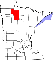 | |
| Townships |
| |
| CDPs | ||
| Unorganized territories | ||
| Unincorporated communities | ||
| Indian reservations | ||
| Footnotes | ‡This populated place also has portions in an adjacent county or counties | |
Coordinates: 47°43′59″N 94°32′55″W / 47.73306°N 94.54861°W