Bloomfield, New Mexico
| Bloomfield, New Mexico | |
|---|---|
| City | |
|
Bloomfield Public Library in 2008 | |
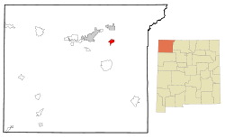 Location within County (left) and State (right) | |
 Bloomfield, New Mexico Location in the United States | |
| Coordinates: 36°42′39″N 107°58′58″W / 36.71083°N 107.98278°WCoordinates: 36°42′39″N 107°58′58″W / 36.71083°N 107.98278°W | |
| Country | United States |
| State | New Mexico |
| County | San Juan |
| Area | |
| • Total | 5.1 sq mi (13.1 km2) |
| • Land | 5.0 sq mi (13.0 km2) |
| • Water | 0.1 sq mi (0.1 km2) |
| Elevation | 5,456 ft (1,663 m) |
| Population (2010) | |
| • Total | 8,112 |
| • Density | 1,600/sq mi (620/km2) |
| Time zone | Mountain (MST) (UTC-7) |
| • Summer (DST) | MDT (UTC-6) |
| ZIP code | 87413 |
| Area code | 505 |
| FIPS code | 35-07880 |
| GNIS feature ID | 0902180 |
| Website | bloomfieldnm.com |

Bloomfield (Navajo: Naabiʼání) is a city in San Juan County, New Mexico, United States. It is part of the Farmington Metropolitan Statistical Area. The population was 8,112 at the 2010 census.
It is on the Trails of the Ancients Byway, one of the designated New Mexico Scenic Byways.[1]
History
In April 2007, Bloomfield attracted attention and some controversy when the city council voted unanimously to erect a stone monument of the Ten Commandments at the city hall.[2] In August 2014, a federal judge ruled the monument must be removed.[3]
Geography
Bloomfield is located at 36°42′39″N 107°58′58″W / 36.71083°N 107.98278°W (36.710722, -107.982668).[4]
According to the United States Census Bureau, the city has a total area of 5.1 square miles (13 km2), of which, 5.0 square miles (13 km2) of it is land and 0.1 square miles (0.26 km2) of it (0.99%) is water.
Demographics
| Historical population | |||
|---|---|---|---|
| Census | Pop. | %± | |
| 1960 | 1,292 | — | |
| 1970 | 1,574 | 21.8% | |
| 1980 | 4,881 | 210.1% | |
| 1990 | 5,214 | 6.8% | |
| 2000 | 6,417 | 23.1% | |
| 2010 | 8,112 | 26.4% | |
| Est. 2015 | 7,314 | [5] | −9.8% |
As of the census[7] of 2000, there were 6,417 people, 2,222 households, and 1,708 families residing in the city. The population density was 1,280.7 people per square mile (494.5/km²). There were 2,446 housing units at an average density of 488.2 per square mile (188.5/km²). The racial makeup of the city was 62.38% White, 0.33% African American, 16.71% Native American, 0.34% Asian, 0.06% Pacific Islander, 15.96% from other races, and 4.22% from two or more races. Hispanic or Latino of any race were 27.51% of the population.
There were 2,222 households out of which 42.6% had children under the age of 18 living with them, 55.9% were married couples living together, 15.5% had a female householder with no husband present, and 23.1% were non-families. 19.7% of all households were made up of individuals and 7.4% had someone living alone who was 65 years of age or older. The average household size was 2.85 and the average family size was 3.26.
In the city the population was spread out with 32.4% under the age of 18, 9.7% from 18 to 24, 27.0% from 25 to 44, 20.9% from 45 to 64, and 10.0% who were 65 years of age or older. The median age was 31 years. For every 100 females there were 91.4 males. For every 100 females age 18 and over, there were 89.5 males.
The median income for a household in the city was $32,905, and the median income for a family was $34,760. Males had a median income of $29,144 versus $19,203 for females. The per capita income for the city was $14,424. About 15.2% of families and 14.7% of the population were below the poverty line, including 18.5% of those under age 18 and 13.6% of those age 65 or over.
Education
The city of Bloomfield and rural areas in eastern/southeastern San Juan County are served by Bloomfield Schools.
Points of interest
The Salmon Ruins pueblo and museum are located just to the west of the city along Highway 64. The ruins are the remains of a 12th-century Anasazi village. The ruins, as well as the homestead of George Salmon are open to the public.
Other nearby attractions include the Aztec Ruins, about 15 miles to the north in the town of Aztec, and the Chaco Culture National Historical Park, approximately 50 miles to the south.
References
- ↑ Trail of the Ancients. Archived August 21, 2014, at the Wayback Machine. New Mexico Tourism Department. Retrieved August 14, 2014.
- ↑ Freedom of Religion - is Bloomfield crossing the line? Archived May 16, 2008, at the Wayback Machine., Aztec Local News, 2007-07-16, p. 3. Accessed 2007-11-06.
- ↑ Judge: Ten Commandments monument at New Mexico city hall must be removed; Fox News; August 8, 2014.
- ↑ "US Gazetteer files: 2010, 2000, and 1990". United States Census Bureau. 2011-02-12. Retrieved 2011-04-23.
- ↑ "Annual Estimates of the Resident Population for Incorporated Places: April 1, 2010 to July 1, 2015". Retrieved July 2, 2016.
- ↑ "Census of Population and Housing". Census.gov. Archived from the original on May 11, 2015. Retrieved June 4, 2015.
- ↑ "American FactFinder". United States Census Bureau. Archived from the original on 2013-09-11. Retrieved 2008-01-31.
External links
| Wikimedia Commons has media related to Bloomfield, New Mexico. |
Municipalities and communities of San Juan County, New Mexico, United States | ||
|---|---|---|
| Cities | 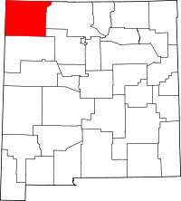 | |
| CDPs |
| |
| Other community | ||
| Indian reservation | ||
| Footnotes | ‡This populated place also has portions in an adjacent county or counties | |