Bodega Bay Nuclear Power Plant

The Bodega Bay Nuclear Power Plant was a proposed Northern California nuclear power facility that was stopped by local activism in the 1960s and never built. The foundations, located atop an active earthquake fault, were being dug at the time the plant was cancelled. The action has been termed "the birth of the anti-nuclear movement."
History
Pacific Gas & Electric planned to build the first commercially viable nuclear power plant in the USA at Bodega Bay, California, a fishing village fifty miles north of San Francisco. The proposal was controversial and conflict with local citizens began in 1958.[1]
The proposed plant site was right on the San Andreas fault and close to the region's environmentally sensitive fishing and dairy industries. Fishermen feared that the "plant's location and thermal discharge would interfere with their livelihood." Other citizens did not want their "simple isolated lifestyle" disturbed. Bodega Bay resident Rose Gaffney, who owned acreage on the Bodega Head that PG&E needed to buy, sued the utility company to keep her land and invited government officials to see the fault lines on the proposed nuclear site.[2] The Sierra Club became actively involved and opposed the choice of the site.[3] The Secretary of the Interior, Stewart Udall, said he was "gravely concerned" about the Bodega site.[4]
The Northern California Association to Preserve Bodega Head (NCAPBH) was formed and released press statements and submitted appeals to various state and federal bodies. In June 1963, NCAPBH organized a public meeting and 1,500 helium balloons were released into the air. They carried the message: "This balloon could represent a radioactive molecule of strontium 90 or iodine 131." These two substances had reached public prominence in the debate about fallout from nuclear weapons testing.[4][5]
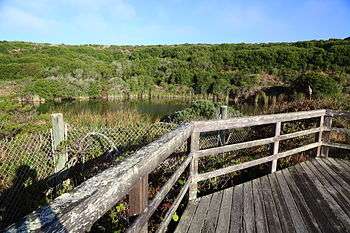
The conflict ended in 1964, when, following a negative review by the Atomic Energy Commission, Pacific Gas & Electric withdrew its application and canceled plans for the plant.[6] By this point, a pit had been dug for the foundation, near the tip of Bodega Head; since the abandonment of the site, the pit has partially filled with water and become a pond, informally called the "Hole in the Head."[7] Thomas Wellock traces the birth of the anti-nuclear movement to the controversy over Bodega Bay.[1]
An attempt by the Los Angeles Department of Water and Power to build a nuclear power plant in Corral Canyon near Malibu, similar to that at Bodega Bay, was abandoned in 1970.[1][4][6]
See also
- Anti-nuclear movement in California
- Critical Masses: Opposition to Nuclear Power in California, 1958-1978
- Energy use in California
- List of articles associated with nuclear issues in California
- Nuclear power in the United States
- Sundesert Nuclear Power Plant
- Stanislaus Nuclear Power Plant
- Allens Creek Nuclear Power Plant
- List of canceled nuclear plants in the United States
References
- 1 2 3 Paula Garb. Critical Masses: Opposition to Nuclear Power in California, 1958-1978 (book review) Journal of Political Ecology, Vol 6, 1999, Retrieved 14 December 2015
- ↑ Hillinger, Charles (January 23, 1972). "'Belle of Bodega Bay': Rose Gaffney Blocked a Nuclear Power Plant and at 77 She Is Full of Fight". Sacramento Bee.
- ↑ Wellock, Thomas Raymond (1998). "The Battle for Bodega Bay, 1958-1964". Critical Masses: Opposition to Nuclear Power in California, 1958-1978. Madison, WI: Univ of Wisconsin Press. p. 18. ISBN 9780299158545. Retrieved 22 September 2016.
- 1 2 3 Wolfgang Rudig (1990). Anti-nuclear Movements: A World Survey of Opposition to Nuclear Energy, Longman, pp. 110-111.
- ↑ Jim Falk (1982). Global Fission: The Battle Over Nuclear Power, Oxford University Press, p. 94.
- 1 2 Daly, James (3 February 2015). "Nuclear Fault Line – Bodega Head". Sonoma Magazine. Santa Rosa, CA. Retrieved 8 July 2016.
- ↑ Gobets, Sara (12 November 2014). "Revisiting the history of Bodega Bay's 'Hole in the Head'". Sonama West Herald and News. Retrieved 14 December 2015.
External links
Coordinates: 38°18′19″N 123°03′32″W / 38.30519°N 123.05881°W