Malibu, California
| Malibu, California | ||
|---|---|---|
| City | ||
| City of Malibu | ||
|
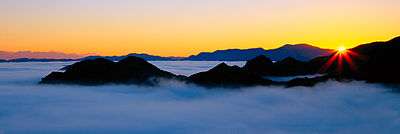
Aerial view of Downtown Malibu and surrounding neighborhoods | ||
| ||
| Nickname(s): The 'Bu[1][2][3] | ||
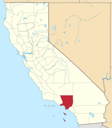
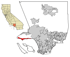 Location of Malibu in Los Angeles County, California | ||
 Malibu, California Location in the United States | ||
| Coordinates: 34°02′N 118°45′W / 34.03°N 118.75°WCoordinates: 34°02′N 118°45′W / 34.03°N 118.75°W | ||
| Country |
| |
| State |
| |
| County |
| |
| Incorporated (city) | March 28, 1991[4] | |
| Named for | Chumash: Humaliwo, The Surf Sounds Loudly[5] | |
| Government | ||
| • Mayor | Laura Zahn Rosenthal[6] | |
| Area[7] | ||
| • Total | 19.828 sq mi (51.354 km2) | |
| • Land | 19.785 sq mi (51.242 km2) | |
| • Water | 0.043 sq mi (0.113 km2) 0.22% | |
| Elevation[8] | 105 ft (32 m) | |
| Population (April 1, 2010)[9] | ||
| • Total | 12,645 | |
| • Estimate (2013)[9] | 12,861 | |
| • Density | 640/sq mi (250/km2) | |
| Time zone | Pacific (UTC-8) | |
| • Summer (DST) | PDT (UTC-7) | |
| ZIP Codes | 90263, 90264, 90265[10] | |
| Area code(s) | 310/424 | |
| FIPS code | 06-45246 | |
| GNIS feature IDs | 1668257, 2410913 | |
| Website |
www | |


.jpeg)
Malibu (/ˈmælᵻbuː/) is a beach city in Los Angeles County, California, situated 30 miles (48 km) west of Downtown Los Angeles. Known for its mediterranean climate, a 21-mile (34 km) strip of the Malibu coast incorporated in 1991 into the City of Malibu. The area is known for being the home of Hollywood movie stars, people in the entertainment industry, and other affluent residents. As of the 2010 census, the city population was 12,645. Signs around the city proclaim "27 miles of scenic beauty", referring to the historical 27-mile (43 km) Malibu coast spanning from Tuna Canyon west to Point Mugu in Ventura County.
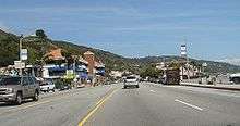
Most Malibu residents live within a few hundred yards of Pacific Coast Highway (State Route 1), which traverses the city, with some residents living up to a mile away from the beach up narrow canyons. For many residents of the unincorporated canyon areas, Malibu has the closest commercial centers and have mail delivered using the Malibu zip codes. The city is also bounded by Topanga to the east, the Santa Monica Mountains (Agoura Hills, Calabasas, and Woodland Hills) to the north, the Pacific Ocean to the south, and Ventura County to the west.
Nicknamed "the 'Bu" by surfers and locals,[1][2][3] Malibu's beaches include Surfrider Beach, Zuma Beach, Malibu Beach, Topanga Beach, Point Dume Beach, County Line, and Dan Blocker Beach; its local parks include Malibu Bluffs Park[11] (formerly Malibu Bluffs State Park), Trancas Canyon Park, Las Flores Creek Park, and Legacy Park,[12] with neighboring parks Malibu Creek State Park, Leo Carrillo State Beach and Park,[13] Point Mugu State Park,[14] and the Santa Monica Mountains National Recreation Area, and neighboring state beach Robert H. Meyer Memorial State Beach,[15] which was once part of Old Malibu (before it became a city), and beaches: El Pescador, La Piedra and El Matador.
History
Malibu was originally settled by the Chumash, Native Americans whose territory extended loosely from the San Joaquin Valley to San Luis Obispo to Malibu, as well as several islands off the southern coast of California. They named it "Humaliwo"[16] or "the surf sounds loudly". The city's name derives from this, as the "Hu" syllable is not stressed.
Explorer Juan Rodríguez Cabrillo is believed to have moored at Malibu Lagoon, at the mouth of Malibu Creek, to obtain fresh water in 1542. The Spanish presence returned with the California mission system, and the area was part of Rancho Topanga Malibu Sequit—a 13,000-acre (53 km2) land grant—in 1802. That ranch passed intact to Frederick Hastings Rindge in 1891. He and his widow, May K. Rindge, guarded their privacy zealously by hiring guards to evict all trespassers and fighting a lengthy court battle to prevent the building of a Southern Pacific railroad line through the ranch. Interstate Commerce Commission regulations would not support a railroad condemning property in order to build tracks that paralleled an existing line, so Frederick H. Rindge decided to build his own railroad through his property first. He died, and May K. Rindge followed through with the plans, building a line starting just inside the ranch's property eastern boundary at Las Flores Canyon, and running 15 miles westward, past Pt. Dume.[17][18][19][20]
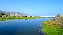
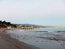
Few roads even entered the area before 1929, when the state won another court case and built what is now known as the Pacific Coast Highway. By then May Rindge was forced to subdivide her property and begin selling and leasing lots. The Rindge house, known as the Adamson House[21] (a National Register of Historic Places site and California Historical Landmark), is now part of Malibu Creek State Park and is situated between Malibu Lagoon State Beach[22] and Surfrider Beach, beside the Malibu Pier[23] that was used to provide transportation to/from the ranch, including construction materials for the Rindge railroad, and to tie up the family's yacht.[20][24]
In 1926, in an effort to avoid selling land to stave off insolvency, May K. Rindge created a small ceramic tile factory. At its height, Malibu Potteries employed over 100 workers, and produced decorative tiles which furnish many Los Angeles-area public buildings and Beverly Hills residences. The factory, located one-half mile east of the pier, was ravaged by a fire in 1931.[25] Although the factory partially reopened in 1932, it could not recover from the effects of the Great Depression and a steep downturn in Southern California construction projects. A distinct hybrid of Moorish and Arts and crafts designs, Malibu tile is considered highly collectible. Fine examples of the tiles may be seen at the Adamson House and Serra Retreat, a fifty-room mansion that was started in the 1920s as the main Rindge home on a hill overlooking the lagoon. The unfinished building was sold to the Franciscan Order in 1942[26] and is operated as a retreat facility,[27] Serra Retreat. It burned in the 1970 fire and was rebuilt using many of the original tiles.
Most of the Big Rock Drive area was purchased in 1936 by William Randolph Hearst, who considered building an estate on the property. He sold the lower half of his holdings there in 1944 to Art Jones. Jones was one of the prominent early realtors in Malibu, starting with the initial leases of Rindge land in Malibu Colony. He was also the owner/part-owner of the Malibu Inn, Malibu Trading Post and the Big Rock Beach Cafe (which is now Moonshadows restaurant). Philiip McAnany owned 80 acres in the upper Big Rock area, which he had purchased in 1919, and had two cabins there, one of which burned in a brush fire that swept through the area in 1959, and the other in the 1993 Malibu fire. McAnany Way is named after him.[28][29][30][31]
Malibu Colony
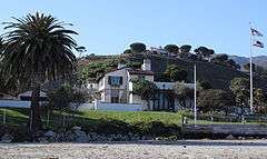
Malibu Colony was one of the first areas with private homes after Malibu was opened to development in 1926. As one of Malibu's most famous districts,[32] it is located south of Malibu Road and the Pacific Coast Highway, west of Malibu Lagoon State Beach, and east of Malibu Bluffs Park (formerly a state park). May Rindge had protected the Malibu coast with only a few wealthy Hollywood stars having vacation homes there. Rindge opened up this small area for development in 1926. The long legal battle to protect her beloved Malibu coast had been costly and she eventually died penniless.[33] Long known as a popular private enclave for wealthy celebrities,[34] the Malibu Colony today is a gated community, with multimillion-dollar homes on small lots. The Colony commands breathtaking views of the Pacific Ocean, affording a spectacular coastline view stretching from Santa Monica to Rancho Palos Verdes to the south (known locally as the Queen's Necklace[35]) and the bluffs of Point Dume to the north.
High technology in Malibu
The first working model of a laser was demonstrated by Dr. Theodore Maiman in 1960 in Malibu at the then Hughes Research Laboratory[36] (now known as HRL Laboratories LLC). In the 1990s HRL Laboratories developed the FastScat computer code,[37] for frequency domain algorithms and implementation, recognized as perhaps the most accurate code in the world for radar cross-section calculations. TRW built a laboratory in Solstice Canyon without any structural steel to test magnetic detectors for satellites and medical devices.[38]
Incorporation
In 1991 most of the old Malibu land grant was incorporated as a city to allow local control of the area (as cities under California law, they are not subject to the same level of county government oversight). Prior to achieving municipal status, the local residents had fought several county-proposed developments, including an offshore freeway,[39] a nuclear power plant,[40] and several plans to replace septic tanks with sewer lines to protect the ocean from seepage that pollutes the marine environment. The incorporation drive gained impetus in 1986, when the Los Angeles County Board of Supervisors approved plans for a regional sewer that would have been large enough to serve 400,000 people in the western Santa Monica Mountains. Residents were incensed that they would be assessed taxes and fees to pay for the oversized sewer project, and feared that the already-capacity Pacific Coast Highway would need to be widened into a freeway to accommodate growth that they did not want. The supervisors fought the incorporation drive and prevented the residents from voting, a decision that was overturned in the courts.
The city councils that were elected in the 1990s were unable to write a Local Coastal Plan (LCP) that preserved enough public access to satisfy the California Coastal Commission, as required by the California Coastal Act. The state Legislature eventually passed a Malibu-specific law that allowed the Coastal Commission to write an LCP for Malibu, thus neutering the city's ability to control many aspects of land use. Because of the failure to adequately address sewage disposal problems in the heart of the city, the local water board ordered Malibu in November 2009 to build a sewage plant for the Civic Center area. The city council has objected to that solution.[41]
Geography
Malibu is located at 34°1′50″N 118°46′43″W / 34.03056°N 118.77861°W (34.030450, −118.778612).[42] Its City Hall building is located at 23825 Stuart Ranch Road (34°02′21″N 118°41′35″W / 34.03917°N 118.69306°W). The eastern end of the city borders the Topanga CDP, which separates it from the city of Los Angeles.
According to the United States Census Bureau, the city has a total area of 19.8 square miles (51 km2), over 99% of it land.
Malibu's dry brush and steep clay slopes make it prone to fires, floods, and mudslides. Poor grading practices and over-irrigation or leaking pipes exacerbate the tendency for landslides.
Carbon Beach, Surfrider Beach, Westward Beach, Escondido Beach, Paradise Cove, Point Dume, Pirates Cove, Zuma Beach, Trancas and Encinal Bluffs are places along the coast in Malibu. Point Dume forms the northern end of the Santa Monica Bay, and Point Dume Headlands Park affords a vista stretching to the Palos Verdes Peninsula and Santa Catalina Island. Directly below the park, on the western side of the point, is Pirates Cove, named for rum-runners during Prohibition who liked the secluded beach for offloading their cargo. Because of its relative seclusion, Pirate's Cove was previously used as a nude beach, but since nudity is now illegal on all beaches in Los Angeles County, nude sunbathers are subject to fines and/or arrest. On the eastern side of the point is "Little Dume", a surf spot which is accessible only by an unmarked trail below Wildlife Drive which has a locked gate. Surfers often paddle out from Paradise Cove to the area when the waves are breaking.
Like all California beaches, Malibu beaches are technically public land below the mean high tide line. Many large public beaches (Zuma Beach, Surfrider Beach) are easily accessible, but such access is sometimes limited for some of the smaller and more remote beaches. Some Malibu beaches are private, such as Paradise Cove, which charges an entrance fee to keep the crowds at bay.[43] Although access to most all Malibu beaches can be obtained after a bit of a walk, the issue of expanded public access is continuously addressed and debated by the city. Many Malibu homeowners favor limited public access expansions to some beaches, claiming that many visitors are less likely than residents to respect the beaches or private property.
Climate
This region experiences warm (but not hot) and dry summers, with no average monthly temperatures above 71.6 °F (22°C). According to the Köppen Climate Classification system, Malibu has a warm-summer Mediterranean climate, abbreviated "Csb" on climate maps.[44]
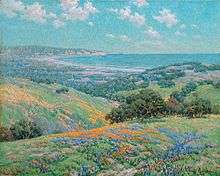
Panorama

Natural disasters

Malibu lies on the fringe of an extensive chaparral wilderness area, the Santa Monica Mountains National Recreation Area.[45] Various environmental elements collectively create a recipe for natural disasters: the mountainous and geologically unstable terrain; seasonal rainstorms that result in dense vegetation growth; seasonal dry Santa Ana winds; and a naturally dry topography and climate.
Wildfires
Malibu has seen dozens of wildfires:[46]
- October 26, 1929 – Malibu Colony, 13 homes burned.[47]
- 1930 – "Potrero," Decker Canyon Road Corridor, 15,000 acres (61 km2), accidental blaze caused by walnut pickers in Thousand Oaks area.[47]
- October 23, 1935 – "Malibu" or "Latigo/Sherwood," Kanan/Decker Corridor, 30,000 acres (120 km2).[47]
- November 23, 1938 – "Topanga," Topanga Canyon, 14,500 acres (59 km2).[47]
- October 20, 1943 – "Las Flores," Malibu Canyon, 5,800 acres (23 km2).[47]
- November 6, 1943 – "Woodland Hills (Las Virgenes)," Kanan/Decker Corridor, 15,000 acres (61 km2).[47]
- December 26, 1956 – "Newton," Kanan/Decker Corridor, 26,000 acres (110 km2), 100 homes, one death, Frank Dickover.[47]
- December 2, 1958 – "Liberty," Malibu Canyon, 18,000 acres (73 km2), eight firefighters injured, 74 homes destroyed (17 in Corral Canyon).[47]
- November 6, 1961 – "Topanga," Topanga Canyon, 8,000 acres (32 km2).[47]
- September 25, 1970 – "Wright," Malibu Canyon, 28,000 acres (110 km2), 10 deaths, 403 homes destroyed.[48]
- October 30, 1973 – "Topanga," Topanga Canyon, 2,800 acres (11 km2).[47]
- October 23, 1978 – "Kanan," Kanan/Decker Corridor, 25,000 acres (100 km2), 2 deaths, 230 homes.[48]
- October 9, 1982 – "Dayton," Malibu Canyon Corridor, 44,000 acres (180 km2), 15 homes in Paradise Cove destroyed.[49]
- October 14, 1985 – "Piuma," Las Flores area, Topanga Canyon, 4,700 acres (19 km2).[47]
- October 14, 1985 – "Decker," Kanan/Decker Corridor, 6,600 acres (27 km2). Both arson-caused; six homes destroyed; $1 million damage.[47]
Malibu incorporated as a city.
- November 2, 1993 – "Old Topanga / North Malibu." In 1993, from November 2 to 11, Malibu experienced one of the largest fires in its history, which burned more than 16,516 acres (67 km2).[50] The 1993 fire storm was composed of two separate fires, one ravaging most of central Malibu/Old Topanga, and another, larger fire affecting areas north of Encinal Canyon. Three lives were lost and 739 homes destroyed in the central Malibu/Old Topanga blaze. 18,949 acres (77 km2) were torched in the north Malibu fire, with zero lives taken and few homes lost in the less densely populated region. Los Angeles County Fire Department officials announced suspicions that the fire was started by arson.[51] The fire and widespread damage to properties and infrastructure resulted in the City of Malibu adopting the strictest fire codes in the country.[52]
- October 21, 1996 – "Calabasas," Malibu Canyon Corridor, Brush fire ignited by arcing power line, 13,000 acres (53 km2).
- January 6, 2003 – "Trancas", Trancas Canyon, 759 acres (3.07 km2).[53]
- January 8, 2007 – On January 8, 2007 at approximately 5:00 pm a fire started in the vicinity of Bluffs Park, south of Pacific Coast Highway in Malibu. The fire hit near the Colony area, burning down four houses on Malibu Road, including the oceanfront home of Step By Step star Suzanne Somers. Los Angeles County Fire Department officials announced that a discarded cigarette stub started the blaze.
- October 21, 2007 – On October 21, 2007 at approximately 5:00 am a fire started off of Malibu Canyon Road. As of 1:00 pm there were 500+ personnel on scene. 1,200 acres (4.9 km2) burned with no containment. 200+ homes have been evacuated. Five homes confirmed to have been destroyed, with at least nine others damaged. Two commercial structures were completely destroyed. Castle Kashan and the Malibu Presbyterian Church have both been destroyed. Los Angeles County Fire Department officials announced that the fire is still under investigation.
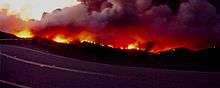
- November 24, 2007 – "Corral." On November 24, 2007, the Corral Fire destroyed 53 homes, damaged 35, and burned over 4,720 acres (19.1 km2), forcing as many as 14,000 people to evacuate. Damages from the fire were expected to reach more than $100 million. The blaze originated at the top of Corral Canyon, where a group of young people who were in closed parkland after dusk had started a bonfire despite the presence of high Santa Ana winds. The individuals responsible for starting the fire were later identified, and are the subject of ongoing civil and criminal litigation.[54][55]
Mudslides
One of the most problematic side-effects of the fires that periodically rage through Malibu is the destruction of vegetation, which normally provides some degree of topographical stability to the loosely packed shale and sandstone hills during periods of heavy precipitation. Rainstorms following large wildfires can thus cause a phenomenon known as mudslides, in which water-saturated earth and rock moves quickly down mountainsides, or entire slices of mountainside abruptly detach and fall downward.
After the 1993 wildfire stripped the surrounding mountains of their earth-hugging chaparral, torrential rainstorms in early 1994 caused a massive mudslide near Las Flores Canyon that closed down the main coastal transport artery, Pacific Coast Highway, for months. Thousands of tons of mud, rocks, and water rained down on the Pacific Coast Highway like a sluicebox. The destruction to property and infrastructure was exacerbated by the narrow constriction of the road at that point, with beachside houses abutting the highway with little or no frontage land acting as a buffer to the mudslide.[56] Another large mudslide occurred on Malibu Canyon Road, between the Pepperdine University campus and HRL Laboratories LLC, closing down Malibu Canyon for two months.[57] Yet another behemoth slide occurred on another main canyon road, Kanan-Dume Road about one mile (1.6 km) up the canyon from the Pacific Coast Highway. This last road closure lasted over a period of many months, with Kanan finally fixed by the California Department of Transportation (Cal-Trans)[58] over a year after the road collapse.
Mudslides can and do occur at any time in Malibu, whether a recent fire or rainstorm has occurred or not. Pacific Coast Highway, Kanan-Dume Road, and Malibu Canyon road (as well as many other local roads) have all been prone to many subsequent mudslide-related closures. During any period of prolonged or intense rain, Caltrans snowplows will patrol most canyon roads in the area, clearing mud, rocks, and other fallen debris from the roadways. Such efforts keep most roads passable, but it is nevertheless typical for one or more of the major roads leading into and out of Malibu to be temporarily closed during the rainy season.
Storms
Malibu is periodically subjected to intense coastal storms, even though its Mediterranean climate is an indication that such occurrences are relatively infrequent.
Friday, January 25, 2008, during a storm which was unusually large for the Southern California area, a tornado came ashore and struck a naval base's hangar, ripping off the roof. It was the first tornado to strike Malibu's shoreline in recorded history.[59]
Earthquakes
Malibu is somewhat near to the San Andreas Fault, a fault over 800 miles (1,300 km) in length that can produce an earthquake over magnitude 8. Several faults are in the region, making the area prone to earthquakes.
The Northridge earthquake and the 1971 Sylmar earthquake (magnitudes 6.7 and 6.6) shook the area. Smaller earthquakes happen more often.
Demographics
| Historical population | |||
|---|---|---|---|
| Census | Pop. | %± | |
| 2000 | 12,575 | — | |
| 2010 | 12,645 | 0.6% | |
| Est. 2015 | 12,965 | [60] | 2.5% |
Ethnic composition
- These were the ten cities or neighborhoods in Los Angeles County with the largest percentage of white residents, according to the 2000 United States Census:[62]
- Malibu, California, 88.8%
- Hidden Hills, California, 88.7%
- Pacific Palisades, Los Angeles, 88.6%
- Topanga, California, 87.6%
- Beverly Crest, Los Angeles, 87.5%
- Westlake Village, California, 85.5%
- Manhattan Beach, California, 85.5%
- Hollywood Hills West, Los Angeles, 84.9%
- Hermosa Beach, California, 84.9%
- Fairfax, Los Angeles, 84.7%
2010
The 2010 United States Census reported that Malibu had a population of 12,645.[63] The population density was 637.7 people per square mile (246.2/km²). The racial makeup of Malibu was 11,565 (91.5%) White (87.4% Non-Hispanic White),[64] 148 (1.2%) African American, 20 (0.2%) Native American, 328 (2.6%) Asian, 15 (0.1%) Pacific Islander, 182 (1.4%) from other races, and 387 (3.1%) from two or more races. Hispanic or Latino of any race were 769 persons (6.1%).
The Census reported that 12,504 people (98.9% of the population) lived in households, 126 (1.0%) lived in non-institutionalized group quarters, and 15 (0.1%) were institutionalized.
There were 5,267 households, out of which 1,379 (26.2%) had children under the age of 18 living in them, 2,571 (48.8%) were opposite-sex married couples living together, 403 (7.7%) had a female householder with no husband present, 222 (4.2%) had a male householder with no wife present. There were 269 (5.1%) unmarried opposite-sex partnerships, and 49 (0.9%) same-sex married couples or partnerships. 1,498 households (28.4%) were made up of individuals and 501 (9.5%) had someone living alone who was 65 years of age or older. The average household size was 2.37. There were 3,196 families (60.7% of all households); the average family size was 2.87.
The population was spread out with 2,366 people (18.7%) under the age of 18, 1,060 people (8.4%) aged 18 to 24, 2,291 people (18.1%) aged 25 to 44, 4,606 people (36.4%) aged 45 to 64, and 2,322 people (18.4%) who were 65 years of age or older. The median age was 47.8 years. For every 100 females there were 100.6 males. For every 100 females age 18 and over, there were 97.0 males.
There were 6,864 housing units at an average density of 346.2 per square mile (133.7/km²), of which 3,716 (70.6%) were owner-occupied, and 1,551 (29.4%) were occupied by renters. The homeowner vacancy rate was 2.8%; the rental vacancy rate was 11.9%. 9,141 people (72.3% of the population) lived in owner-occupied housing units and 3,363 people (26.6%) lived in rental housing units.
According to the 2010 United States Census, Malibu had a median household income of $133,869, with 10.6% of the population living below the federal poverty line.[64]
2000
As of the census[65] of 2000, there were 12,575 people, 5,137 households, and 3,164 families residing in the city. The population density was 632.9 inhabitants per square mile (244.4/km²). There were 6,126 housing units at an average density of 308.3 per square mile (119.0/km²). The racial makeup of the city was 91.91% White, 8.49% Asian, 0.90% African American, 0.21% Native American, 0.10% Pacific Islander, 1.67% from other races, and 2.72% from two or more races. Hispanic or Latino of any race were 1.48% of the population.
There were 5,137 households out of which 25.3% had children under the age of 18 living with them, 51.5% were married couples living together, 6.7% had a female householder with no husband present, and 38.4% were non-families. 27.3% of all households were made up of individuals and 6.7% had someone living alone who was 65 years of age or older. The average household size was 2.39 and the average family size was 2.86.
In the city the population was spread out with 19.6% under the age of 18, 7.9% from 18 to 24, 26.4% from 25 to 44, 32.0% from 45 to 64, and 14.0% who were 65 years of age or older. The median age was 43 years. For every 100 females there were 97.8 males. For every 100 females age 18 and over, there were 95.6 males.
The median income for a household in the city was $102,031, and the median income for a family was $123,293. Males had a median income of $100,000 versus $46,919 for females. The per capita income for the city was $74,336. About 3.2% of families and 7.6% of the population were below the poverty line, including 6.8% of those under age 18 and 1.1% of those age 65 or over.
Economy

Carbon Beach has been described as "the world's most expensive sandbox" with an estimated real estate cost of greater than US$200,000 per foot of beachfront.[67]
Government
Municipal government
Malibu is a general law city governed with a five-member City Council including the mayor and mayor pro tem. The City Council hires a city manager to carry out policies and serve as executive officer. Every even-numbered year either two or three members are elected by the people to serve a four-year term. Usually, the City Council meets in April and chooses one of its members as mayor and one as mayor-pro-tem. In 2006, this pattern was deviated from when the council decided to have a cycle of three mayors and mayors pro-tem in the coming two years.
County, state, and federal representation
In the state legislature, Malibu is in the 27th Senate District, represented by Democrat Henry Stern, and in the 50th Assembly District, represented by Democrat Richard Bloom.[68]
In the United States House of Representatives, Malibu is in California's 33rd congressional district, which has a Cook PVI of D+11[69] and is represented by Democrat Ted Lieu.[70]
Politics
Malibu residents tend to be politically left of center, like much of Los Angeles County. 60% of Malibu voters chose presidential candidate John Kerry in the 2004 election, compared to 39% for incumbent President George W. Bush.
Infrastructure
Fire protection is served by the Los Angeles County Fire Department.
The Los Angeles County Sheriff's Department (LASD) operates the Malibu/Lost Hills Station in Calabasas, serving Malibu under contract with the City.[71][72]
The Los Angeles County Department of Health Services SPA 5 West Area Health Office serves Malibu.[73] The department operates the Simms/Mann Health and Wellness Center in Santa Monica, serving Malibu.[74]
The United States Postal Service operates the Malibu Post Office at 23838 Pacific Coast Highway,[75] the Colony Annex at 23648 Pacific Coast Highway, adjacent to the Malibu Post Office,[76] and the La Costa Malibu Post Office at 21229 Pacific Coast Highway.[77]
Education
Schools
The Santa Monica-Malibu Unified School District serves Malibu with three elementary schools: John L. Webster Elementary School (grades K-5, located in central Malibu), Juan Cabrillo Elementary School (grades K-5, located in northwestern Malibu's Malibu Park district), and Point Dume Elementary School (grades K-5, located in northwestern Malibu's Pt. Dume district).
Private schools include: Calmont,[78] Our Lady Of Malibu (Catholic),[79] Colin McEwen High School, New Roads,[80] and St. Aidan's School.
Malibu High School (MHS) provides secondary public education for both middle school (grades 6–8) and high school (grades 9–12). MHS is located in the northwestern region of Malibu.
Pepperdine University, a private college affiliated with the Church of Christ, which is located in central Malibu, north of the Malibu Colony at the intersection of the Pacific Coast Highway and Malibu Canyon Road. Malibu is also served by Santa Monica College, a community college in the nearby city of Santa Monica to the south.
Library
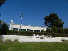
Malibu Public Library, a 16,530 square feet (1,536 m2) branch of the County of Los Angeles Public Library, is in the Malibu Civic Center Complex. The branch has an adult reading area, a children's reading area, a 125-person meeting room, and free parking. The library opened in 1970. Prior to 1970 residents were served by a bookmobile.[81]
"On April 22, 2012, a grand opening celebration was held to mark the completion of a $6 million renovation of the Malibu Library, designed by the architectural firm of LPA, Inc. and funded by revenue generated from local property taxes." Retrieved at http://www.colapublib.org/libs/malibu/index.php on 10/16/2013.
Arts and culture
Getty Villa, an art museum that is part of the J. Paul Getty Museum, is located just outside the city limits in the adjacent Pacific Palisades neighborhood of Los Angeles.[82] It is owned and operated by the J. Paul Getty Trust, which also oversees the Getty Center in West Los Angeles.[83] The Museum at the Getty Villa houses Getty's collections of antiquities, sculptures, art pieces and cultural artifacts of ancient Greece, Rome, and Etruria.
The Malibu Art Association, a non-profit organization to foster the arts in Malibu produces shows, demonstrations and workshops for its members, and offers art for public display throughout the community.[84]
The Malibu Garden Club holds an annual garden tour of private, residential gardens.[85]
Malibu High School offers musicals every spring and instrumental and vocal musical concerts every winter and spring.[86]
Smothers Theatre of Pepperdine University's Theatrical Drama Department offers concerts, plays, musicals, opera, and dance.[87]
Beaches, parks, and other attractions
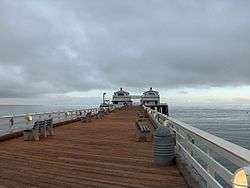
The long waves of Surfrider Beach, adjacent to the Adamson House and Malibu Lagoon, draw a steady beach and surfer crowd.
California State Parkland carpets the hills behind Malibu, and provides extensive horseback-riding, hiking, running, and mountain-biking options, affording many different views of the Santa Monica Mountains, the curve of the Santa Monica Bay, Santa Catalina Island, and the San Fernando Valley. There are many points of access to the Backbone Trail System scattered throughout the local canyons, as well as a variety of smaller, local trail-heads.
Pacific Coast Highway is popular with road cycling enthusiasts for its vistas. The route also has a reputation for being quite dangerous for cyclists, a fact which inspired the creation of the Dolphin Run, an annual community event commemorating local victims of reckless driving. The Dolphin Run was held each Autumn from 1990 to 2004.
Adamson House, the unused homesite of the 19th century original owners of Malibu, the Rindge Family, draws some visitors.
In late June 2008, the Malibu Pier reopened after $10 million in renovations.[88]
There are several shopping centers in the Malibu Civic Center area including the Malibu Country Mart, the Point Dume Plaza, and the newly opened Malibu Lumberyard, so named for the community Lumberyard that used to occupy that space. The Malibu Civic Center is well known for being frequented by paparazzi and tourists looking to catch a glimpse of local celebrities.
Malibu Bluffs Community Park and Malibu Bluffs Recreation Area
The former Malibu Bluffs State Park ownership changed hands in 2006 after the California Department of Parks and Recreation transferred the park's 93 acres (380,000 m2) control to the Santa Monica Mountains Conservancy,[89] They established the Malibu Bluffs Recreation Area, an Open Space Preserve of 90 acres (360,000 m2) on the bluffs between the Pacific Coast Highway and Malibu Road, directly opposite Pepperdine University and Malibu Canyon Road. The 100-foot (30 m) bluffs rise above Amarillo Beach and Puerco Beach across Malibu Road. Five public stairways (which adjoin private property) lead down to the shoreline from the base of the bluffs. The trails begin from the spacious lawns in Malibu Bluffs Community Park
The Malibu Bluffs Recreation Area surrounds the 6-acre (24,000 m2) Malibu Bluffs Community Park, whose 10-acre (40,000 m2) parcel the Santa Monica Mountains Conservancy sold to the city.[90] It consists of the Michael Landon Community Center, baseball diamonds, and soccer fields. Home of the Malibu Little League[91] (MLL), once the largest youth team sports organization in Malibu. (That honor was wrested in the 1990s by Malibu AYSO,[92] a youth soccer organization that shares park space (practice fields).) For over 20 years, the State Parks had tried to kick out Malibu Little League's baseball diamonds and tall baseball fences, with the intention of returning the land to its native wetlands and vegetation.[93] A rider to a California state law was written specifically in the 1950s to allow baseball, with its attendant field accoutrements, to continue being played in the state park.[94] Several generations of Malibuites worked to keep Malibu Bluffs Park for baseball and soccer.
Malibu Legacy Park Project
Adjacent to the Malibu Country Mart was a vacant, 20-acre (81,000 m2) plot of land owned by billionaire Jerry Perenchio and sold to the City of Malibu in 2005 with strict deed restrictions prohibiting any further commercial use.[95][96]
This site is now home to Malibu Legacy Park, an ongoing restoration project undertaken by the City, with broad community support. The City hopes that a state-of-the-art water treatment plant already built will use stormwater runoff that accumulates in the park, making it into an environmental cleaning machine that will end the City's stormwater pollution contribution to Malibu Creek, Malibu Lagoon, and the world-famous Surfrider Beach.[97] The Malibu Legacy Park Project responds to critical issues: (1) bacteria reduction by stormwater treatment, (2) nutrient reduction in wastewater management, (3) restoration and development of riparian habitats, and (4) the development of an open space area for passive recreation and environmental education. In addition, the Project will be linked by a “linear park” to neighboring Surfrider Beach, Malibu Pier, Malibu Lagoon, and Malibu Bluffs Park.[98]
The park is located east of Webb Way, and between Civic Center Way on the north and PCH to the south. It was the site of the annual Labor Day Weekend Kiwanis Club Chili Cook-Off from 1982–2009 (in 2010, the Chili Cook-Off and Carnival went on as usual, but moved to still-open land across Civic Center Way, on the Ioki property, at the corner of Civic Center Way and Stuart Ranch Road).[99] Further back, it was agricultural land, planted in geraniums, other flowers and vegetables by the Takahashi family since 1924.[100]
As of now, "Legacy Park" stands in the lot adjacent to the Malibu Public Library. Some dissidents of the park development feel the project was a waste of money because the park does not contain grass areas, only many walkways and plants. What they may not be aware of are the strict "passive use" restrictions also included in the land purchase agreement. Not only are all ball sports prohibited, but running/jogging and other sports are banned within the park as well.[100][101] The park does include many educational features, an outdoor classroom, and other informative features which explain the different habitats included in the park's final design.[102]
World Surfing Reserve
On October 9, 2010 Malibu Surfrider Beach was dedicated as the first World Surfing Reserve.[103]
Businesses and organizations

The Malibu Chamber of Commerce was formed in 1949 to provide support to local Malibu business, and now has over 500 members.[104]
HRL Laboratories, the research arm of the former Hughes Aircraft Company, was established in 1960 in Malibu. Among its research accomplishments was the first working laser. Despite aerospace industry downsizing in the 1990s, HRL is the largest employer in Malibu.
Jakks Pacific is based in Malibu.
Established in 1937 in south-central Los Angeles, Pepperdine University moved to its Malibu campus in 1972. However, when Malibu incorporated as a city the boundaries were drawn to exclude Pepperdine, at the college's insistence.[105]
The Surfrider Foundation was formed in 1984 by a group of surfers gathered to protect 31 miles (50 km) of coastal waters from Marina Del Rey through Malibu to Ventura County, and represent the surfing community.[106]
Heal the Bay, a non-profit organization for environmental advocacy, was formed in 1985 to protect Santa Monica Bay, which extends from Malibu's Point Dume along the entire coastline of Malibu past Santa Monica to the Palos Verdes Peninsula.
Following the opening of Passages Malibu in 2001, the city has become home to numerous residential drug-abuse treatment centers. As of 2013, there are 35 state-licensed drug and alcohol rehabilitation facilities in Malibu, in addition to a multiplying number of unlicensed sober-living homes.[107]
Events
The Malibu Arts Festival is held annually on the last weekend in July by the Malibu Chamber of Commerce.[108]
The Malibu International Film Festival is held every year showcasing new films and filmmakers from around the world.[109]
The Malibu Chili Cookoff, held every Labor Day weekend, is sponsored by the Kiwanis Club of Malibu. Proceeds benefit children and youth organizations.[110]
The Malibu Nautica Triathlon is held every September. In 2007, it raised $718,000 to benefit Children's Hospital Los Angeles.[111]
The Polar Plunge (Los Angeles) is held each year in February at Zuma Beach to help raise funds for the Special Olympics in Southern California.[112]
National Get Organized Month is provided by Bee Organized.[113]
Malibu International Marathon is a half and full marathon race held every November. These races started in 2009. A SUPathlon a sport created by Forever Runners (7 miles run and a 6 miles Stand Up Paddle boarding) was added in 2011. A kids' fun run was added in 2013.
Filming location

Malibu has been used as a location or setting for many films, television programs and music videos.
Surfrider Beach was home to Gidget, and surfing movies of the 1960s. Jill Munroe and her sister Kris Munroe's Charlie's Angels beach house was located in Malibu. The residence can also be seen in the first scene after the opening theme song of Beach Blanket Bingo. Important scenes in the Planet of the Apes series were filmed at Point Dume. The hero's trailer in The Rockford Files was parked by the Paradise Cove Pier. Love American Style and The Mod Squad are among many TV series and commercials filmed in Paradise Cove. A 1978 film starring Suzanne Somers was entitled Zuma Beach.[114] In the 1990s and 2000s (decade), it was the setting for MTV Beach House, Malibu's Most Wanted, and Nickelodeon's Zoey 101. In the Coen Brothers 1998 motion picture The Big Lebowski, the fictional chief of police describes it thus: "We've got a nice, quiet beach community here, and I aim to keep it nice and quiet". In the 2008 movie Iron Man and its sequels, 2010's Iron Man 2 and 2013's Iron Man 3, Tony Stark's primary residence is located in Malibu, on Point Dume. In George Cukor's 1981 film Rich and Famous, Candice Bergen's character, Merry Noel Blake, resides in Malibu, during a portion of the film.
Malibu is the setting for the television series Two and a Half Men. The television series So Little Time (2001) portrayed two Malibu teens (Mary-Kate and Ashley Olsen) who attend the fictional school West Malibu High. Fictional teen star Hannah Montana / Miley Stewart (portrayed by Miley Cyrus) and her father Robbie Ray Stewart (portrayed by Billy Ray Cyrus) live in Malibu on the Disney Channel Original Series, Hannah Montana. In the Fox TV series The O.C., both the Cohen house and the Cooper homes were actually located in Malibu.[115] Malibu Shores, a teen drama that aired on NBC, was set in Malibu. Some scenes from The Even Stevens Movie were filmed on Westward Beach in Point Dume. The small hit TV show Summerland was also filmed and set in Malibu.
In 2006, Bravo television aired Million Dollar Listing, a real-estate related show based on million dollar listings in Malibu, as well as Hollywood, including real-life Malibu agents such as Chris Cortazzo, Scotty Brown, Madison Hildebrand, and Lydia Simon.[116]
The MTV reality show Buzzin' starring Shwayze and Cisco Adler is mostly filmed in Malibu, at locations including Westward Beach, Malibu Courthouse, Pacific Coast Highway, Point Dume Trailer Park, Malibu Inn, and the outside of PC Greens.
Malibu was the setting of the 52nd installment in the Goosebumps series of books: How I Learned to Fly, it was also the setting of Alex Duval's Vampire Beach series.
There are also many music videos filmed on Malibu's beaches. In 1998, the alternative rock band Hole shot the video for the song "Malibu". Mariah Carey's video for her 2009 single H.A.T.E.U. was filmed there. Selena Gomez's "Love You Like a Love Song" video was partly filmed in Malibu. Music videos for "Survivor" by Destiny's Child, "If It's Lovin' That You Want" by Rihanna, "Sunshine" by Lil Flip, "Natural" by S Club 7, "Feel It Boy" by Beenie Man featuring Janet Jackson, and many others were filmed on Westward Beach such as Shania Twain's "You're Still the One". Linda Ronstadt who lived in the Colony is photographed in front of her home for her 1976 Grammy award winning album Hasten Down the Wind. Girls Aloud filmed their video "Call the Shots" on the beach at Malibu. In spring 1999, Britney Spears shot the video for the song "Sometimes" directed by Nigel Dick on the pier at Paradise Cove. Also in late 1998, Madonna shot her video for "The Power of Good-Bye" near Silver Top mansion. In May 2011, the German band Rammstein filmed the music video for "Mein Land", directed by Jonas Åkerlund, in Sycamore Beach. In July 2011, English-Irish boy band One Direction filmed the music video for "What Makes You Beautiful", directed by John Urbano. The most recent music video filmed on Malibu Beach was "Somebody to You", the fourth single from British pop rock band The Vamps featuring Demi Lovato in May 2014.
Jan & Dean recorded a song named "Down at Malibu Beach" on their album, Ride the Wild Surf.
Local media
Pepperdine University's TV-32 is fed on Educational-access television cable TV channel 32, and was previously on channel 26.[117][118]
Broadcast radio stations licensed for Malibu include FM booster station KPFK-FM1 for 90.7 KPFK Los Angeles. 92.7 KYRA, Thousand Oaks, has a booster KLSI-FM1 with a city of license of "Malibu Vista".[119]
Malibu has three local newspapers: The Malibu Times, founded in 1946, the Malibu Surfside News, and Pepperdine University's student newspaper, the Graphic.
There are also three magazines in Malibu: Malibu Arts Journal, Malibu Magazine, and Malibu Times Magazine and "Malibu Biz".
Notable people
See also
References
- 1 2 Poole, Matthew Richard (2010). Frommer's Los Angeles 2011. Hoboken: Wiley. p. 49. ISBN 978-0-470-91715-2. Retrieved March 1, 2012.
With plenty of green space and dramatic rocky outcroppings, Malibu's rural beauty is unsurpassed in L.A., and surfers flock to "the 'Bu" for great, if crowded waves
- 1 2 Taylor, Jennifer Brandt (2008). Vintage L.A.: Eats, Boutiques, Decor, Landmarks, Markets & More. HarperCollins. ISBN 978-0-06-112278-1. Retrieved March 1, 2012.
About 10 miles north of Santa Monica, Malibu (or "The Bu" as locals and wannabe gangstas like to call it) is where much of Hollywood hangs on the weekends to breathe its clean salt air and catch some rays.
- 1 2 Partridge, Eric (2008). Dalzell, Tom, ed. The Concise New Partridge Dictionary of Slang and Unconventional English. Victor, Terry (8th (rev.) ed.). Abingdon: Routledge. p. 95. ISBN 978-0-415-21259-5. Retrieved March 1, 2012.
Bu; the Bu; Mother Bu nickname Malibu, California
- ↑ "California Cities by Incorporation Date" (Word). California Association of Local Agency Formation Commissions. Retrieved August 25, 2014.
- ↑ McCall, Lynne; Perry, Rosalind (2002). California's Chumash Indians: a project of the Santa Barbara Museum of Natural History Education Center (Revised ed.). San Luis Obispo, Calif: EZ Nature Books. ISBN 0936784156.
- ↑ "City Council". Malibu, CA. Retrieved January 28, 2015.
- ↑ "2010 Census U.S. Gazetteer Files – Places – California". United States Census Bureau.
- ↑ "Malibu". Geographic Names Information System. United States Geological Survey.
- 1 2 "Malibu (city) QuickFacts". United States Census Bureau. Retrieved March 17, 2015.
- ↑ "USPS – ZIP Code Lookup – Find a ZIP+ 4 Code By City Results". Retrieved January 18, 2007.
- ↑ Malibu Bluffs Park (local) from the City of Malibu's website
- ↑ "Malibu Legacy Park (local)". Malibulegacy.org.
- ↑ "Leo Carrillo SB". Parks.ca.gov.
- ↑ "Pt. Mugu SP". Parks.ca.gov.
- ↑ "Robert H. Meyer Memorial SB". Parks.ca.gov.
- ↑ "Humaliwo: An Ethnographic Overview of the Chumash in Malibu". Parks.ca.gov.
- ↑ Doyle, Thomas W. et al. The Malibu Story, pp. 25-27, Malibu Lagoon Museum, Malibu, CA, 1985.
- ↑ Doyle, Thomas W. and Rindge, Ronald L. Malibu Rails and Roads, pp. 6, 14-15, 17-19, 22-27, 30-45, 52-61, 70, 74-9, 85, Malibu Lagoon Museum, Malibu, CA, 2012.
- ↑ Hemenez, Jane Sullivan. Malibu: A Good Way of Life, p. 37, Ocean Park Press, Santa Monica, CA. ISBN 978-0-9899458-0-6.
- 1 2 Myrick, David F. The Determined Mrs. Rindge and her Legendary Railroad: A History of the Hueneme, Malibu and Port Los Angeles Railway, pp. 1-53, Ventura County Historical Society, 1996.
- ↑ "Adamson House". Parks.ca.gov.
- ↑ "Malibu Lagoon State Beach". Parks.ca.gov. January 19, 2005.
- ↑ "Malibu Pier". Parks.ca.gov.
- ↑ Doyle, Thomas W. and Rindge, Ronald L. Malibu Rails and Roads, pp. 74, Malibu Lagoon Museum, Malibu, CA, 2012.
- ↑ Doyle, Thomas W and Rindge, Ronald L. Malibu Rails and Roads: A Photographic Journey Across Rancho Topanga-Malibu-Sequit, pp. 78-9, Malibu Adamson House Foundation, Malibu, CA, 2012.
- ↑ Rindge House sold to Franciscans from serraretreat.com
- ↑ "Serra Retreat". Serra Retreat.
- ↑ Map Books of the Los Angeles County Assessor
- ↑ Lummis, Jr., Dayton. Captain Midnight and the California Dream: 50 Years Adrift in the Golden State, pp. 13-26, iUniverse, Inc., Lincoln, NE, 2005.
- ↑ Lummis, Jr., Dayton. Dust Devils, pp. 15-32, SunstonePress.com, Santa Fe, NM, 2007.
- ↑ Larson, Louise. "Colorful Pioneer of Malibu Inured," Evening Outlook, Dec. 15, 1970, Santa Monica, CA.
- ↑ "MalibuCa.org". MalibuCa.org.
- ↑ Randall, David K. (March 13, 2016). "The long and complicated fight to preserve paradise in Malibu". Los Angeles Times. Retrieved 8 July 2016.
- ↑ Celebrities living in Malibu Colony from seeing-stars.com
- ↑ Malibu to RPV: Queen's Necklace from trails.com
- ↑ Dr. Maiman's laser, the world's first from seattlepi.nwsource.com
- ↑ HRL's FastScat from the HRL Laboratories website
- ↑ SOBLE, ANNE (November 29, 2007). "Historic Buildings in Solstice Canyon Are Burned: Park Is Closed: Matthew Keller House and TRW Aerospace Research Buildings Destroyed by Corral Fire". Malibu Surfside News. Retrieved December 1, 2009.
- ↑ "The freeway that never was". Malibu Times. July 31, 2013. Retrieved April 26, 2012.
- ↑ Pool, Bob (June 14, 2005). "Still Generating Controversy". LA Times. Retrieved April 26, 2015.
- ↑ Augustyn, Arthur (July 7, 2016). "Construction Begins on Civic Center Sewer". Malibu Times. Retrieved 9 July 2016.
- ↑ "US Gazetteer files: 2010, 2000, and 1990". United States Census Bureau. 2011-02-12. Retrieved 2011-04-23.
- ↑ Review of Paradise Cove Retrieved November 5, 2009. Archived February 7, 2015, at the Wayback Machine.
- ↑ Climate Summary for Malibu, California
- ↑ Santa Monica Mountains National Recreation Area from the National Park Service website
- ↑ "Malibu Times Article". Malibu Times Article. November 21, 2007.
- 1 2 3 4 5 6 7 8 9 10 11 12 Malibu Fires, MalibuComplete.com
- 1 2 [http://la.indymedia.org/news/20 October 8946.php Let Malibu Burn: A political history of the Fire Coast Mike Davis], by repost publish in LA Weekly 1996 Wednesday, Oct. 24, 2007, Los Angeles Independent Media Center
- ↑ "MALIBU HISTORY: 1970 TO CITYHOOD IN 1991". Malibucomplete.com.
- ↑ 1993 Fire, LACFD official report
- ↑ Malibu: Public Safety from coastal.ca.gov
- ↑ Malibu Lessons from National Public Radio
- ↑ "Malibu burns again; fire contained, damage limited". The Malibu Times. January 10, 2003. Retrieved September 28, 2016.
- ↑ Goldman, Judy-Anne (2003-06-04). "MHS Newspaper Wins National Awards". MalibuTimes.com. The Malibu Times. Retrieved 2014-10-01.
- ↑ Malibu gossip from monstersandcritics.com
- ↑ "Mudslides in Malibu, etc". Colorado.edu.
- ↑ Malibu Mudslides from noaa.gov
- ↑ "Cal-Trans official web site". Dot.ca.gov.
- ↑ "Small Tornado Strikes Point Mugu". Ventura County Star. January 25, 2008. Retrieved September 28, 2012.
- ↑ "Annual Estimates of the Resident Population for Incorporated Places: April 1, 2010 to July 1, 2015". Retrieved July 2, 2016.
- ↑ "Census of Population and Housing". Census.gov. Retrieved June 4, 2015.
- ↑ "White". Los Angeles Times. Mapping L.A. Retrieved 20 July 2015.
- ↑ "2010 Census Interactive Population Search: CA - Malibu city". U.S. Census Bureau. Retrieved July 12, 2014.
- 1 2 "Malibu (city), California". Census.gov. United States Census Bureau. Retrieved 2014-10-01.
- ↑ U.S. Census, Malibu, CA from the U.S. Census website
- ↑ "Segel House by John Lautner". Take Sunset. 3 September 2009. Retrieved 10 July 2016.
- ↑ Brennan, Morgan (6 March 2013), "California's Billionaire Beach: Where Larry Ellison Leads A Pack Of 10-Figure-Plus Fortunes" (paper), Forbes (published March 25, 2013), p. 23, retrieved 10 July 2016
- ↑ "Statewide Database". UC Regents. Retrieved November 22, 2014.
- ↑ "Partisan Voting Index: Districts of the 113th Congress" (PDF). The Cook Political Report. Retrieved October 20, 2014.
- ↑ "California's 33rd Congressional District - Representatives & District Map". Civic Impulse, LLC.
- ↑ "Malibu/Lost Hills Station." Los Angeles County Sheriff's Department. Retrieved January 21, 2010.
- ↑ "Calabasas city, California." U.S. Census Bureau. Retrieved January 21, 2010.
- ↑ "About Us." Los Angeles County Department of Health Services. Retrieved March 18, 2010.
- ↑ "Simms/Mann Health and Wellness Center." Los Angeles County Department of Health Services. Retrieved March 17, 2010.
- ↑ "Post Office Location – MALIBU." United States Postal Service. Retrieved on December 6, 2008.
- ↑ "Post Office Location – COLONY ANNEX." United States Postal Service. Retrieved on December 6, 2008.
- ↑ "Post Office Location – LA COSTA MALIBU." United States Postal Service. Retrieved on December 6, 2008.
- ↑ "Calmont School for preschool through seventh grade". CalmontSchool.org. Archived from the original on October 14, 1999. Retrieved May 7, 2011.
- ↑ "Our Lady of Malibu". Our Lady of Malibu. Retrieved May 7, 2011.
- ↑ ["New Roads School". New Roads School. Retrieved May 7, 2011.]
- ↑ "Maliby Library." County of Los Angeles Public Library. Retrieved March 17, 2010.
- ↑ Getty Villa. Retrieved August 28, 2008.
- ↑ About the J. Paul Getty Museum. Retrieved August 28, 2008.
- ↑ "Malibu Art Association website". Malibuart.org.
- ↑ Malibu Garden Club, Tour
- ↑
- ↑ "Smothers Theatre, Pepperdine". Pepperdine.edu.
- ↑ Groves, Martha (June 28, 2008). "Reopening marks new chapter in Malibu Pier's history book". The Los Angeles Times. Retrieved June 29, 2008.
- ↑ "Santa Monica Mountains Conservancy website". Smmc.ca.gov. December 1, 2002.
- ↑ MLL's 50th year from the Malibu Times
- ↑ "Malibu Little League's official website". Malibulittleleague.org.
- ↑ "Malibu AYSO official website". Malibuayso.org.
- ↑ Bluffs Park under local control from the Malibu Times
- ↑ 20-yr conflict over Malibu Bluffs Park from the Malibu Times
- ↑ "Malibu'S Wealthy: A. Jerrold Perenchio". Malibucomplete.com.
- ↑ "#85 A Jerrold Perenchio". Forbes. September 21, 2006.
- ↑ Brager, Robert L. (February 2014). "Malibu's Legacy Park: A Public Works Approach to Sustainability". Western City. The League of California Cities. Retrieved 1 October 2016.
- ↑ "Annenberg Foundation | News | City of Malibu Announces $2 Million Matching Grant from". the Annenberg Foundation.
- ↑ "Malibu Chili Cook-Off". Malibukiwanischilicookoff.com.
- 1 2 "Malibu Chili Cook-Off Land Purchase". Malibucomplete.com.
- ↑ "Malibu Surfside News" (PDF).
- ↑ "Malibu Legacy Park Features". Malibulegacy.org.
- ↑ "Malibu World Surfing Reserve Dedication". World Surfing Reserves. March 10, 2012. Retrieved March 11, 2012.
- ↑ "Malibu Chamber of Commerce". Malibu.org.
- ↑ "Aloof Pepperdine? : Many Dislike Its Decision Not to Join Proposed City of Malibu". latimes.com.
- ↑ History from the Surfrider Foundation website
- ↑ Peter Haldeman (September 13, 2013), An Intervention for Malibu New York Times.
- ↑ "Malibu Arts Festival". Malibu Arts Festival.
- ↑ "Malibu Film Festival 2011". Malibufilmfestival.com.
- ↑ Malibu Chili Cookoff from malibukiwanis.com
- ↑ Malibu Nautica Press Release from nauticamalibutri.com
- ↑ Polar Plunge (Los Angeles) from sosc.kintera.org
- ↑ Bee Organized from beeorganized.la
- ↑ imdb
.com imdb.com/title /tt0078531 / - ↑ The O.C. Filming Locations from seeing-stars.com
- ↑ www
.bravotv bravotv.com.com /Million _Dollar _Listing //index .shtml - ↑ "Alumn sports broadcaster heads to Maui". Malibu, California: Pepperdine University. September 23, 2010. Retrieved March 28, 2011.
- ↑ Sabin, Karin (March 24, 2005). "TV-26 strolls down the red carpet". Graphic. Malibu, California: Pepperdine University. Retrieved March 28, 2011.
- ↑ "FM Records With Principal Community of Malibu, CA". FCCInfo.com. Manassas, Virginia: Cavell Mertz & Associates, Inc. March 23, 2011. Retrieved March 28, 2011.
Further reading
- Rindge, Frederick Hastings. Happy Days in Southern California, 222 pgs., Cambridge, MA and Los Angeles, CA, 1898. Reprinted by Nabu Press, 2010. ISBN 978-1145362505. A description of his Malibu ranch.
External links
| Wikimedia Commons has media related to Malibu, California. |
| Wikivoyage has a travel guide for Malibu. |
 |
Oxnard PCH (SR 1) |
Thousand Oaks SR 23 |
| |
| |
Pacific Palisades PCH (SR 1) | |||
| ||||
| | ||||
| Pacific Ocean |