Troy, Idaho
| Troy, Idaho | |
|---|---|
| City | |
|
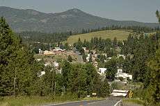
south entrance to Troy in 2008 | |
 Location in Latah County and the state of Idaho | |
| Coordinates: 46°44′19″N 116°46′15″W / 46.73861°N 116.77083°WCoordinates: 46°44′19″N 116°46′15″W / 46.73861°N 116.77083°W | |
| Country | United States |
| State | Idaho |
| County | Latah |
| Area[1] | |
| • Total | 0.79 sq mi (2.05 km2) |
| • Land | 0.79 sq mi (2.05 km2) |
| • Water | 0 sq mi (0 km2) |
| Elevation | 2,487 ft (758 m) |
| Population (2010)[2] | |
| • Total | 862 |
| • Estimate (2012[3]) | 888 |
| • Density | 1,091.1/sq mi (421.3/km2) |
| Time zone | Pacific (PST) (UTC-8) |
| • Summer (DST) | PDT (UTC-7) |
| ZIP code | 83871 |
| Area code(s) | 208 |
| FIPS code | 16-82360 |
| GNIS feature ID | 0400145 |
| Website | troyidaho.net |
Troy is a city in Latah County, Idaho, United States. Located in the eastern part of the Palouse region, its population was 862 at the 2010 census.
Geography
Troy is located at 46°44′19″N 116°46′15″W / 46.73861°N 116.77083°W (46.738571, -116.770785).,[4] east of Moscow on State Highway 8, at an elevation of 2,487 feet (758 m) above sea level.
According to the United States Census Bureau, the city has a total area of 0.79 square miles (2.05 km2), all of it land.[1]
History
The community was originally known as Huffs Gulch when J. Wesley Seat homesteaded in the area in 1885. In 1890, area businessman John P. Vollmer rechristened the area with his own surname when he brought the railroad through. Vollmer gained much of his 30,000 acres of land by foreclosing on the bank loans of local farmers. This made him so unpopular that in 1897 the residents decided to rename the town. Local legend states that the name Troy was selected when a Greek railroad worker offered free shots of whiskey to any who would support the name.[5]
Highways
Demographics
| Historical population | |||
|---|---|---|---|
| Census | Pop. | %± | |
| 1900 | 283 | — | |
| 1910 | 543 | 91.9% | |
| 1920 | 591 | 8.8% | |
| 1930 | 619 | 4.7% | |
| 1940 | 580 | −6.3% | |
| 1950 | 531 | −8.4% | |
| 1960 | 555 | 4.5% | |
| 1970 | 541 | −2.5% | |
| 1980 | 820 | 51.6% | |
| 1990 | 699 | −14.8% | |
| 2000 | 798 | 14.2% | |
| 2010 | 862 | 8.0% | |
| Est. 2015 | 880 | [6] | 2.1% |
2010 census
As of the census[2] of 2010, there were 862 people, 324 households, and 242 families residing in the city. The population density was 1,091.1 inhabitants per square mile (421.3/km2). There were 355 housing units at an average density of 449.4 per square mile (173.5/km2). The racial makeup of the city was 96.1% White, 0.2% Native American, 0.6% Asian, 0.5% from other races, and 2.7% from two or more races. Hispanic or Latino of any race were 3.0% of the population.
There were 324 households of which 38.6% had children under the age of 18 living with them, 63.9% were married couples living together, 5.6% had a female householder with no husband present, 5.2% had a male householder with no wife present, and 25.3% were non-families. 20.4% of all households were made up of individuals and 8.4% had someone living alone who was 65 years of age or older. The average household size was 2.66 and the average family size was 3.10.
The median age in the city was 37.9 years. 29% of residents were under the age of 18; 5.1% were between the ages of 18 and 24; 28.4% were from 25 to 44; 26.1% were from 45 to 64; and 11.4% were 65 years of age or older. The gender makeup of the city was 49.8% male and 50.2% female.
2000 census
As of the census[8] of 2000, there were 798 people, 309 households, and 224 families residing in the city. The population density was 1,004.8 people per square mile (390.0/km²). There were 341 housing units at an average density of 429.4 per square mile (166.7/km²). The racial makeup of the city was 96.12% White, 0.50% Native American, 0.38% Asian, and 3.01% from two or more races. Hispanic or Latino of any race were 0.13% of the population.
There were 309 households out of which 38.5% had children under the age of 18 living with them, 61.2% were married couples living together, 7.8% had a female householder with no husband present, and 27.2% were non-families. 20.7% of all households were made up of individuals and 7.8% had someone living alone who was 65 years of age or older. The average household size was 2.58 and the average family size was 3.02.
In the city the population was spread out with 29.8% under the age of 18, 7.1% from 18 to 24, 29.2% from 25 to 44, 22.4% from 45 to 64, and 11.4% who were 65 years of age or older. The median age was 34 years. For every 100 females there were 99.5 males. For every 100 females age 18 and over, there were 92.4 males.
The median income for a household in the city was $36,250, and the median income for a family was $42,031. Males had a median income of $33,194 versus $23,295 for females. The per capita income for the city was $16,557. About 11.9% of families and 12.1% of the population were below the poverty line, including 14.7% of those under age 18 and 3.1% of those age 65 or over.
Tamarack Ski Area
The defunct Tamarack Ski Area was 7 miles (11 km) northwest of Troy on East Moscow Mountain, near the top of Tamarack Road. Founded in 1966, the ski hill operated intermittently due to varying conditions, and seldom after 1980. The primary lift, a T-bar, was removed in 1992 and its A-frame lodge was later razed.
References
- 1 2 "US Gazetteer files 2010". United States Census Bureau. Retrieved 2012-12-18.
- 1 2 "American FactFinder". United States Census Bureau. Retrieved 2012-12-18.
- ↑ "Population Estimates". United States Census Bureau. Retrieved 2013-06-03.
- ↑ "US Gazetteer files: 2010, 2000, and 1990". United States Census Bureau. 2011-02-12. Retrieved 2011-04-23.
- ↑ Monroe, Julie (2006). Images of America:Latah County. Arcadia Publishing. p. 99. ISBN 0738531332.
- ↑ "Annual Estimates of the Resident Population for Incorporated Places: April 1, 2010 to July 1, 2015". Retrieved July 2, 2016.
- ↑ "Census of Population and Housing". Census.gov. Retrieved June 4, 2015.
- ↑ "American FactFinder". United States Census Bureau. Retrieved 2008-01-31.
External links
- Official website
- Idaho Department of Commerce Fact sheet
- Latah County Historical Society site
- Latah County Library link
Municipalities and communities of Latah County, Idaho, United States | ||
|---|---|---|
| Cities | ||
| CDP | ||
| Unincorporated communities | ||