Bowersville, Ohio
| Bowersville, Ohio | |
|---|---|
| Village | |
|
| |
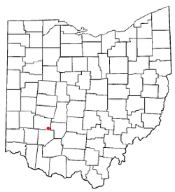 Location of Bowersville, Ohio | |
 Location of Bowersville in Greene County | |
| Coordinates: 39°34′49″N 83°43′25″W / 39.58028°N 83.72361°WCoordinates: 39°34′49″N 83°43′25″W / 39.58028°N 83.72361°W | |
| Country | United States |
| State | Ohio |
| County | Greene |
| Area[1] | |
| • Total | 0.15 sq mi (0.39 km2) |
| • Land | 0.15 sq mi (0.39 km2) |
| • Water | 0 sq mi (0 km2) |
| Elevation[2] | 1,089 ft (332 m) |
| Population (2010)[3] | |
| • Total | 312 |
| • Estimate (2012[4]) | 314 |
| • Density | 2,080.0/sq mi (803.1/km2) |
| Time zone | Eastern (EST) (UTC-5) |
| • Summer (DST) | EDT (UTC-4) |
| ZIP code | 45307 |
| Area code(s) | 937 |
| FIPS code | 39-07930[5] |
| GNIS feature ID | 1048537[2] |
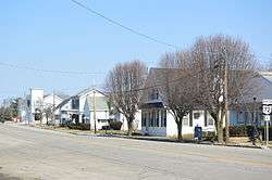
Bowersville is a village in Greene County, Ohio, United States. The population was 312 at the 2010 census. It is part of the Dayton Metropolitan Statistical Area.
History
Bowersville was laid out in 1848, and named for Peter Bowermaster, a first settler.[6] A post office called Bowersville has been in operation since 1847.[7]
Geography
Bowersville is located at 39°34′49″N 83°43′25″W / 39.58028°N 83.72361°W (39.580198, -83.723635).[8]
According to the United States Census Bureau, the village has a total area of 0.15 square miles (0.39 km2), all of it land.[1]
Demographics
| Historical population | |||
|---|---|---|---|
| Census | Pop. | %± | |
| 1870 | 193 | — | |
| 1880 | 84 | −56.5% | |
| 1900 | 370 | — | |
| 1910 | 297 | −19.7% | |
| 1920 | 312 | 5.1% | |
| 1930 | 310 | −0.6% | |
| 1940 | 316 | 1.9% | |
| 1950 | 362 | 14.6% | |
| 1960 | 327 | −9.7% | |
| 1970 | 358 | 9.5% | |
| 1980 | 329 | −8.1% | |
| 1990 | 225 | −31.6% | |
| 2000 | 290 | 28.9% | |
| 2010 | 312 | 7.6% | |
| Est. 2015 | 313 | [9] | 0.3% |
2010 census
As of the census[3] of 2010, there were 312 people, 119 households, and 89 families residing in the village. The population density was 2,080.0 inhabitants per square mile (803.1/km2). There were 134 housing units at an average density of 893.3 per square mile (344.9/km2). The racial makeup of the village was 97.1% White, 0.6% African American, 0.3% from other races, and 1.9% from two or more races. Hispanic or Latino of any race were 2.2% of the population.
There were 119 households of which 37.0% had children under the age of 18 living with them, 58.0% were married couples living together, 14.3% had a female householder with no husband present, 2.5% had a male householder with no wife present, and 25.2% were non-families. 19.3% of all households were made up of individuals and 10.1% had someone living alone who was 65 years of age or older. The average household size was 2.62 and the average family size was 2.99.
The median age in the village was 36 years. 26% of residents were under the age of 18; 8.1% were between the ages of 18 and 24; 29.6% were from 25 to 44; 23.4% were from 45 to 64; and 13.1% were 65 years of age or older. The gender makeup of the village was 49.0% male and 51.0% female.
2000 census
As of the census[5] of 2000, there were 290 people, 111 households, and 85 families residing in the village. The population density was 2,101.3 people per square mile (799.8/km²). There were 121 housing units at an average density of 876.7 per square mile (333.7/km²). The racial makeup of the village was 98.28% White, 0.34% Native American, 0.34% Asian, 0.34% from other races, and 0.69% from two or more races. Hispanic or Latino of any race were 0.34% of the population.
There were 111 households out of which 36.0% had children under the age of 18 living with them, 61.3% were married couples living together, 12.6% had a female householder with no husband present, and 23.4% were non-families. 20.7% of all households were made up of individuals and 9.9% had someone living alone who was 65 years of age or older. The average household size was 2.61 and the average family size was 3.01.
In the village the population was spread out with 24.5% under the age of 18, 10.7% from 18 to 24, 29.7% from 25 to 44, 22.8% from 45 to 64, and 12.4% who were 65 years of age or older. The median age was 38 years. For every 100 females there were 108.6 males. For every 100 females age 18 and over, there were 102.8 males.
The median income for a household in the village was $36,406, and the median income for a family was $38,846. Males had a median income of $31,250 versus $25,625 for females. The per capita income for the village was $14,132. None of the families and 2.2% of the population were living below the poverty line, including no under eighteens and 8.3% of those over 64.
Notable person
Norman Vincent Peale was born in Bowersville.
References
- 1 2 "US Gazetteer files 2010". United States Census Bureau. Archived from the original on 2012-01-24. Retrieved 2013-01-06.
- 1 2 "US Board on Geographic Names". United States Geological Survey. 2007-10-25. Retrieved 2008-01-31.
- 1 2 "American FactFinder". United States Census Bureau. Retrieved 2013-01-06.
- ↑ "Population Estimates". United States Census Bureau. Archived from the original on 2013-06-17. Retrieved 2013-06-17.
- 1 2 "American FactFinder". United States Census Bureau. Archived from the original on 2013-09-11. Retrieved 2008-01-31.
- ↑ Dills, R. S. (1881). History of Greene County: Together with Historic Notes on the Northwest, and the State of Ohio ... Odell & Mayer. p. 827.
- ↑ "Greene County". Jim Forte Postal History. Archived from the original on 12 March 2016. Retrieved 13 January 2016.
- ↑ "US Gazetteer files: 2010, 2000, and 1990". United States Census Bureau. 2011-02-12. Retrieved 2011-04-23.
- ↑ "Annual Estimates of the Resident Population for Incorporated Places: April 1, 2010 to July 1, 2015". Retrieved July 2, 2016.
- ↑ "Census of Population and Housing". Census.gov. Archived from the original on May 11, 2015. Retrieved June 4, 2015.
Municipalities and communities of Greene County, Ohio, United States | ||
|---|---|---|
| Cities | 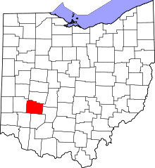 | |
| Villages | ||
| Townships | ||
| CDPs | ||
| Unincorporated communities | ||
| Footnotes | ‡This populated place also has portions in an adjacent county or counties | |