Bowlegs, Oklahoma
| Bowlegs, Oklahoma | |
|---|---|
| Town | |
 Location of Bowlegs, Oklahoma | |
| Coordinates: 35°8′51″N 96°40′11″W / 35.14750°N 96.66972°WCoordinates: 35°8′51″N 96°40′11″W / 35.14750°N 96.66972°W | |
| Country | United States |
| State | Oklahoma |
| County | Seminole |
| Area | |
| • Total | 3.8 sq mi (9.7 km2) |
| • Land | 3.8 sq mi (9.7 km2) |
| • Water | 0.0 sq mi (0.0 km2) |
| Elevation | 938 ft (286 m) |
| Population (2010) | |
| • Total | 405 |
| • Density | 98.7/sq mi (38.1/km2) |
| Time zone | Central (CST) (UTC-6) |
| • Summer (DST) | CDT (UTC-5) |
| ZIP code | 74830 |
| Area code(s) | 405 |
| FIPS code | 40-07950[1] |
| GNIS feature ID | 1090427[2] |
Bowlegs is a town in Seminole County, Oklahoma, United States. The population was 405 at the 2010 census.
Etymology
Bowlegs was named after an early resident, Lula Bowlegs, a descendant of the Florida Seminole Chief Billy Bowlegs. It has been a popular misconception that the town was named after the chief. It has frequently been noted on lists of unusual place names.[3][4] The name of the town was popularized by the 1976 song "Bowlegs" by the Nitty Gritty Dirt Band.
Geography
Bowlegs is located at 35°8′51″N 96°40′11″W / 35.14750°N 96.66972°W (35.147566, -96.669603).[5] According to the United States Census Bureau, the town has a total area of 3.8 square miles (9.8 km2), all of it land.
Demographics
| Historical population | |||
|---|---|---|---|
| Census | Pop. | %± | |
| 1980 | 522 | — | |
| 1990 | 398 | −23.8% | |
| 2000 | 371 | −6.8% | |
| 2010 | 405 | 9.2% | |
| Est. 2015 | 406 | [6] | 0.2% |
As of the census[1] of 2000, there were 371 people, 148 households, and 108 families residing in the town. The population density was 98.7 people per square mile (38.1/km²). There were 167 housing units at an average density of 44.4 per square mile (17.1/km²). The racial makeup of the town was 81.13% White, 0.54% African American, 15.63% Native American, 0.27% from other races, and 2.43% from two or more races. Hispanic or Latino of any race were 1.35% of the population.
There were 148 households out of which 25.7% had children under the age of 18 living with them, 56.1% were married couples living together, 10.1% had a female householder with no husband present, and 27.0% were non-families. 23.0% of all households were made up of individuals and 8.8% had someone living alone who was 65 years of age or older. The average household size was 2.51 and the average family size was 2.97.
In the town the population was spread out with 25.6% under the age of 18, 6.5% from 18 to 24, 23.5% from 25 to 44, 29.9% from 45 to 64, and 14.6% who were 65 years of age or older. The median age was 40 years. For every 100 females there were 86.4 males. For every 100 females age 18 and over, there were 90.3 males.
The median income for a household in the town was $26,250, and the median income for a family was $28,333. Males had a median income of $22,125 versus $16,354 for females. The per capita income for the town was $12,459. About 15.5% of families and 24.0% of the population were below the poverty line, including 27.5% of those under age 18 and 36.0% of those age 65 or over.
References
- 1 2 "American FactFinder". United States Census Bureau. Archived from the original on 2013-09-11. Retrieved 2008-01-31.
- ↑ "US Board on Geographic Names". United States Geological Survey. 2007-10-25. Retrieved 2008-01-31.
- ↑ Parker, Quentin (2010). Welcome to Horneytown, North Carolina, Population: 15: An insider's guide to 201 of the world's weirdest and wildest places. Adams Media. pp. viii.
- ↑ Don Voorhees (4 October 2011). The Super Book of Useless Information: The Most Powerfully Unnecessary Things You Never Need to Know. Penguin Group US. p. 67. ISBN 978-1-101-54513-3.
- ↑ "US Gazetteer files: 2010, 2000, and 1990". United States Census Bureau. 2011-02-12. Retrieved 2011-04-23.
- ↑ "Annual Estimates of the Resident Population for Incorporated Places: April 1, 2010 to July 1, 2015". Retrieved July 2, 2016.
- ↑ "Census of Population and Housing". Census.gov. Archived from the original on May 11, 2015. Retrieved June 4, 2015.
External links
Municipalities and communities of Seminole County, Oklahoma, United States | ||
|---|---|---|
| Cities | 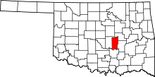 | |
| Towns | ||
| Unincorporated communities |
| |
| Footnotes | ‡This populated place also has portions in an adjacent county or counties | |