Konawa, Oklahoma
| Konawa, Oklahoma | |
|---|---|
| City | |
 Location of Konawa, Oklahoma | |
| Coordinates: 34°57′33″N 96°45′10″W / 34.95917°N 96.75278°WCoordinates: 34°57′33″N 96°45′10″W / 34.95917°N 96.75278°W | |
| Country | United States |
| State | Oklahoma |
| County | Seminole |
| Area | |
| • Total | 1.4 sq mi (3.5 km2) |
| • Land | 1.4 sq mi (3.5 km2) |
| • Water | 0.0 sq mi (0.0 km2) |
| Elevation | 965 ft (294 m) |
| Population (2010) | |
| • Total | 1,298 |
| • Density | 927.1/sq mi (1,083.9/km2) |
| Time zone | Central (CST) (UTC-6) |
| • Summer (DST) | CDT (UTC-5) |
| ZIP code | 74849 |
| Area code(s) | 580 |
| FIPS code | 40-40200[1] |
| GNIS feature ID | 1094430[2] |
Konawa is a city in Seminole County, Oklahoma, United States. The population was 1,479 at the 2000 census. Konawa is a Seminole word meaning, "string of beads." [3]
History
Located in southwestern Seminole County, Konawa, a Seminole word meaning "string of beads," lies at the intersection of State Highways 9A and 39. On January 7, 1904, Tom West, a mixed-blood Seminole, sold George Northrup a plot of land that became the Konawa townsite. The post office was established on July 15, 1904, with Robert C. Lovelace as postmaster. Early-day establishments included the first newspaper, the Konawa Chief, hardware and drug stores, lumberyards, a blacksmith, and a bank. In 1903, the Missouri, Kansas and Oklahoma Railroad (later the Missouri, Kansas and Texas Railway) bypassed the nearby town of Violet Springs. Most families and businesses moved to other towns. Some moved their houses to Konawa, and many of these buildings continued to stand at the turn of the twenty-first century.[3]
Konawa served as a trade center for a surrounding agricultural region. At 1907 statehood population stood at 620. The Konawa Leader has informed the citizens since 1917. During the 1920s streets were paved, several oil wells were discovered, and a new high school was built. In November 1931 Konawa caught the attention of Charles "Pretty Boy" Floyd, who robbed the First National Bank. During World War II the Konawa National Guard Armory (National Register of Historical Places, NR 94000483), a Works Progress Administration project, housed German prisoners of war. On February 17, 1961, a tornado destroyed downtown Konawa and injured five individuals.[3]
The energy industry remained a mainstay of the local economy, with oil-field service companies still important. In May 1968 Oklahoma Gas and Electric Corporation broke ground for the Seminole Power Plant, creating the 1,350-acre Konawa Reservoir at a cost of $45 million. By 1975 the third power unit with an output of more than 1.6 million kilowatts was built. Konawa Reservoir is one of Oklahoma's top trophy lakes.[3]
In August 1963 Konawa hosted its first All-Night Gospel Singing. During its heyday an estimated twenty-five thousand people attended the annual event. The town maintains a council-city manager type of government. At the turn of the twenty-first century Konawa had 1,479 residents.[3]
Geography
Konawa is located at 34°57′33″N 96°45′10″W / 34.95917°N 96.75278°W (34.959284, -96.752863).[4] According to the United States Census Bureau, the city has a total area of 1.4 square miles (3.6 km2), all of it land.
Climate
Climate is characterized by relatively high temperatures and evenly distributed precipitation throughout the year. Temperatures are high and can lead to warm, oppressive nights. Summers are usually somewhat wetter than winters, with much of the rainfall coming from convectional thunderstorm activity. The Köppen Climate Classification subtype for this climate is "Cfa" (Humid Subtropical Climate).[5]
Demographics
| Historical population | |||
|---|---|---|---|
| Census | Pop. | %± | |
| 1910 | 701 | — | |
| 1920 | 896 | 27.8% | |
| 1930 | 2,070 | 131.0% | |
| 1940 | 2,205 | 6.5% | |
| 1950 | 2,707 | 22.8% | |
| 1960 | 1,555 | −42.6% | |
| 1970 | 1,719 | 10.5% | |
| 1980 | 1,711 | −0.5% | |
| 1990 | 1,508 | −11.9% | |
| 2000 | 1,479 | −1.9% | |
| 2010 | 1,298 | −12.2% | |
| Est. 2015 | 1,290 | [6] | −0.6% |
As of the census[1] of 2000, there were 1,479 people, 551 households, and 360 families residing in the city. The population density was 1,083.9 people per square mile (419.9/km²). There were 657 housing units at an average density of 481.5 per square mile (186.5/km²). The racial makeup of the city was 70.11% White, 1.89% African American, 22.92% Native American, 0.20% Asian, 0.81% from other races, and 4.06% from two or more races. Hispanic or Latino of any race were 2.16% of the population.
There were 551 households out of which 35.4% had children under the age of 18 living with them, 45.0% were married couples living together, 16.9% had a female householder with no husband present, and 34.5% were non-families. 31.0% of all households were made up of individuals and 16.9% had someone living alone who was 65 years of age or older. The average household size was 2.53 and the average family size was 3.19.
In the city the population was spread out with 28.9% under the age of 18, 9.0% from 18 to 24, 25.2% from 25 to 44, 19.9% from 45 to 64, and 17.0% who were 65 years of age or older. The median age was 36 years. For every 100 females there were 91.1 males. For every 100 females age 18 and over, there were 86.5 males.
The median income for a household in the city was $17,300, and the median income for a family was $23,375. Males had a median income of $21,771 versus $15,208 for females. The per capita income for the city was $10,474. About 31.2% of families and 31.5% of the population were below the poverty line, including 42.4% of those under age 18 and 24.1% of those age 65 or over.
References
| Wikimedia Commons has media related to Konawa, Oklahoma. |
- 1 2 "American FactFinder". United States Census Bureau. Archived from the original on September 11, 2013. Retrieved 2008-01-31.
- ↑ "US Board on Geographic Names". United States Geological Survey. 2007-10-25. Retrieved 2008-01-31.
- 1 2 3 4 5 Konawa Genealogical Society, "Konawa," Encyclopedia of Oklahoma History and Culture. Accessed May 24, 2015.
- ↑ "US Gazetteer files: 2010, 2000, and 1990". United States Census Bureau. 2011-02-12. Retrieved 2011-04-23.
- ↑ Climate Summary for Konawa
- ↑ "Annual Estimates of the Resident Population for Incorporated Places: April 1, 2010 to July 1, 2015". Retrieved July 2, 2016.
- ↑ "Census of Population and Housing". Census.gov. Archived from the original on May 11, 2015. Retrieved June 4, 2015.
External links
Municipalities and communities of Seminole County, Oklahoma, United States | ||
|---|---|---|
| Cities | 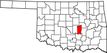 | |
| Towns | ||
| Unincorporated communities |
| |
| Footnotes | ‡This populated place also has portions in an adjacent county or counties | |