Bowler, Wisconsin
| Bowler, Wisconsin | |
|---|---|
| Village | |
|
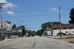
Downtown Bowler | |
 Location of Bowler, Wisconsin | |
| Coordinates: 44°51′45″N 88°58′51″W / 44.86250°N 88.98083°WCoordinates: 44°51′45″N 88°58′51″W / 44.86250°N 88.98083°W | |
| Country | United States |
| State | Wisconsin |
| County | Shawano |
| Area[1] | |
| • Total | 1.02 sq mi (2.64 km2) |
| • Land | 1.02 sq mi (2.64 km2) |
| • Water | 0 sq mi (0 km2) |
| Elevation[2] | 1,073 ft (327 m) |
| Population (2010)[3] | |
| • Total | 302 |
| • Estimate (2012[4]) | 300 |
| • Density | 296.1/sq mi (114.3/km2) |
| Time zone | Central (CST) (UTC-6) |
| • Summer (DST) | CDT (UTC-5) |
| Area code(s) | 715 & 534 |
| FIPS code | 55-09025[5] |
| GNIS feature ID | 1562100[2] |
Bowler is a village in Shawano County, Wisconsin, United States. The population was 302 at the 2010 census.
History

Bowler was named for Col. J. C. Bowler, who owned a tract of land near the town site.[6]
Geography
Bowler is located at 44°51′45″N 88°58′51″W / 44.86250°N 88.98083°W (44.862462, -88.980822).[7]
According to the United States Census Bureau, the village has a total area of 1.02 square miles (2.64 km2), all of it land.[1]
Climate
The Köppen Climate Classification subtype for this climate is "Dfb" (Warm Summer Continental Climate).[8]
Demographics
| Historical population | |||
|---|---|---|---|
| Census | Pop. | %± | |
| 1930 | 318 | — | |
| 1940 | 315 | −0.9% | |
| 1950 | 344 | 9.2% | |
| 1960 | 274 | −20.3% | |
| 1970 | 272 | −0.7% | |
| 1980 | 339 | 24.6% | |
| 1990 | 279 | −17.7% | |
| 2000 | 343 | 22.9% | |
| 2010 | 302 | −12.0% | |
| Est. 2015 | 298 | [9] | −1.3% |
2010 census
As of the census[3] of 2010, there were 302 people, 130 households, and 87 families residing in the village. The population density was 296.1 inhabitants per square mile (114.3/km2). There were 150 housing units at an average density of 147.1 per square mile (56.8/km2). The racial makeup of the village was 74.5% White, 17.2% Native American, and 8.3% from two or more races. Hispanic or Latino of any race were 3.3% of the population.
There were 130 households of which 30.8% had children under the age of 18 living with them, 43.8% were married couples living together, 18.5% had a female householder with no husband present, 4.6% had a male householder with no wife present, and 33.1% were non-families. 29.2% of all households were made up of individuals and 13.9% had someone living alone who was 65 years of age or older. The average household size was 2.32 and the average family size was 2.85.
The median age in the village was 41.7 years. 23.5% of residents were under the age of 18; 7.9% were between the ages of 18 and 24; 23.6% were from 25 to 44; 27.1% were from 45 to 64; and 17.9% were 65 years of age or older. The gender makeup of the village was 47.4% male and 52.6% female.
2000 census
As of the census[5] of 2000, there are 343 people, 126 households, and 90 families residing in the village. The population density is 337.7 people per square mile (129.8/km²). There are 135 housing units at an average density of 132.9 per square mile (51.1/km²). The racial makeup of the village is 78.13% White, 0.87% African American, 16.62% Native American, and 4.37% from two or more races. 0.00% of the population are Hispanic or Latino of any race.
There are 126 households out of which 42.1% have children under the age of 18 living with them, 49.2% are married couples living together, 18.3% have a female householder with no husband present, and 27.8% are non-families. 24.6% of all households are made up of individuals and 12.7% have someone living alone who is 65 years of age or older. The average household size is 2.62 and the average family size is 3.11.
In the village the population is spread out with 33.2% under the age of 18, 8.7% from 18 to 24, 25.1% from 25 to 44, 20.1% from 45 to 64, and 12.8% who are 65 years of age or older. The median age is 34 years. For every 100 females there are 80.5 males. For every 100 females age 18 and over, there are 81.7 males.
The median income for a household in the village is $34,167, and the median income for a family is $36,563. Males have a median income of $24,375 versus $20,000 for females. The per capita income for the village is $13,285. 6.6% of the population and 3.4% of families are below the poverty line. Out of the total population, 9.0% of those under the age of 18 and 23.5% of those 65 and older are living below the poverty line.
Notable people
- Paul T. Fuhrman, Wisconsin State Assemblyman and businessman lived in Bowler; Fuhrman served as village president of Bowler.[11]
References
- 1 2 "US Gazetteer files 2010". United States Census Bureau. Archived from the original on 2012-01-24. Retrieved 2012-11-18.
- 1 2 "US Board on Geographic Names". United States Geological Survey. 2007-10-25. Retrieved 2008-01-31.
- 1 2 "American FactFinder". United States Census Bureau. Retrieved 2012-11-18.
- ↑ "Population Estimates". United States Census Bureau. Archived from the original on 2013-06-17. Retrieved 2013-06-24.
- 1 2 "American FactFinder". United States Census Bureau. Archived from the original on 2013-09-11. Retrieved 2008-01-31.
- ↑ Chicago and North Western Railway Company (1908). A History of the Origin of the Place Names Connected with the Chicago & North Western and Chicago, St. Paul, Minneapolis & Omaha Railways. p. 46.
- ↑ "US Gazetteer files: 2010, 2000, and 1990". United States Census Bureau. 2011-02-12. Retrieved 2011-04-23.
- ↑ Climate Summary for Bowler, Wisconsin
- ↑ "Annual Estimates of the Resident Population for Incorporated Places: April 1, 2010 to July 1, 2015". Retrieved July 2, 2016.
- ↑ "Census of Population and Housing". Census.gov. Archived from the original on May 11, 2015. Retrieved June 4, 2015.
- ↑ 'Wisconsin Blue Book 1937,' Biographical Sketch of Paul T. Fuhrman, pg. 65
External links
Municipalities and communities of Shawano County, Wisconsin, United States | ||
|---|---|---|
| Cities | 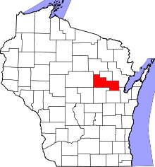 | |
| Villages | ||
| Towns | ||
| CDPs | ||
| Unincorporated communities | ||
| Indian reservations | ||
| Footnotes | ‡This populated place also has portions in an adjacent county or counties | |