Bronco, California
| Bronco | |
|---|---|
| Former settlement | |
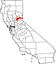
 Bronco Location in California | |
| Coordinates: 39°23′11″N 120°01′18″W / 39.38639°N 120.02167°WCoordinates: 39°23′11″N 120°01′18″W / 39.38639°N 120.02167°W | |
| Country |
|
| State |
|
| County | Nevada County |
| Elevation[1] | 5,348 ft (1,630 m) |
| Time zone | Pacific (PST) (UTC-8) |
| • Summer (DST) | PDT (UTC-7) |
Bronco is a former settlement in Nevada County, California, 9.5 mi (15.3 km) from Truckee by the Southern Pacific Railroad. Its elevation is 5,348 ft (1,630 m) above sea level.[1]
History
The Bronco post office was open during the period of 1872 until 1891.[2]
In 1933, an alternate spelling, Broncho, was rejected by the United States Board on Geographic Names.[2]
References
This article is issued from Wikipedia - version of the 4/17/2015. The text is available under the Creative Commons Attribution/Share Alike but additional terms may apply for the media files.