Brookside Township, Clinton County, Illinois
| Brookside Township | |
|---|---|
| Township | |
 Location in Clinton County | |
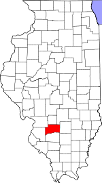 Clinton County's location in Illinois | |
| Coordinates: 38°32′N 89°12′W / 38.533°N 89.200°WCoordinates: 38°32′N 89°12′W / 38.533°N 89.200°W | |
| Country | United States |
| State | Illinois |
| County | Clinton |
| Established | November 4, 1873 |
| Area | |
| • Total | 24.33 sq mi (63.0 km2) |
| • Land | 24.33 sq mi (63.0 km2) |
| • Water | 0 sq mi (0 km2) 0% |
| Elevation | 449 ft (137 m) |
| Population (2010) | |
| • Total | 5,503 |
| • Density | 226.2/sq mi (87.3/km2) |
| Time zone | CST (UTC-6) |
| • Summer (DST) | CDT (UTC-5) |
| ZIP codes | 62250, 62801 |
| GNIS feature ID | 0428716 |
Brookside Township is one of fifteen townships in Clinton County, Illinois, USA. As of the 2010 census, its population was 5,503 and it contained 1,700 housing units.[1] The township's name changed from Crooked Creek Township on June 1, 1874.
Geography
According to the 2010 census, the township has a total area of 24.33 square miles (63.0 km2), all land.[1]
Cities, towns, villages
Cemeteries
The township contains these seven cemeteries: Barker, Chambers, Garrison, Gilmore, Jolliff, Jones and Petrea.[2]
Major highways
Airports and landing strips
- Centralia Correctional Center Heliport
Landmarks
- Fairview Park
- Warren G Murray Developmental Center
School districts
- Carlyle Community Unit School District 1
Political districts
- Illinois' 19th congressional district
- State House District 107
- State Senate District 54
References
- "Brookside Township, Clinton County, Illinois". Geographic Names Information System. United States Geological Survey. Retrieved 2010-01-10.
- United States Census Bureau 2007 TIGER/Line Shapefiles
- United States National Atlas
- 1 2 "Population, Housing Units, Area, and Density: 2010 - County -- County Subdivision and Place -- 2010 Census Summary File 1". United States Census. Retrieved 2013-05-28.
- ↑ "Brookside Township Cemetery Index". Clinton Co ILGenWeb Project. Retrieved 28 August 2013.
External links

Municipalities and communities of Clinton County, Illinois, United States | ||
|---|---|---|
| Cities | ||
| Villages | ||
| Townships | ||
| Unincorporated communities | ||
| Ghost town | ||
| Footnotes | ‡This populated place also has portions in an adjacent county or counties | |
This article is issued from Wikipedia - version of the 11/9/2016. The text is available under the Creative Commons Attribution/Share Alike but additional terms may apply for the media files.